
Note the 10pm WeatherCast will be posted here by 10:50 pm or watch us live at 10pm on KATC or www.katc.com/live
As of late Friday evening, the latest Predictive Radar (HRRR) Model has upped the timing for showers and storms arriving into Acadiana by daybreak Saturday.
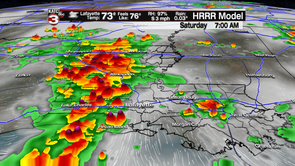
Not only is the latest run a little sooner on the storms arriving, but also quicker with the storm departing.
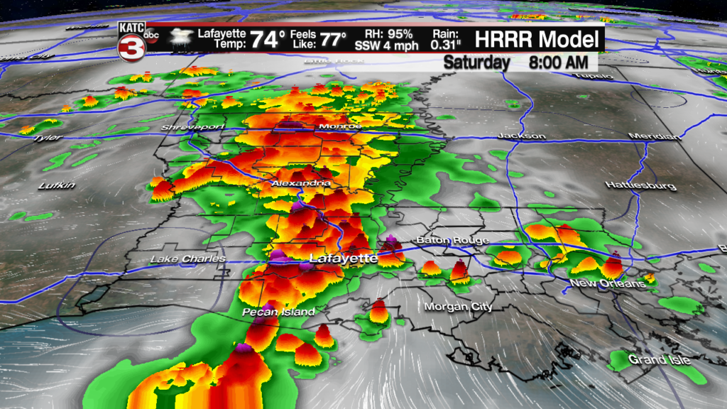
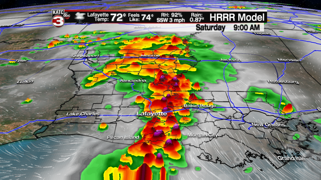

As for rainfall totals, the latest model run stays in the general vicinity of up to 1-2″ possible across the area.

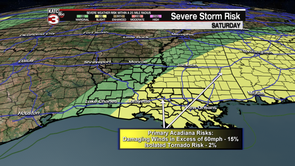
Although flooding should not be a major concern, the slight risk of severe weather is still a possibility with damaging winds the primary threat.
See previous article for full discussion, and details of the forecast beyond Saturday.
Latest Doppler Radar and Satellite Imagery:
 Power Doppler HD Acadiana View


