
Acadiana will get to enjoy more spring weather, albeit slightly warmer through Friday, before a weekend cool front ushers in some rain chances and much cooler temperatures for Sunday.
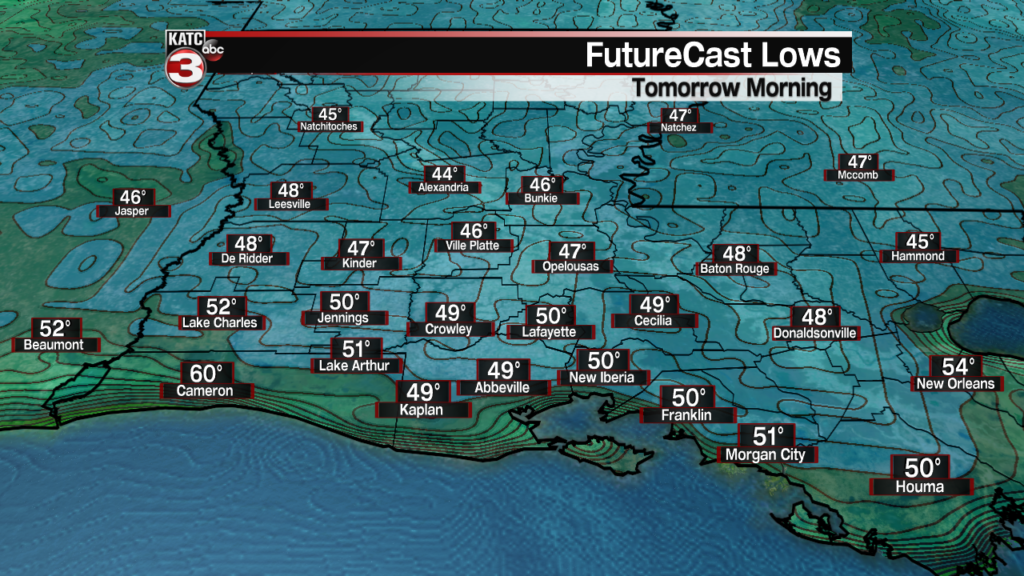
In the near term, expect another cool night overnight through Thursday morning with lows in the upper 40s to lower 50s.
Mostly sunny skies will continue for our Thursday with a few high level cirrus clouds punctuating the blue skies from time to time.
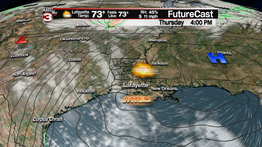
Temperatures Thursday will top out in the mid to upper 70s across the area and near 77F in Lafayette.

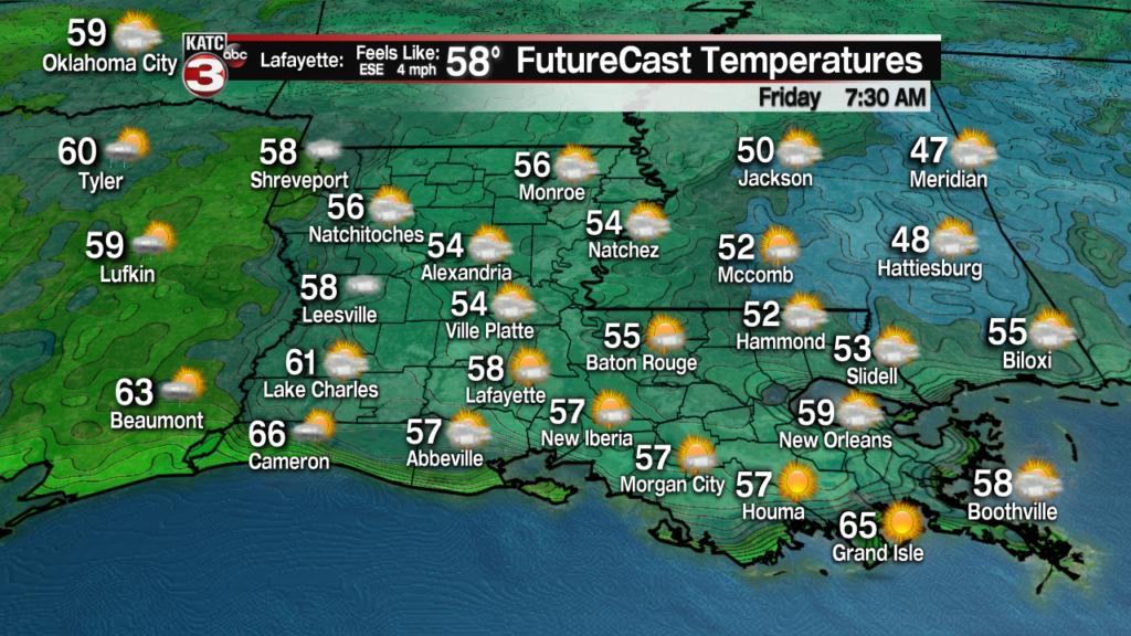
Winds will become southerly Thursday keeping temperatures milder at night with lows closer to the mid-upper 50s Friday morning.
Most of us will see fair to partly cloudy skies Friday, with a few periods of more clouds than sun. But overall it should be a nice day, with highs again topping out in the mid-upper 70s.
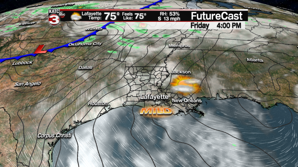
Rain chances Friday remain low, near the 10% range.
Changes will be arriving this weekend as a cool front approaches the area for Saturday night.
Look for partly to mostly cloudy and warm conditions Saturday with highs near 80. There may be a few showers and storms entering the area from the northwest, but we are keeping rain chances no higher than 20-30% for the day.
So Saturday could ultimately be a pretty nice day.

Chance of showers, perhaps a thunderstorm will increase Saturday night into the predawn hours of Sunday with the aforementioned cool front.
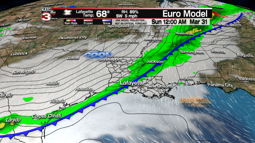
While there might be a slight risk of severe storms with this frontal system near Oklahoma Friday, no severe weather, nor heavy rainfall is expected here in Acadiana this weekend.
Rain this weekend through Monday totals will likely be in the quarter inch range or less.

Some shower activity may last into Sunday morning.
Temperatures Sunday will be in stark contrast to Saturday, with readings falling into the 50s Sunday morning and likely staying in the 50s all day long.
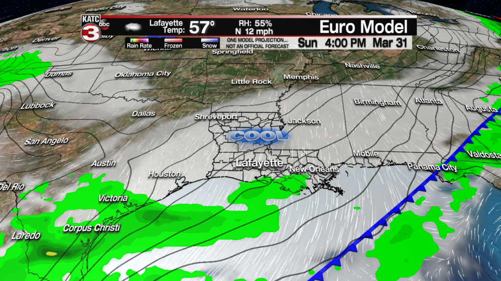
And with breezy northerly winds, there will be a little but of a winter chill in the air Sunday.
The forecast for next week has been quite changeable thanks to a messy upper air pattern and lack of agreement between the GFS and Euro Models.
For now, although we may see some sun return early Monday, there could be an afternoon disturbance that rolls west to east across the area allowing for the chance of showers by the evening.
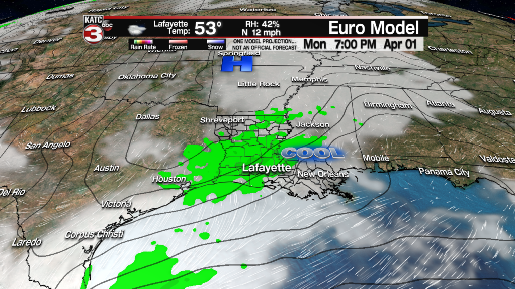
It still appears that Tuesday of next week will be the nicest of the week, albeit on the seasonably chilly side with sunny skies highs in mid to upper 60s accompanied by rather chilly lows in the lower 40s.
Beyond Tuesday the forecast is quite murky with well below normal confidence levels in the 10 Day Forecast for this period.
Nonetheless, expect plenty of clouds with some rain chances possible Wednesday through the rest of the week and into the weekend, while temperatures gradually moderate back into the mid-upper 70s.
