
A slow moving upper low will keep the skies over Acadiana overcast with periods of light rain, drizzle and mist likely, especially from the mid-morning through the mid-afternoon hours.

Rain chances Thursday will peak near 80% during the midday hours…and should be closer to 20% later in the afternoon/evening.
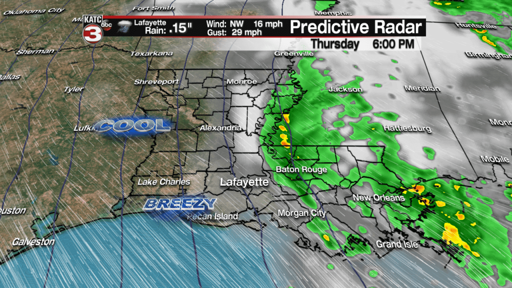
Rainfall totals will be light Thursday, with most areas receiving between .10 and.25″.
Latest FutureCast:
 Futurecast 3 Hour


As stronger jet steam winds develop tomorrow behind the upper low and digging into the surface low pressure system that will be well northeast of the area, expect winds to increase from the northwest near 15-25 mph with gusts up to 30-40 mph possible.
So it will feel quite blustery tomorrow afternoon into the evening/overnight hours.

Latest FutureCast Winds:
 Acadiana 1 Hour Wind Forecast


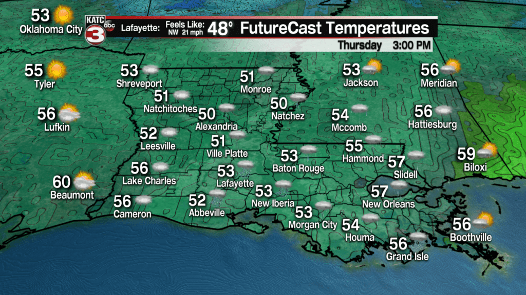
Temperatures will drop and stay in the 50s overnight Wednesday through all day Thursday, and with gusty northwest winds, it will feel like it’s in the low-mid 40s most of the day.
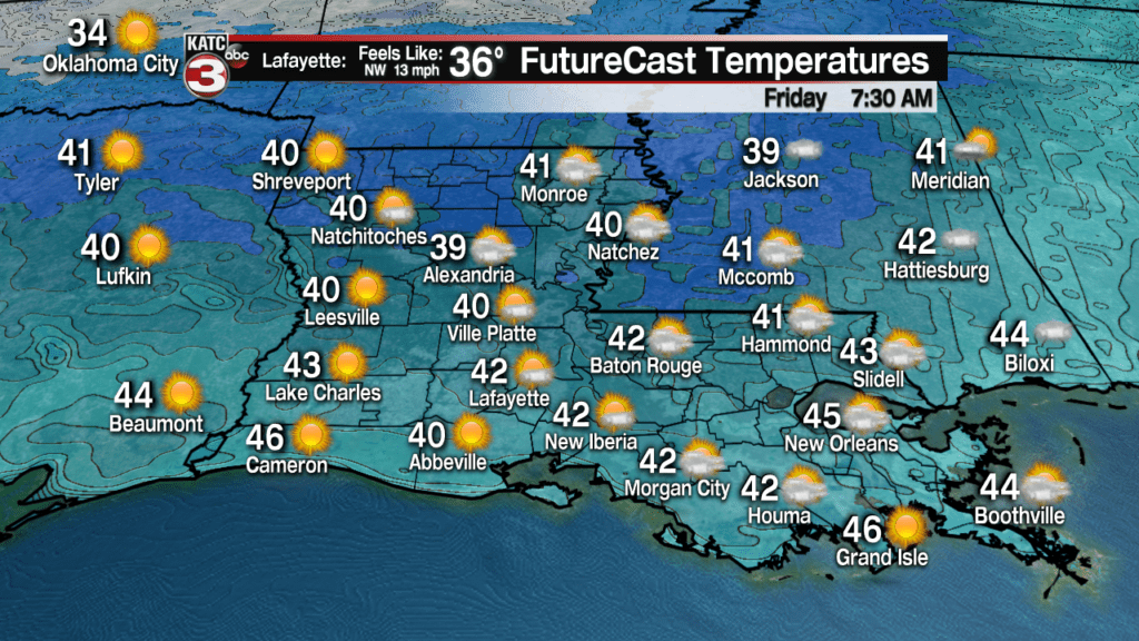
Skies will begin to clear from west to east Thursday night through Friday morning with temperature likely dropping into the lower 40s. Wind chills Friday morning will be in the mid-30s, so bundle up!
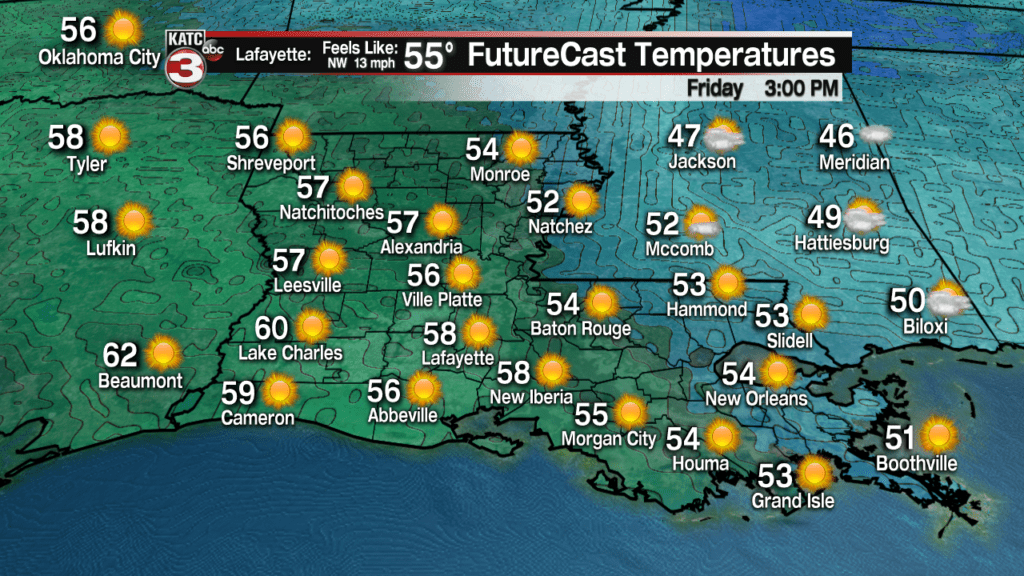
Sunshine should be back in full Friday afternoon with temperatures topping out in the mid-upper 50s.
It will be cold Friday night into Saturday morning with temperatures dropping into the mid-30s along with the chance of some patchy frost Saturday morning.
Thereafter, expect a rapid warm-up with mostly sunny skies Saturday allowing readings to soar into the mid-upper 60s for the afternoon.

Clouds will stream back into the area Sunday along with the chance of a few light sprinkles, at 10%, but more importantly temperatures will top out near 70 degrees!
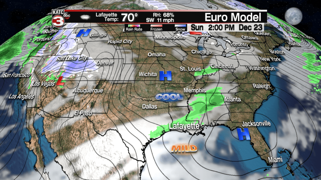
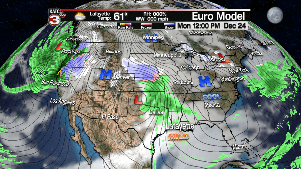
In fact, other than perhaps a few degrees cooling for Monday, the period through Christmas and beyond looks quite mild for this time of year.
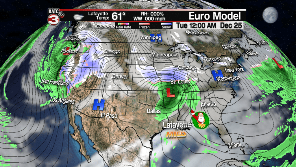
Highs Christmas Day will be in the lower 70s along with a slight chance (at 20%) of a quick passing shower.
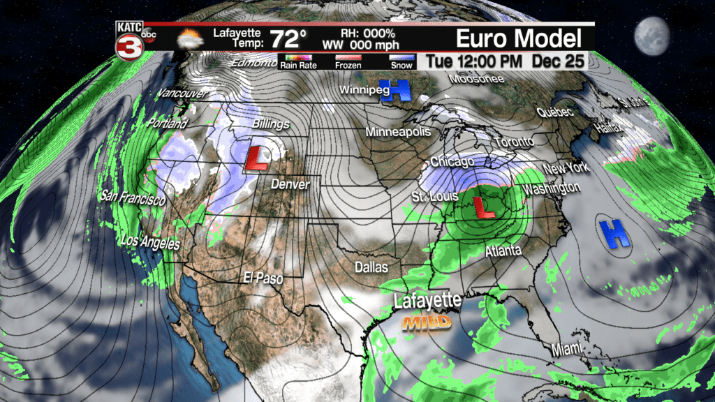
Highs will stay in the upper 60s to low-mid 70s for the rest of next week, but it appears that we will be entering a wet period with the prospects of scattered showers and storms increasing from Wednesday through Friday.
Colder air will be lurking just north of the area and should make a run for Acadiana sometime during the weekend that follows Christmas.
