Daylight Saving Time ends Saturday night so don’t forget to turn the clocks back an hour before going to bed tonight.
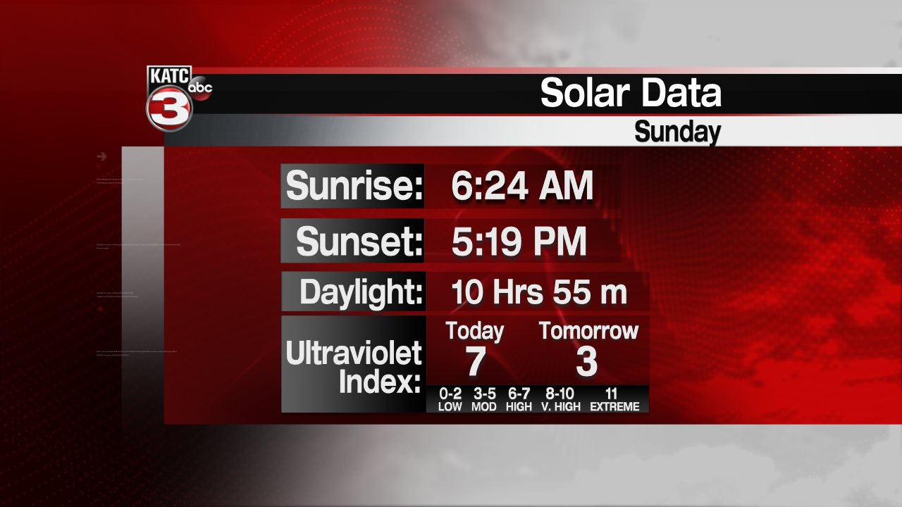
But by falling back that means it will start to get dark really early again with the sun setting at 5:19PM Sunday evening.

As for our weather things are going to change in a big way Sunday compared to today.
Clouds will start to increase across Acadiana through the overnight hours and by Sunday morning it should be mostly cloudy with a few isolated showers possible.
Then during the late morning into the afternoon a front will be marching from west to east across Acadiana producing a line of showers and storms.
For the latest look at the timing of the storms here is a look at the Predictive Radar:
A few storms Sunday could be on the strong to severe as the Storm Prediction Center has all of Acadiana under a marginal risk(5%) for the possibility of damaging wind gusts up to 60 mph and a brief spin-up tornado.

This looks to be a fast moving system so rainfall amounts will be near a half inch for most thus flooding should not be an issue.
Monday we will have a mix of sun and clouds and warm temperatures with highs in the low to mid 80s as Acadiana will be squeezed between a couple systems.
Late Monday into early Tuesday morning our next cold front will swing through the region.
For the latest look at the timing for these storms here is a look at the Futurecast Model:
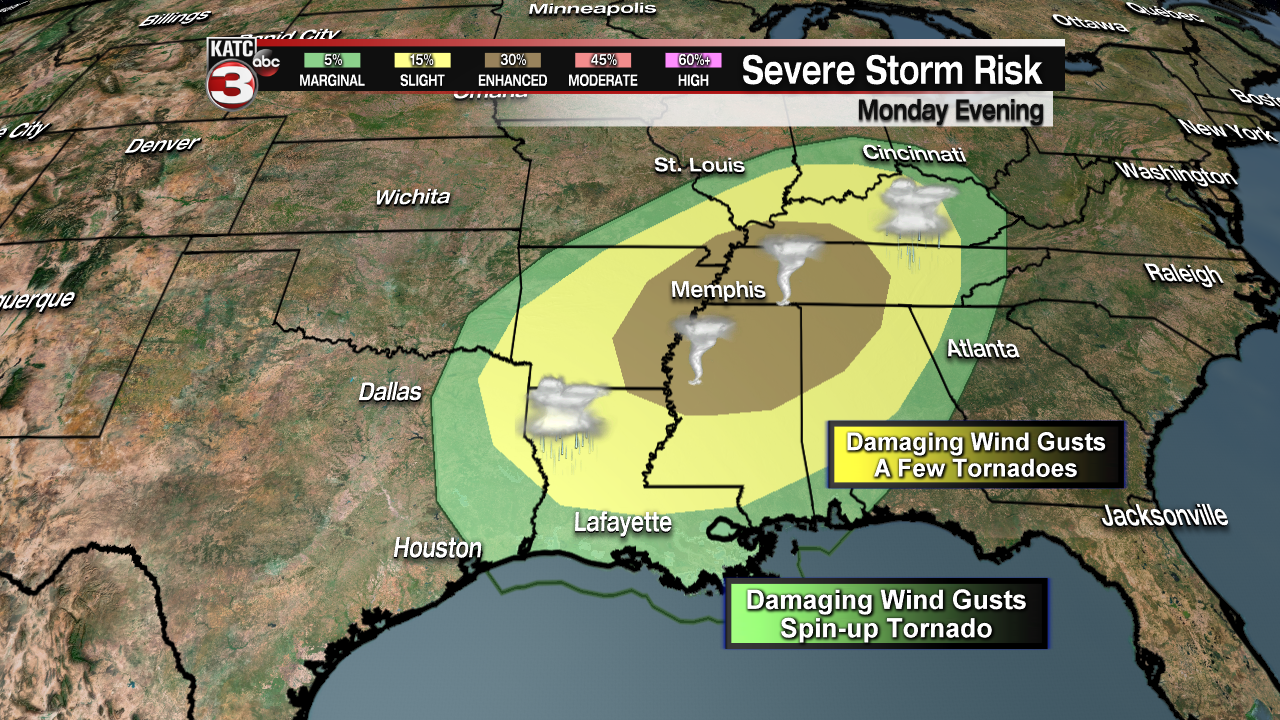
Again the Storm Prediction Center has most of Acadiana under a marginal risk(5%) for the possibility of a couple strong to severe storms with gusty winds up to 60 mph as the main threat but a spin-up tornado can not be ruled out.

There is a little higher risk for severe weather for the northern portion of Acadiana but the worst of the severe weather looks like it will be located near Arkansas, Mississippi and Tennessee where they have an enhanced risk for severe weather and a good chance for a few strong tornadoes to develop.
This front should clear Acadiana by morning setting up a nice Election Day in the area with mostly sunny skies and temperatures near 80.
A few more clouds will be around the region on Wednesday along with the slight chance for a couple stray showers but our next chance for rain will be Thursday afternoon into Friday as another cold front slides through the southeast.
For a look at the timing for this system here is a look at the long range European model:
Behind this front we will get our first shot of some really cool temperatures as highs Friday through Sunday will be in the low to mid 60s with overnight lows getting down to the lower 40s, with the possibility for upper 30s in the northern portions of Acadiana over the weekend.
Although it will be on the cool side next weekend we should have lots of sunshine both days.


