Cloudy, gray skies will continue for Acadiana for a good part of the week with showers a fairly good bet Tuesday along with steadier and heavier rains developing late Wednesday into early Thursday.
A disturbance riding along a nearly stationary frontal boundary in the Gulf of Mexico Tuesday will likely yield periods of rain shower activity with rain chances in the 60% range.
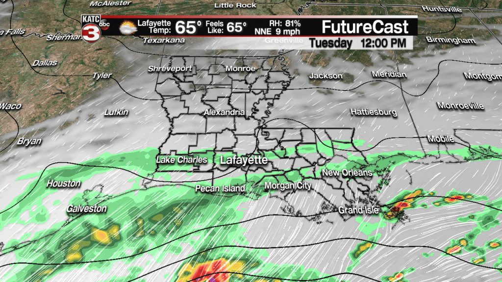
Most activity inland will be light to moderate in nature, with most areas not receiving more than 1/4 to 1/2 of an inch of rain…a few spots closer to the coast could catch up to an inch.
Temperatures with the clouds and showers will stay in the 60s Tuesday.
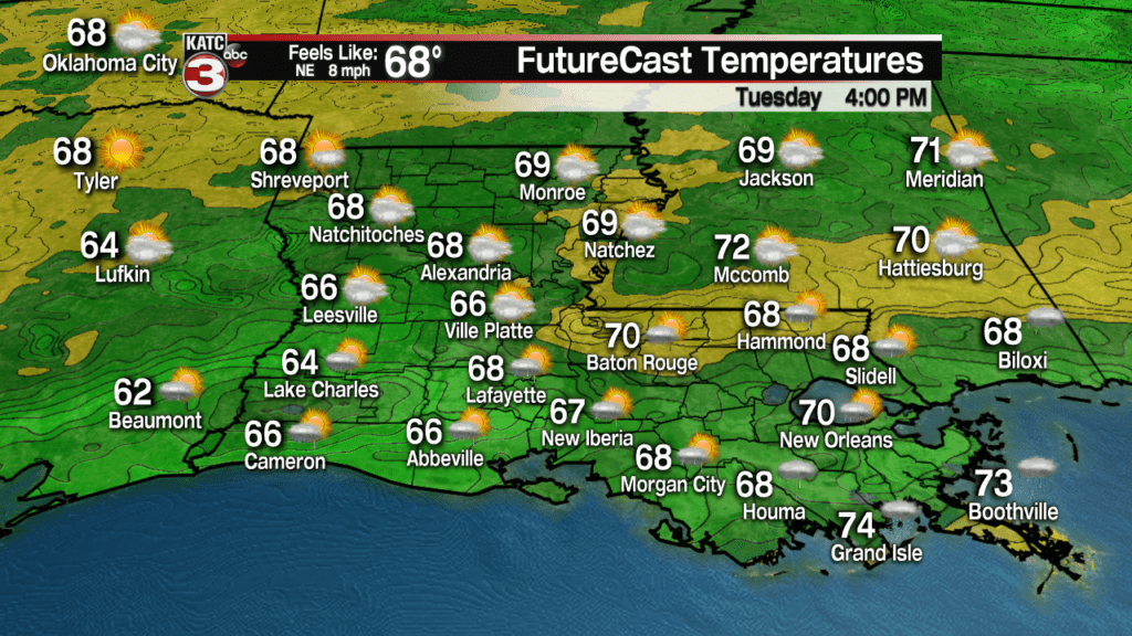
Showers should end Tuesday evening with a brief break in precipitation likely into Wednesday morning.
Latest FutureCast:
Then it gets much more interesting by Wednesday afternoon as an area of non-tropical low pressure will be developing in the Western Gulf of Mexico, and then traveling east-northeastward along the Louisiana Coast Wednesday night into early Thursday.

This system will yield at least a 90% chance of rain, perhaps with a few embedded rumbles of thunder Wednesday night, with locally heavy rainfall a possibility depending on the track of the low.
The added wildcard will be the remnant moisture and some energy from a powerful Eastern Pacific Hurricane that will make landfall on the Western Mexican Coast Tuesday and for the most part dissipate in Central Mexico Wednesday.
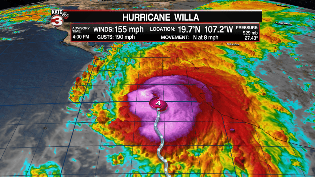
Hurricane Willa attained Category 5 status early Monday with 160 mph winds but has since begun it’s weakening process. Willa will likely make landfall as a major hurricane on the Western Mexican Coast, just south of Mazatlan, Tuesday afternoon.
Within 48 hours, Willa went through a rapid intensification cycle from a 40 mph tropical storm Saturday to a Category 5 hurricane Monday.
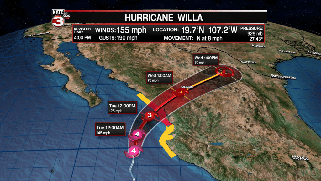
While the identifiable system should dissipate in Central Mexico Wednesday, the remnant mid- and high level moisture with this system (and some energy) may certainly contribute to the developing non-tropical low pressure system in the Gulf of Mexico.
And while it’s not going to happen in this case, if an Eastern Pacific tropical system were to cross Mexico intact and then reform into a tropical system in the Gulf of Mexico it would get a new name…again this is not going to happen.
Back to the forecast…Acadiana will see a break in the rain shower activity Tuesday night into early Wednesday but the action will likely increase again by late Wednesday and into Wednesday night.
For now, the forecast will call for several inches of rain, generally between 1-4″ between Wednesday night into early Thursday. The highest amounts will be found along the coastal parishes with lesser amounts anticipated farther inland.
Since the low pressure system will be moving along at a fairly good clip, the threat of flooding rains should be kept to a minimum, however, with that being said, low-lying, poor drainage areas may see some pooling/ponding of water Wednesday night into Thursday morning.
While the European model is forecast rain amounts of a couple inches or less locally across Acadiana, notice that the model also indicates rain amounts of 10-15″ just 50-75 miles offshore the Louisiana Coast…48 hours out, the models are not that good in pin-pointing the most vulnerable areas for where a heavy rain event might occur.
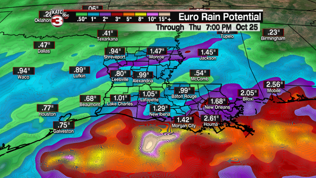
Meanwhile, the GFS model has been more robust on rainfall for Acadiana and Southern Louisiana with amounts closer to 2-4″ on the latest model run Monday…which may be more realistic.

And one final factor to consider: with very few exceptions, computer models have had a notorious history of underestimating rain systems with Pacific tropical influences that manifest in our region into heavy rain events…so the system should be watched closely as it may very well produce more rainfall than currently forecast.
So be on notice that soaking rains, and perhaps the threat of some flooding could be possible locally, especially closer to the coastal parishes with our mid-week system.
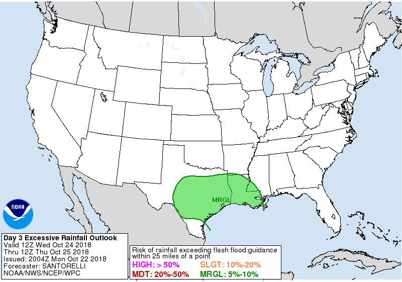
In addition, Weather Prediction Center has much of the region under a marginal risk of excessive rainfall with the system late Wednesday into Thursday, but that forecast could be increased to a “slight” risk in future updates.
After the mid-week rain excitement, conditions will begin to calm down with rains ending from west to east Thursday afternoon/evening along with lingering clouds likely to continue into Friday.
Latest European Model and GFS rainfall Forecasts:
Temperatures will likely stay in the 60s for highs for much of the week, while lows drop back into the lower 50s for lows by the end of the week.
The weekend for now looks quite promising, and while a weak upper disturbance may produce a few clouds and perhaps a light shower into Saturday night, overall expect mostly sunny skies and pleasant temperatures.
Good looking weather continues into early next week with partly cloudy skies and seasonable temperatures anticipated for Halloween…check the KATC 10 Day Forecast for the latest.


