Per the National Hurricane Center (NHC) at 4pm Friday, Sub-Tropical Storm Alberto had changed little in organization, but with an anticipated run toward the Northern Gulf Coast expected by late in the holiday weekend, Tropical Storm Watches have been issued from Grand Isle, Louisiana eastward to the Indian River, including Panama City Florida.
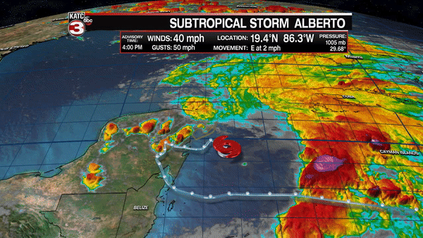
Alberto currently with 40 mph winds is expected to become a strong tropical storm with 65 mph winds prior to landfall late Monday along the Mississippi and Alabama Coasts.
Heaviest rains and highest winds with this system will likely be in the eastern half of the storm and close to where the core makes landfall.
Most if not all impacts from Alberto should remain well east of Acadiana.
The European Model is fairly consistent with the NHC forecast track with outer rain bands reaching Gulf Coast beaches Sunday with main storm impacts arriving by Monday.
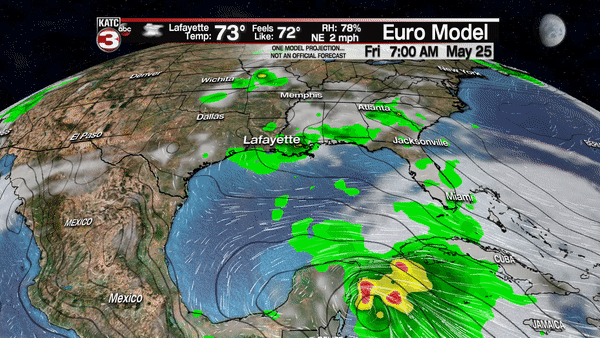
Remember just one model. – NOT AN OFFICIAL TRACK…the NHC landfall is closer to Mississippi not Alabama, but the effects on either coasts might be quite similar anyway…the farther west from the track you go, the impacts will be much, much lower. Farther east of track, messy.
