The weather for Festival International de Louisiane will be magnifique with lots of sunshine and seasonably warm afternoons accompanied by clear and refreshing evenings.
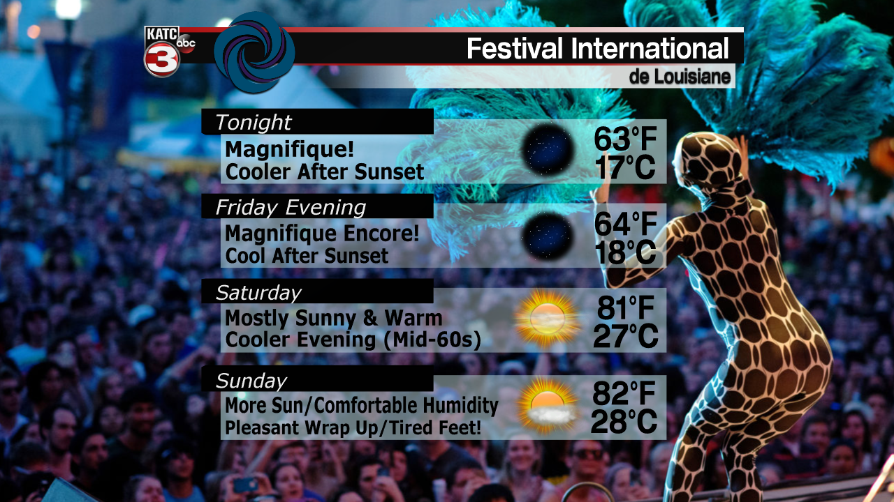
Temperatures this evening will drop from the lower 60s around 10pm into low to mid 50s by Friday morning.
A weak upper disturbance will pass through Louisiana Friday engendering a cloud and sun mix during the midday hours, with a very slight chance of a sprinkle…but chances of measurable rainfall will be 10% or less.
Look for highs Friday in the mid-70s.

Skies will clear for Friday evening, with temperatures once again dropping into the low-mid 60s by the end of the Festival performances.
Then there is this weekend…the best weekend forecast this spring, and it falls perfectly during the biggest festival in Lafayette and Acadiana!
Look for mostly sunny skies and comfortable humidity Saturday and Sunday with highs reaching the lower 80s. Winds will be light so it could get a little hot standing in direct sunshine for several hours.

It will cool nicely again Saturday evening, with temperatures dropping into the sun-burn-cooling mid-upper 60s.
And yes, do not forget the hats and sunblock this weekend, as even if it doesn’t feel hot, the sun can bake your unprotected skin in less than an hour, no matter what the skin type!
Moving into next week, it appears Monday and Tuesday will ease the new week in with similar weather as to the weekend, but humidity, clouds and warmer temperatures will likely be increasing, especially mid- to later in the week.
In fact we may see our warmest temperatures so far for this "below-normal" spring, with highs reaching the mid-80s accompanied by night-time lows edging into the lower 70s Wednesday through Friday.
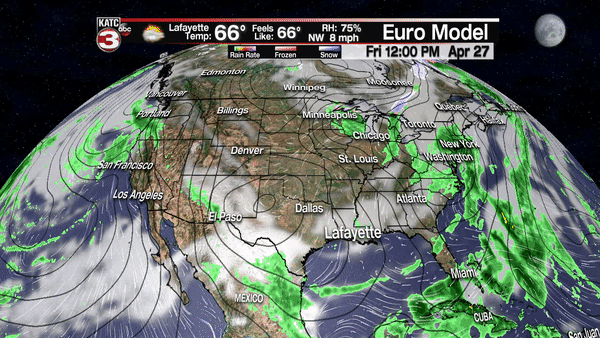
Eventually a good chance of showers and storms will arrive in the forecast, but like yesterday, best rain chances continue to get pushed farther down the road, with next Saturday showing the highest probability of rain, per the latest operational European Model.
