Make the outdoor plans now as Thursday is going to be another fantastic day with lots of sunshine and comfortable temperatures in the upper 70s.

Clouds will start to move back over Acadiana Friday as winds pick up out of the south at 10-20 mph with some gusts up to 30 mph pushing more humid air off the Gulf and over the region.
We could even have a few isolated showers during the afternoon/evening but these shouldn’t last long so I would not cancel any plans and the weather should be nice for Downtown Alive.

Widespread showers and thunderstorms arrive Saturday morning.
Models are still figuring out the timing but most agree the line of storms will begin to push into western Acadiana about 3-4AM, move through Lafayette around 7-10AM and then push off to the east by 1-2PM.

With this line of storms we will need to watch it closely as the Storm Prediction Center has the western half of Acadiana under a slight risk(15%) for severe weather while the eastern half is under a marginal risk(5%).
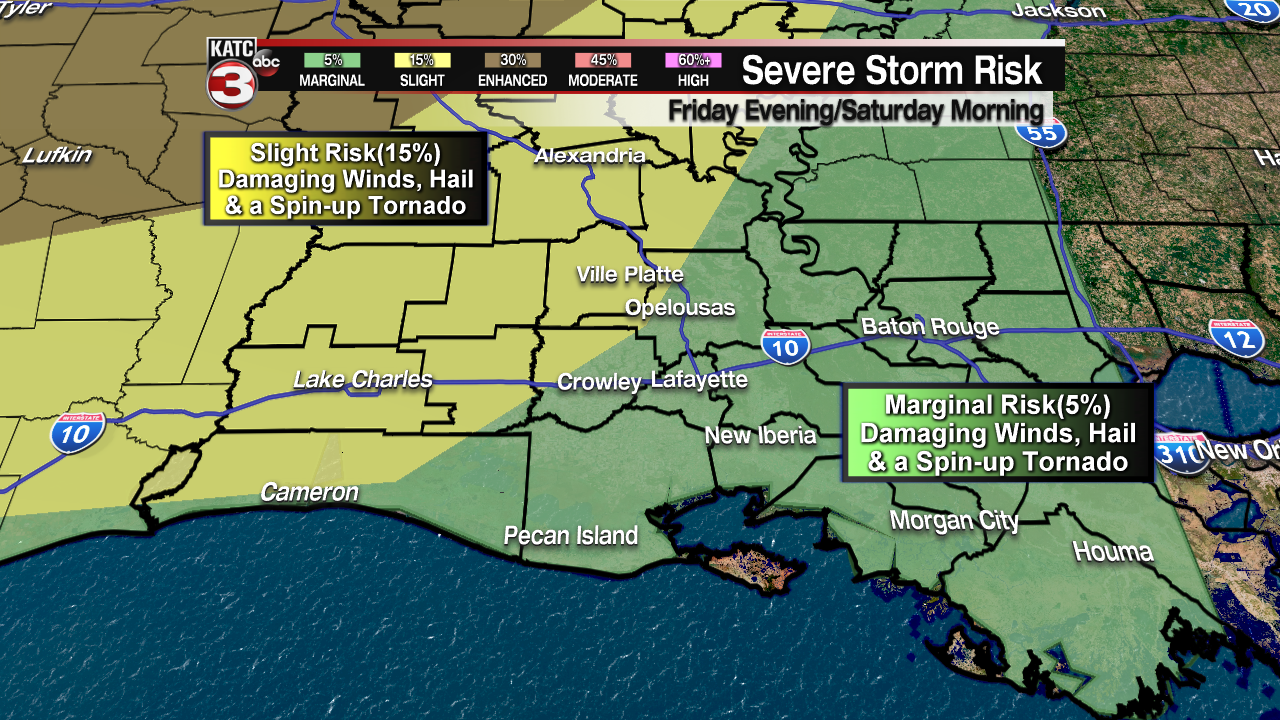
And with this line of storms we will have to watch out for damaging winds and large hail as the main threats but we can not rule out a couple weak EF0-EF1 tornadoes spinning up, especially over western Acadiana.
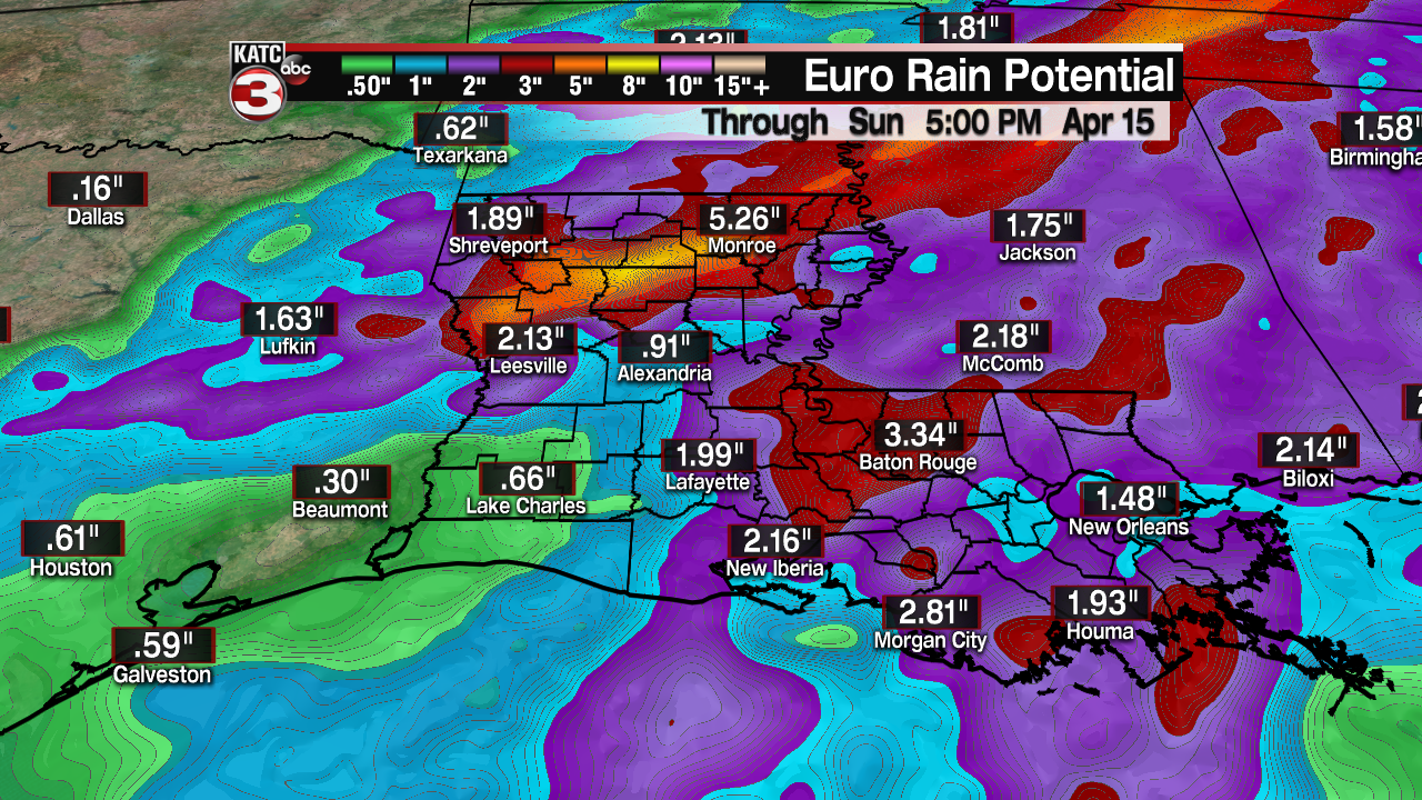
Also with this front the showers and storms might linger over the area a little longer than the past couple systems so we will have the chance for some minor flash flooding as most areas with see between 1-2 inches of rain but isolated spots could get 2-4 inches.
Behind this front another round of cool air dives down into Acadiana.
Temperatures on Saturday will fall into the lower 60s and upper 50s during the afternoon before cooling into the lower to mid 40s by Sunday morning.
Sunday afternoon sunshine returns to Acadiana but it is still going to feel rather cool with highs struggling to reach the lower 60s and with winds out of the north at 10-15 mph and gusts up 25 mph it will only feel like the mid 50s.
It will be a chilly start to the new work week as lows Monday morning will drop into the upper 30s to lower 40s.
With more sunshine and winds not as breezy highs will climb into the upper 60s Monday afternoon, but that is still 10° below average for mid-April.
Moving into Tuesday and Wednesday temperatures start to warm up as winds flip back out of the south pushing highs Tuesday into the mid 70s and upper 70s on Wednesday.
Next chance for a few showers will be Thursday morning as a weak cool front slides through the region but this front could fall a part before reaching the area and the good news is we are not expecting any cooler air to follow this front as highs stay in the upper 70s Thursday and Friday.
