


It seems like the whole country is bracing for an extreme outbreak, and for good reason as the coldest temperatures of the season seem to be right around the corner.
A very strong ridge of high pressure is going to drop in from the Arctic and settle in across the middle of the country which is going to open the door for some dangerous temperatures by the end of the weekend.

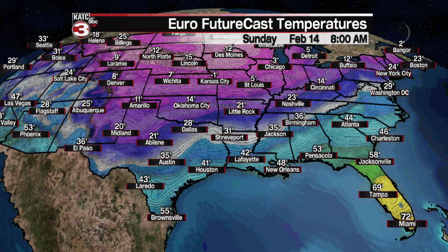
This Arctic air mass is going to open the door for some extreme temperatures, especially for the country's heartland, with temperatures dropping below zero for large parts of the country and dangerous wind chills.
In fact, these temperatures are expected to be so extreme that models seem to be having a hard time wrapping their heads around it, and we've seen some dramatic swings from run to run and model to model.
Acadiana will see the cold filter into the area at the end of this week, but the extreme cold isn't expected to arrive here until late Sunday night/early Monday morning (although timing could certainly change).

The two images above are two of our more reliable models and you can see the difference in the two of them, and without a consensus it makes it really hard to say with certainty exactly how cold it will get and how long that will last.
That being said it's continuing to look likely that we will see temperatures at some point drop down into the 20s early next week and that we may see weather which could cause some exposed pipes to burst.
It would be a good idea to go ahead and make sure that exposed pipes are taken care of as early as possible, keeping in mind that while it won't be freezing over the weekend it doesn't look like it will be overly pleasant.
What could potentially be even more concerning, especially for the mid-west, than what the thermometer is ready is estimated wind chill which is likely going to be down at least in the teens to start the week.
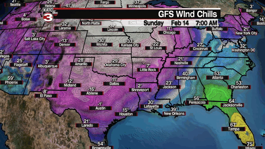
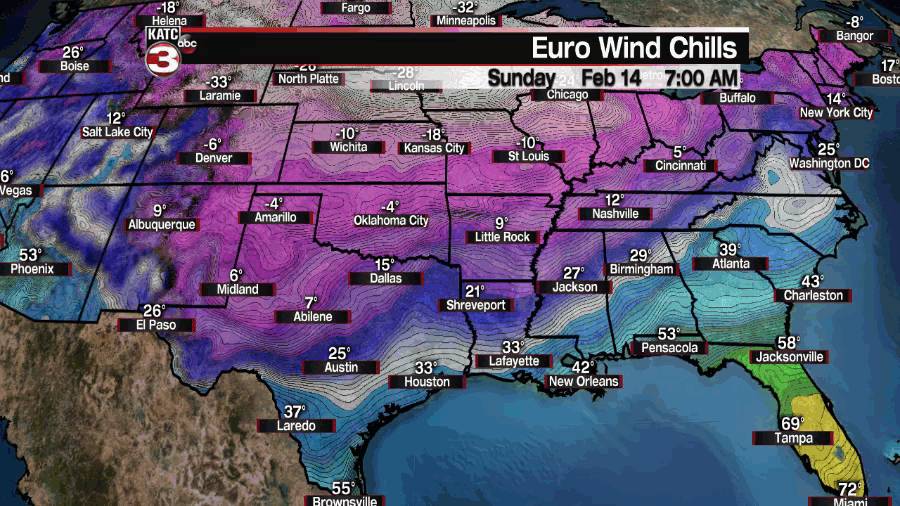
On the extreme range wind chills could drop into the single digits by early Tuesday morning, but again there is a large discrepancy between the two models and it hasn't been just this run either.
If you go back to model runs from last week there was a large variance then as well and it doesn't look like they're coming together much outside of agreeing that it will be cold to start next week.
The GFS is significantly more cold than the EURO and also keeps the cold lingering through the majority of next week and the EURO trying to warm us up a little faster.
It's hard to say with any certainty which model appears to have a better grip on the even as it seems to be changing a couple times a day, both computers seems to be struggling which goes to show how this seems to be a pretty extreme event.

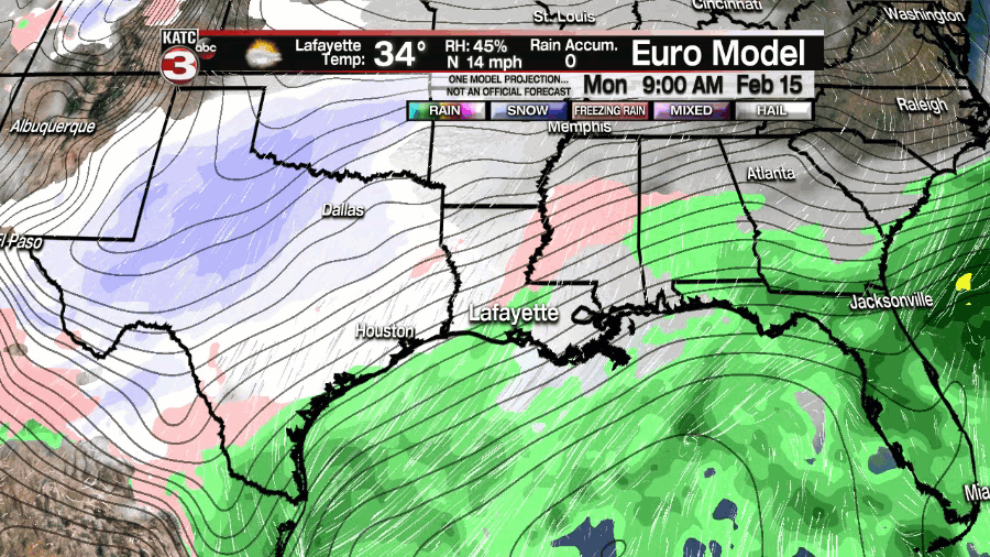
Adding even more complexity to the forecast is indications that along with the cold air there seems to be the chance for some winter precipitation that is also in play with a round of freezing rain possible and even some potential flurries.
As you may have guessed though models are in agreement that it's possible but that's where the consensus ends as both seem to have different views how this will all play out and it's too early to start talking freezing lines or anything like that.
I'll mention briefly though the EURO is much messier with the boundary between rain and freezing rain sitting right on top of Acadiana which would be an absolute nightmare, the GFS solution has much more defined boundaries.
We're talking about weather seven days away and as a result it's important to remember that none of this is set in stone, so don't get fixated on one particular forecast instead look for trends.
If by the end of this work week we're still talking about all of this then you know that confidence is growing, so in the meantime monitor the forecast and see which way it trends.
------------------------------------------------------------
Stay in touch with us anytime, anywhere.
To reach the newsroom or report a typo/correction, click HERE.
Sign up for newsletters emailed to your inbox. Select from these options: Breaking News, Evening News Headlines, Latest COVID-19 Headlines, Morning News Headlines, Special Offers
