


LOWS TONIGHT: Mid-40s
HIGHS MONDAY: Lower 70s
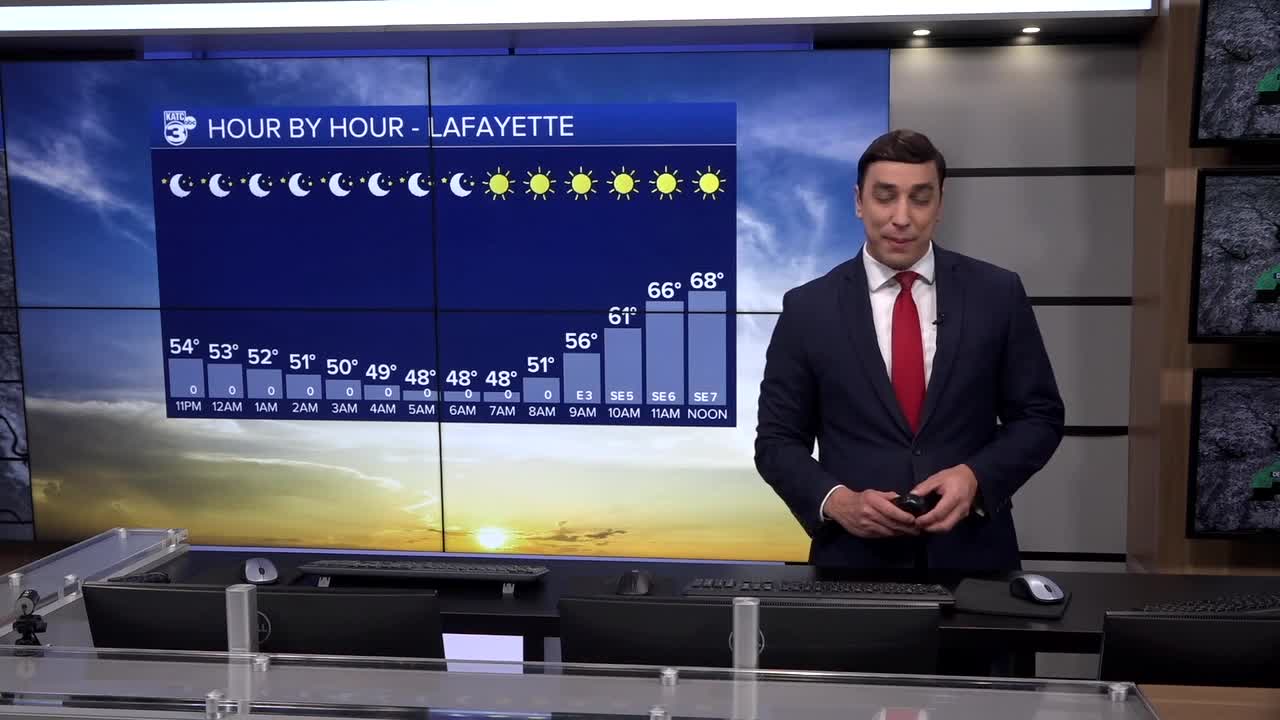
DISCUSSION
Hopefully, y'all had a nice weekend and had the opportunity to enjoy this sunny weather.
The good news is the sunshine will stick around as we start the new week Monday.
After a chilly start in the mid-40s and some patchy fog, expect highs to easily push into the lower 70s by our Monday afternoon.
Winds will be somewhat breezier out of the southeast at around 6-12mph.
Clouds and moisture will continue to build into Tuesday.
Highs will remain unseasonably warm, and actually reach the mid-70s Tuesday afternoon.
An isolated shower could be possible.
Rain chances at 20%.
Scattered showers and storms will be more likely Wednesday, especially the second half of the day, as a cold front makes its way through Acadiana.

There is likely going to be some sort of severe weather risk with this feature, but to what extent as well as exact details remain uncertain at this time.
We'll of course have more over the next couple of days.
Behind this front, we are looking at colder than normal temperatures for the end of the week and into next weekend.
Highs will be back in the 50s/60s with lows in the 30s/40s.
Soooo, not done with winter quite yet!
Although it'll be quite chilly, we do look to remain dry for the next round of parades for next weekend.
Have a great week, y'all!
------------------------------------------------------------
Stay in touch with us anytime, anywhere.
To reach the newsroom or report a typo/correction, click HERE.
Sign up for newsletters emailed to your inbox. Select from these options: Breaking News, Evening News Headlines, Latest COVID-19 Headlines, Morning News Headlines, Special Offers
