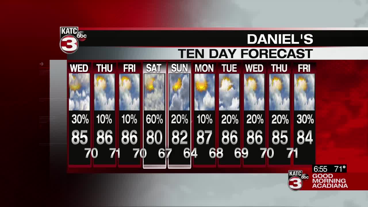
A slight bump in moisture could translate to a few more showers on Wednesday, although most will remain driven by day time heating and will be pop up in nature.
As the day heats up and the sun churns the atmosphere a little we'll see a handful of thunderstorms fire up close to lunch and in the late afternoon.
The storms should stay garden variety and there isn't a concern for flooding or severe weather as those storms will stay very isolated.
In the mean time temperatures are going to sit in the mid 80s through the later parts of the afternoon with the heat index values pushing closer to 90.
Slightly drier air is moving in for the back half of the week, and while that may squash rain chances slightly it's going to allow temperatures to get just a little bit warmer.
Widely scattered showers will return on Saturday though with a weak front moving through, even though it won't be a wash out Saturday you'll certainly want to watch the radar.
------------------------------------------------------------
Stay in touch with us anytime, anywhere.
To reach the newsroom or report a typo/correction, click HERE.
Sign up for newsletters emailed to your inbox. Select from these options: Breaking News, Evening News Headlines, Latest COVID-19 Headlines, Morning News Headlines, Special Offers


