


After a nice weekend, the pattern will be turning more active this week across Acadiana.
Southerly winds will yield to a mild night ahead.
Overnight lows only in the mid-upper 60s.
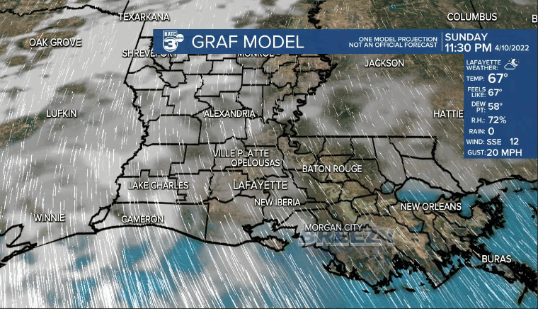
Clouds will be increasing across the area as well.
Partly to mostly cloudy skies heading into our Monday.
Highs will push the lower 80s.
Breezy southerly winds at around 15-20 mph.
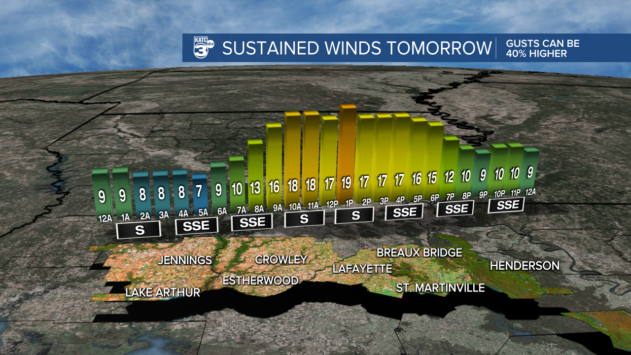
You'll notice humidity on the uptick as well..
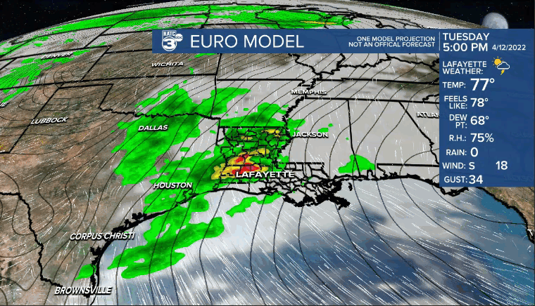
A few isolated showers could be possible by the afternoon, but better rain chances arriving Tuesday/Wednesday.
Essentially, impulses of upper-level energy, along with daytime heating and instability will lead to increased rain and storm chances for mid-week.
With enough energy available in the atmosphere, any storms that do develop could be on the strong to perhaps severe-side.
Strong winds and hail would be the primary concern, but an isolated tornado can not be ruled out.
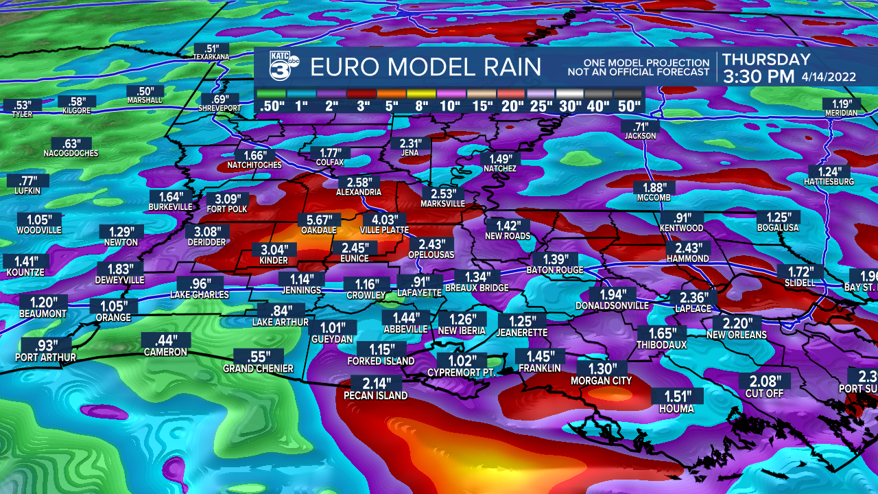
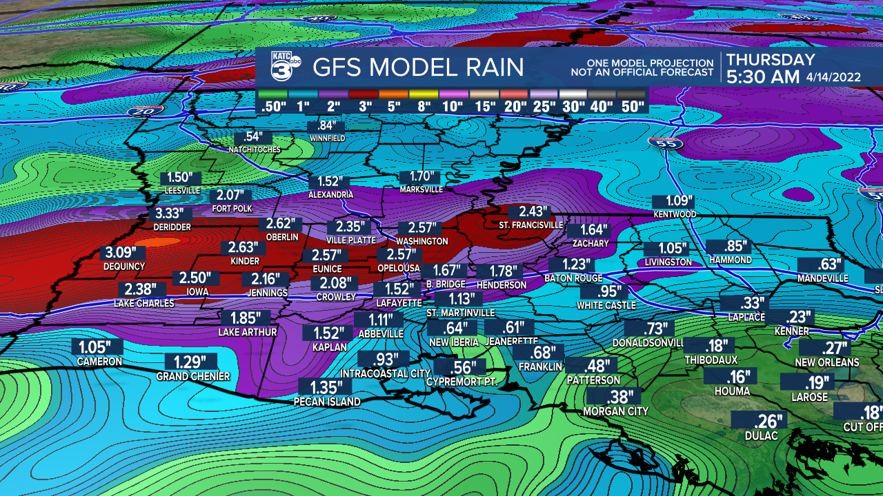
Rain chances remaining non-zero heading into the end of the week.
A decent soaking of 1-2+" of rainfall could be possible before all is said and done.
Rain chances may start to taper off into the Easter weekend.
It'll be quite warm as highs push the mid-80s.
Models continue to hint at a cool down into the following week.
We'll see how the pattern evolves with time...
Have a great week!
------------------------------------------------------------
Stay in touch with us anytime, anywhere.
To reach the newsroom or report a typo/correction, click HERE.
Sign up for newsletters emailed to your inbox. Select from these options: Breaking News, Evening News Headlines, Latest COVID-19 Headlines, Morning News Headlines, Special Offers
