


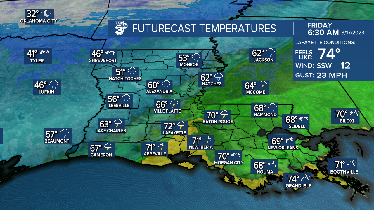
LOWS TONIGHT: UPPER 60's/LOWER 70's
HIGHS FRIDAY: LOWER 70's EARLY... DROPPING INTO 50's BY PM
DISCUSSION
A strong cold front is poised to push through Acadiana Friday morning.
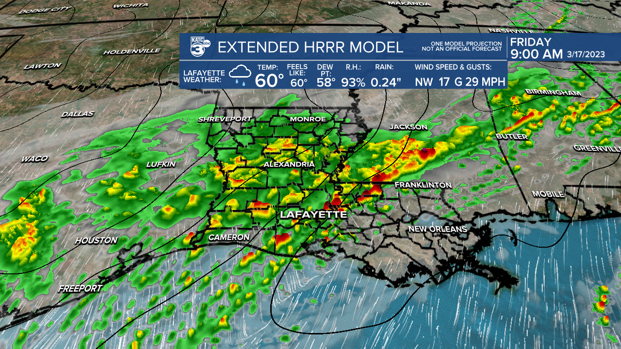
An isolated severe storm or two could be possible as the line of showers and storms work in.
Damaging wind gusts would be the primary threat.
1-2+" of rainfall looks like for most of the area.
It'll be one of those days where you'll need the rain jacket in the morning and then the winter jacket by the afternoon as temperatures drop into the low-mid 50's.
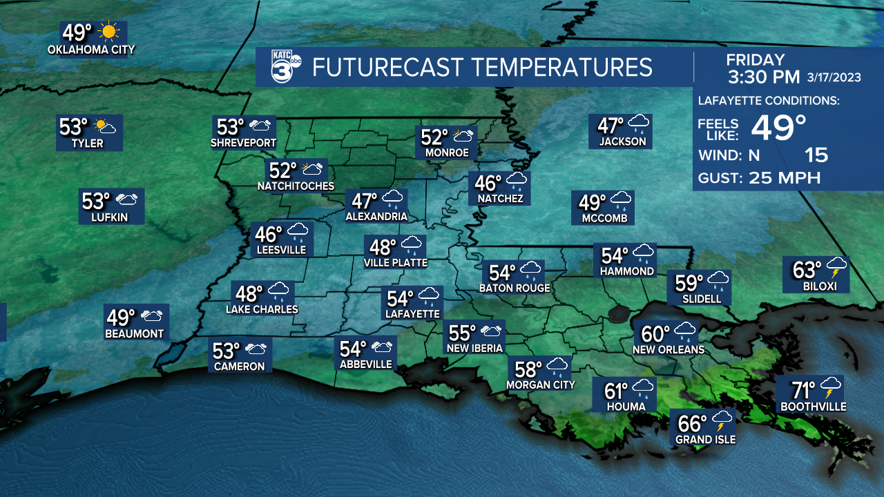
The bulk of the showers will come to an end by the mid-afternoon hours setting up a quiet, but chilly Friday night.
Lows will head for the mid-40's come Saturday morning.
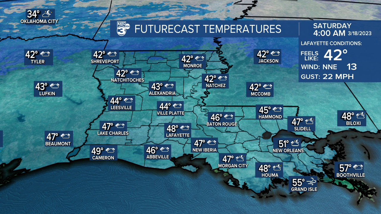
This weekend will feel and look more like January.
Highs may struggle to reach the lower 50's both Saturday and Sunday afternoon thanks to abundant cloud cover.
Some patchy light rain could also be possible at time.
Believe it or not, patchy frost could be possible Sunday night into Monday morning as lows drop into the mid-30's... BRR.
A colder than normal pattern looks to stick around at least for the start of the new week.
Have a good one!
------------------------------------------------------------
Stay in touch with us anytime, anywhere.
To reach the newsroom or report a typo/correction, click HERE.
Sign up for newsletters emailed to your inbox. Select from these options: Breaking News, Evening News Headlines, Latest COVID-19 Headlines, Morning News Headlines, Special Offers
