


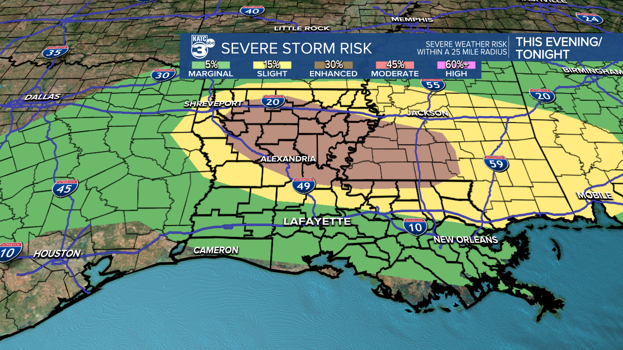
Showers and storms will try and advance into the area later this evening as a frontal boundary approaches.
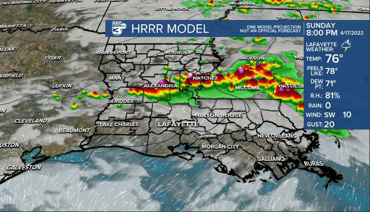
Timing: 9pm-1am
There is an low-end chance that a few storms could contain strong winds or hail.
We'll be turning slightly cooler and certainly less humid behind the boundary.
Overnight lows will drop into the 60s.
After a partly/mostly cloudy start to our Monday, expect plenty of sunshine into the afternoon.
Highs will top out in the mid-upper 70s.
Cool by Tuesday morning with readings heading for the low-mid 50s.
Outside of a few high-level clouds on Tuesday, it'll be another mostly sunny day.
Comfortable temperatures (upper 70s) and humidity throughout the day.
Humidity and warmer temperatures will be back for mid-late week and into the weekend.
Overall, rain chances will remain fairly isolated through the next several days.
Have a great week
------------------------------------------------------------
Stay in touch with us anytime, anywhere.
To reach the newsroom or report a typo/correction, click HERE.
Sign up for newsletters emailed to your inbox. Select from these options: Breaking News, Evening News Headlines, Latest COVID-19 Headlines, Morning News Headlines, Special Offers
