


Expect scattered thunderstorms for the rest of the afternoon.
Activity will begin to slowly diminish as the evening wears on.
Rain-cooled overnight lows will look to settle into the mid-70s.
Would not be surprised if at least some activity begins to flare back up later tonight.
Essentially, a stalled frontal trough draped across the region will keep storm chances elevated into Friday.
Plan on showers and storms to develop as early as the morning hours.

Similar to today, locally heavy rains and lightning will be possible.
With any luck, rains will start to taper by the second half of the day and into the evening hours.
The pattern will remain quite unsettled into the weekend as abundant tropical moisture remains in place.

We have to keep healthy 60-70% rain chances in the forecast.
No signs of drier weather into next week either.
Deep low-level moisture will continue to yield to better than normal rain chances.
We're not concerned with flooding at this point, but a decent soaking will certainly be in store for the area.

We'll let you know of any changes.
Have a good one!
TROPICS
The area of interest over Central America currently still has a 30% of developing into a depression once it emerges out into the Bay of Campeche this weekend.
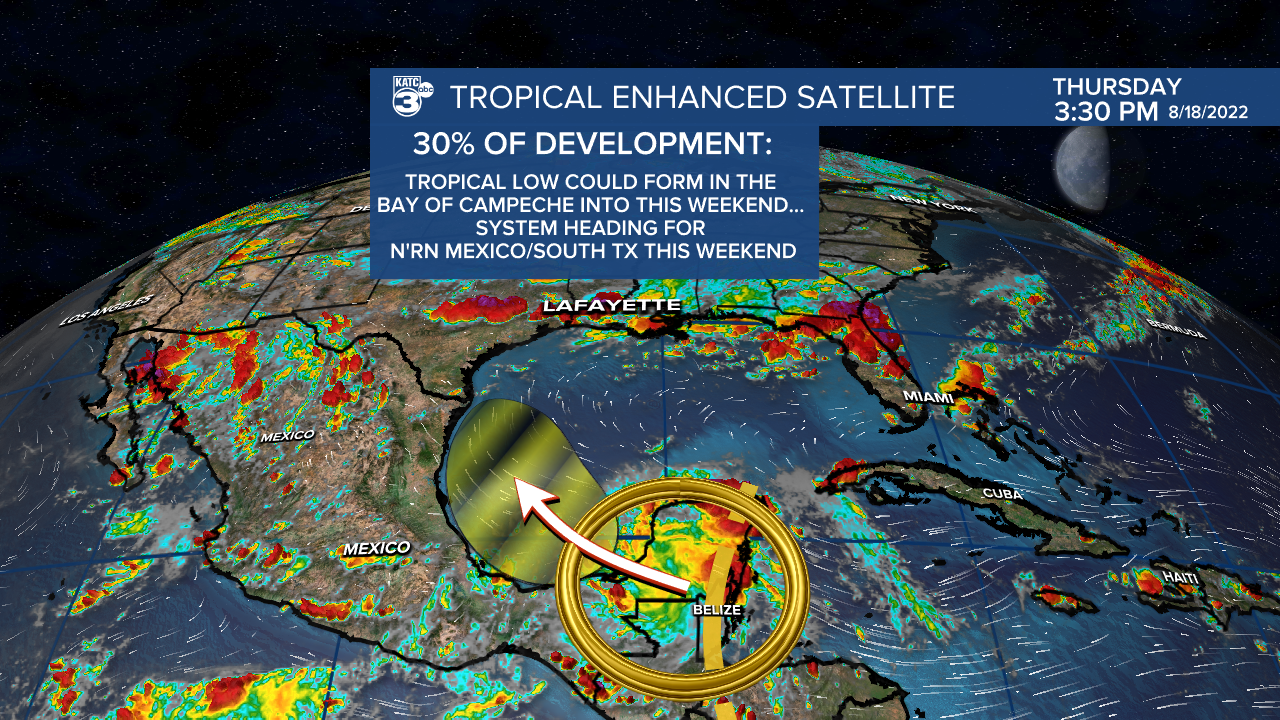
Regardless, this is mainly going to be a rainmaker for portions of Mexico and Texas in the days ahead.
Rest of the tropics are quiet at this time.
------------------------------------------------------------
Stay in touch with us anytime, anywhere.
To reach the newsroom or report a typo/correction, click HERE.
Sign up for newsletters emailed to your inbox. Select from these options: Breaking News, Evening News Headlines, Latest COVID-19 Headlines, Morning News Headlines, Special Offers
