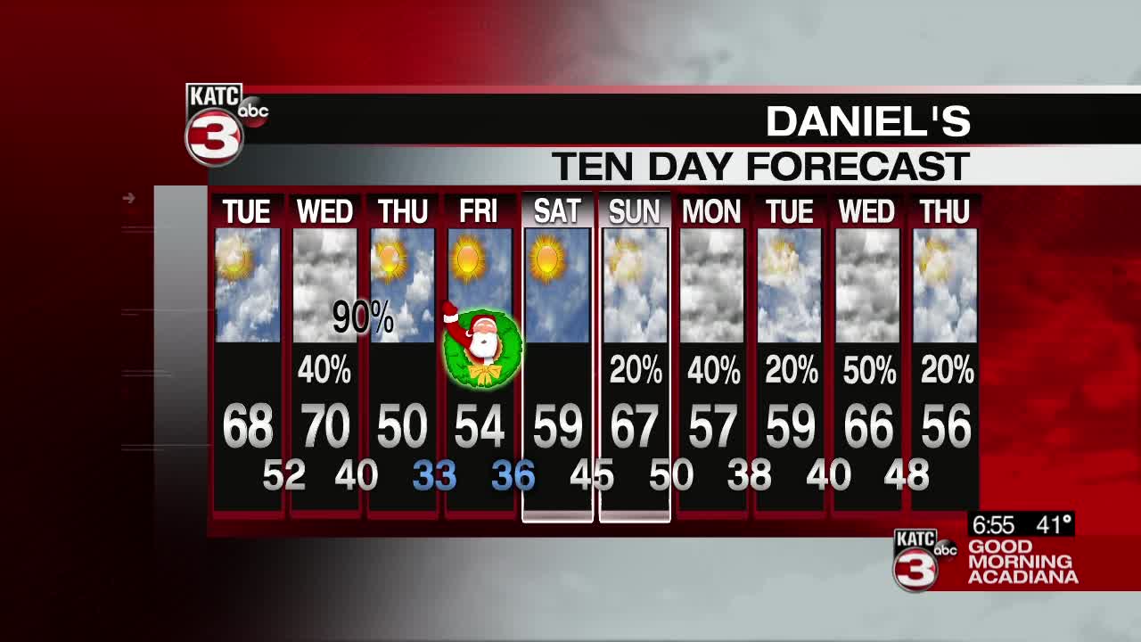

There's another round of thick fog across Acadiana Tuesday morning, but similar to the day before we'll see the fog burn off and leave behind a mild, pleasant day.
A Dense Fog Advisory is in effect until 9:00 a.m. so the visibility will improve in the immediate hours after sunrise, and the sun will be coming out in full force for the rest of the day.
The sunshine will push help push the temperatures into the upper 60s in the afternoon, and with a return of the clouds at overnight the evening is expected to be a little warmer as well dropping down into the low 50s.
The arrival of those clouds will be the early signs of our next front which is scheduled to arrive late Wednesday night and into early Thursday morning.
Storms will arrive in the overnight hours on Wednesday and into early Thursday morning, a few of those storms have the potential to be on the strong side.
A marginal risk of severe weather exists for Wednesday night with a few of the storms that develop along the front having the capability of becoming severe, strong winds and an isolated tornado or two will be the primary threats.
This front will knock temperatures down into the low 30s by Christmas morning so a frosty start to Christmas day certainly looks likely, and the skies will be clear.
------------------------------------------------------------
Stay in touch with us anytime, anywhere.
To reach the newsroom or report a typo/correction, click HERE.
Sign up for newsletters emailed to your inbox. Select from these options: Breaking News, Evening News Headlines, Latest COVID-19 Headlines, Morning News Headlines, Special Offers
