


A warm front is pushing through Acadiana Tuesday morning which has resulted in a handful of showers, and a thunderstorm or two will certainly be possible.
There's enough moisture in the forecast to keep rain chances fairly high through the first half of the day so be prepared to run into a little precipitation as you go through Tuesday morning.
Severe weather is not expected although don't get caught off guard if you hear a rumble or two of thunder through the course of the day.
If there is going to be any severe weather on Tuesday it will be for areas north of Alexandria.
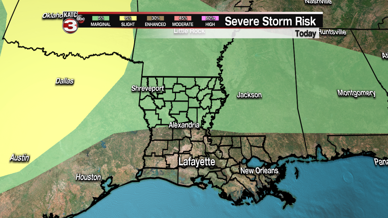
Breaks in the clouds will be possible later in the afternoon, although it'll be more cloudy than sunny, and regardless of the sky cover it is going to be warm and muggy.
Highs will average right around 80 in the afternoon and lows will be down in the low 70s with clouds returning overnight (similar to the last few nights).
As the winds pick up Tuesday night so will the chance for severe weather through the mid week as a strong, dynamic system pushes across the south east Wednesday afternoon.
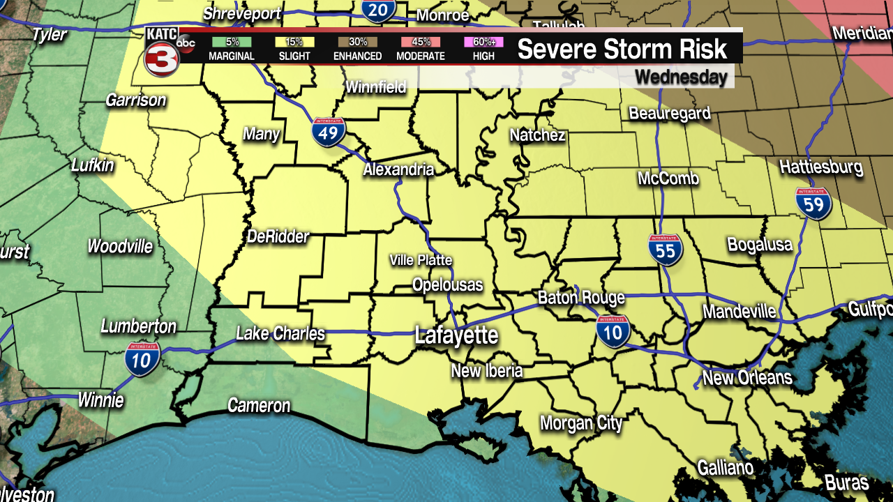
Acadiana's severe weather chances increase Wednesday afternoon with the arrival of an intense front that will swing through between about 2-5 p.m. bringing with it some strong storms.
The storms that move through will be capable of producing all modes of severe weather, tornadoes, hail, damaging winds, frequent lightning, and heavy downpours.
Not all the storms will be severe but the chances are high enough that all storms should be watched closely and residents should remain weather aware through the day.
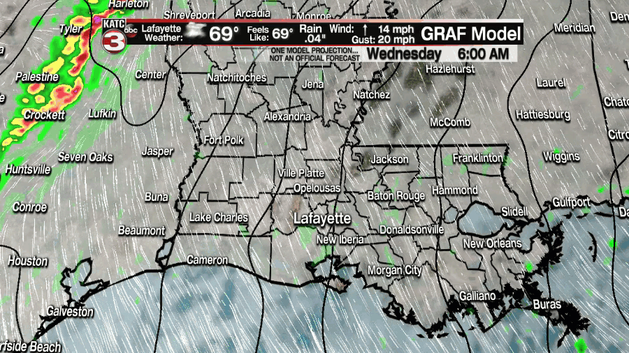
Most short term models seem to be in agreement that the clouds will limit the chances for isolated supercells developing ahead of the front.
This means that our severe threat will primarily exist along the front as it swings through which helps us narrow down the timing a little without the sporadic, isolated thunderstorms popping up.
Leading into the storms the winds will be strong, and out of the south which is going to energize the atmosphere and winds will likely be the biggest issue with the storms on Wednesday.
Wind gusts could push close to 60 mph as the front swings through, which is more than enough to produce damage across Acadiana.
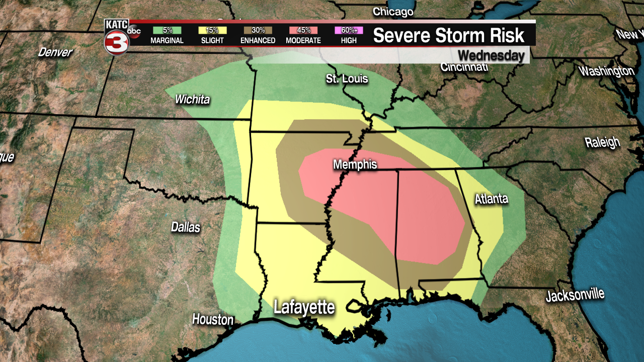
Wednesday's front is producing what will likely be a major severe weather outbreak through the southeast with the main corridor of severe storms setting up between eastern Arkansas and central Alabama.
This seems to be where all the severe ingredients are coming together and long-track violent tornadoes will be possible in the red highlighted area in the above graphic.
If you have travel plans to this area Wednesday evening or Thursday early morning I would urge you to make sure you have a reliable source for breaking weather information.
And keep in mind just because it could be worse somewhere else doesn't mean we don't need to pay attention here at home.
------------------------------------------------------------
Stay in touch with us anytime, anywhere.
To reach the newsroom or report a typo/correction, click HERE.
Sign up for newsletters emailed to your inbox. Select from these options: Breaking News, Evening News Headlines, Latest COVID-19 Headlines, Morning News Headlines, Special Offers
