

As Texas digs out from this week's record-breaking winter storm, we now have a better idea of the toll the storm took on the state's electric grid.
Photos captured by the NOAA-20 satellite show the difference in nighttime illumination of city lights from before the storm, on January 31, and after, on February 16.
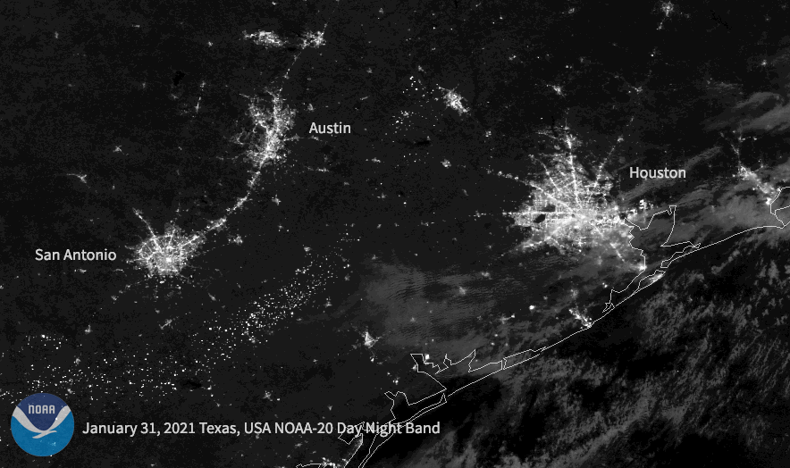
Dimming can be seen around much of the metropolitan Houston area, as well as in portions of San Antonio and Austin.
The outages at one point left more than 4 million people in the dark and cold, as frigid temperatures crippled electric grids.
This week's extreme weather affected people from several southern states and is being blamed for the deaths of at least 70, according to The Associated Press.
Texas was hit particularly hard, and officials employed rolling blackouts across the state in an effort to conserve electricity.
The NOAA-20 satellite is part of the Joint Polar Satellite System, a collaborative effort between NOAA and NASA. Read more here.
------------------------------------------------------------
Stay in touch with us anytime, anywhere.
To reach the newsroom or report a typo/correction, click HERE.
Sign up for newsletters emailed to your inbox. Select from these options: Breaking News, Evening News Headlines, Latest COVID-19 Headlines, Morning News Headlines, Special Offers
