


As southerly flow continues to get established, temperatures won't be quite as cold tonight heading into Tuesday morning.
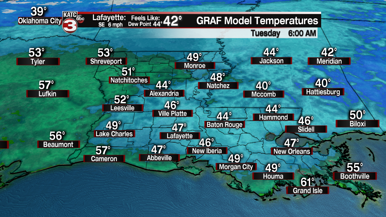
We will start out in the mid to upper 40s across the area as some clouds start to stream into the region.
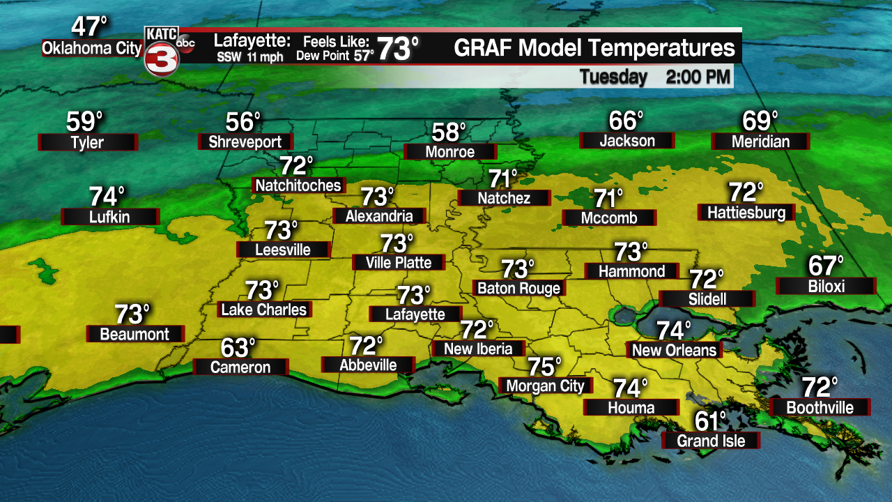
Fair to partly clouds are expected throughout Tuesday as highs push the lower and mid-70s!
A cold front will be off into the northern parts of the state, but that is where the cooler air and rainfall will stay tomorrow.
That front tries to push through our region going into early Wednesday morning, but it will start to run out of gas as it mainly brings in cloud cover.
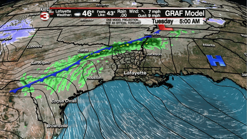
That front may help to generate a few light sprinkles first thing on Wednesday morning, but most of us will remain dry.
Otherwise, expect partly to mostly cloudy skies on Wednesday as that frontal boundary starts to slowly lift back northward.
That will bring back a return flow out of the Gulf, thus, any sort of a cool down is out of the window.
In fact, afternoon highs on Wednesday will still climb to near 70 degrees.
We will be lacking low-level moisture on Wednesday, so I do expect the day to remain dry.
Our next surface low will start to approach from the west on Thursday.
That, coupled with southerly flow in place, may help to generate at least a few isolated showers throughout Thursday afternoon.
I have rain chances at 30% for now...
Staying mild as highs top out in the lower 70s.
Best rain chances of the week still appear to arrive on Friday as that surface features moves closer to the region helping to bring through a cool frontal passage as well.
As of now, models have continued to trend on keeping the highest rainfall totals (heaviest of the precipitation) off to our north.

We will continue to watch the trends to make sure that does indeed come to fruition.
Slightly cooler heading into Saturday as highs return to the lower and mid-60s.
I have kept slight rain chances (albeit low) through the course of the weekend as models continue to differ slightly on a solution.
We then perhaps turn a little more unsettled into the first parts of next week as our next upper-disturbance approaches.
Still a week out on that, so plenty of time to watch...
------------------------------------------------------------
Stay in touch with us anytime, anywhere.
To reach the newsroom or report a typo/correction, click HERE.
Sign up for newsletters emailed to your inbox. Select from these options: Breaking News, Evening News Headlines, Latest COVID-19 Headlines, Morning News Headlines, Special Offers
