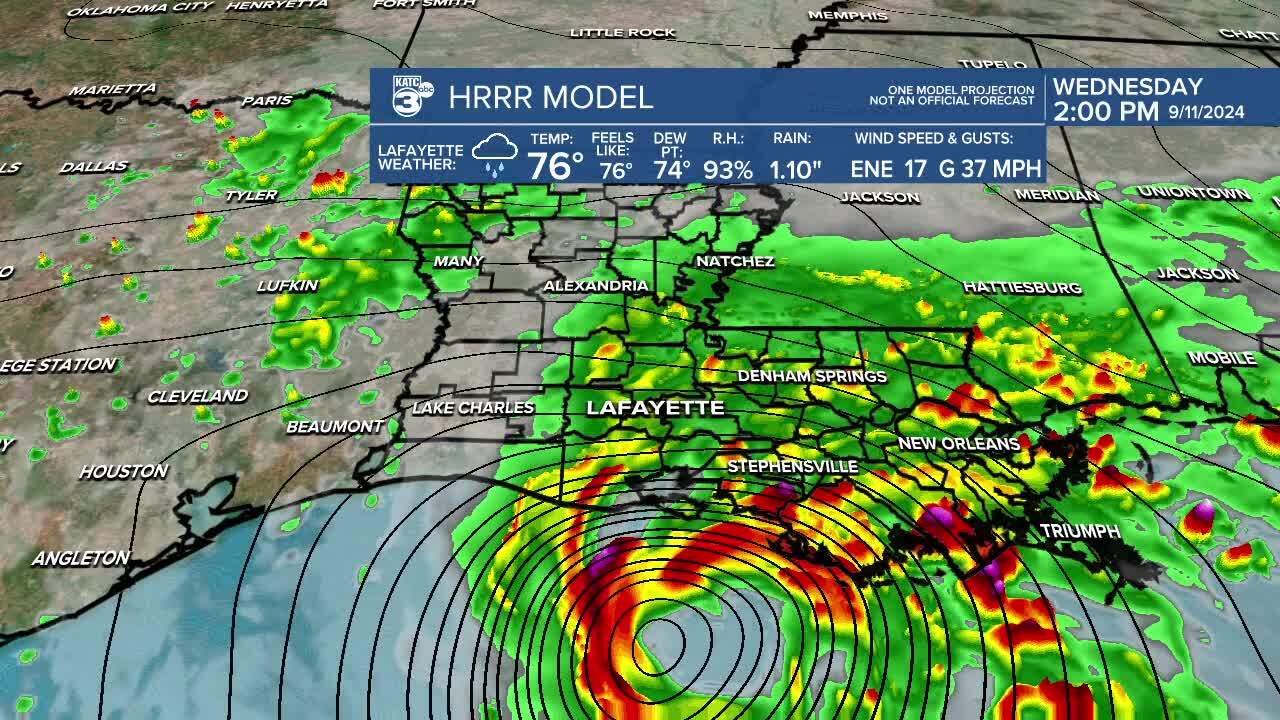
Tracking Francine: Hour-by-hour look at storm's impact on Louisiana

The drift to the east means that the most significant impacts will also slide to the east, but tropical storm conditions are still expected in central Acadiana and hurricane conditions are expected along the coast.
Weather will gradually deteriorate as we go through the remainder of the day with the worst of the weather arriving in the late afternoon and early evening.
Flash flooding will remain a concern in St. Mary Parish as hot spots of 8" will occur and as that arrives quickly it will be hard for that water to drain out of the area.
Most of the flood threat has shifted to the east and that could include both New Orleans and the Mississippi coast line.
The rest of Acadiana will take on about 2-4" of rain which shouldn't be a major issue outside of some pooling on some of the low lying roadways.


