


After a cold and dreary past couple of days, skies gradually clear tonight.
It'll be a cold one with temperatures heading for the mid-20s for most of us... slightly colder to the north.
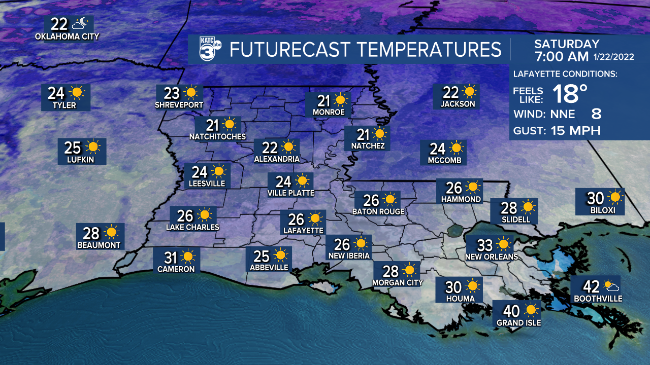
Wind chills will be in the teens first thing Saturday morning, so bundle up!
Remember the 4 P's tonight: People, pets, plants, and pipes.
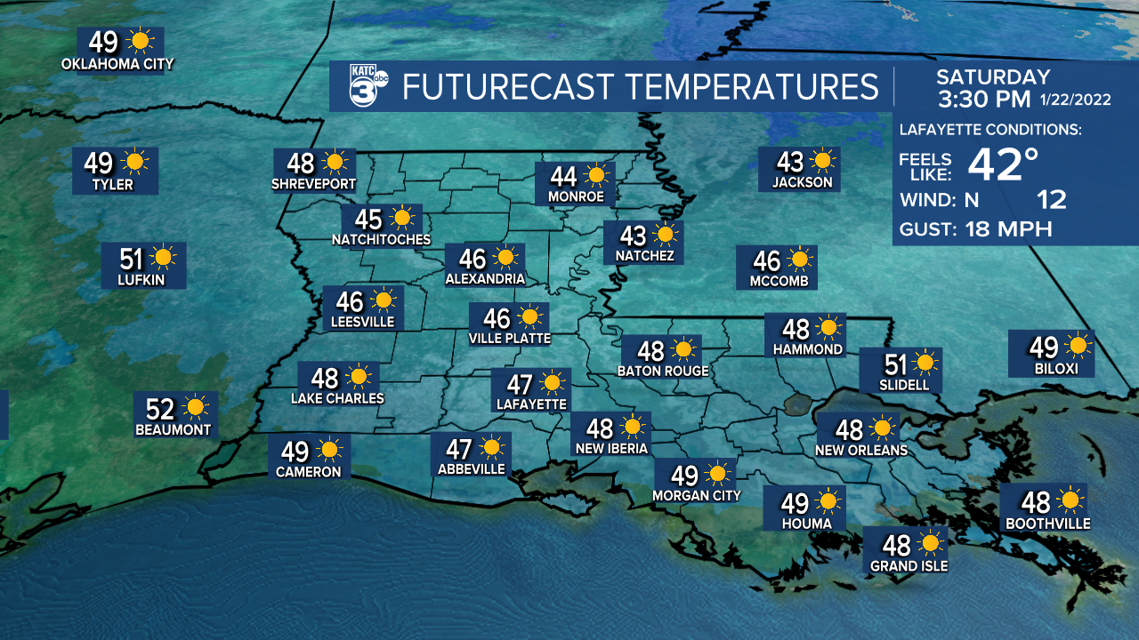
Sun returns Saturday, but highs with only rebound into the upper 40s.
Winds will be out of the north at around 8-14 mph.
Likely heading for another hard freeze Saturday night/Sunday morning.
Sunny skies expected again for Sunday.
Highs will top out in the mid-50s.
A disturbance will give us a healthy rain chance late Monday and into Monday night.
An inch or two of rainfall could be possible.
Seasonably cool weather will stick around through much of next week.
We'll be talking highs in the 50s and lows in the 30s/40s.
In the meantime, find ways to stay warm and maybe break out the gumbo pots!
------------------------------------------------------------
Stay in touch with us anytime, anywhere.
To reach the newsroom or report a typo/correction, click HERE.
Sign up for newsletters emailed to your inbox. Select from these options: Breaking News, Evening News Headlines, Latest COVID-19 Headlines, Morning News Headlines, Special Offers
