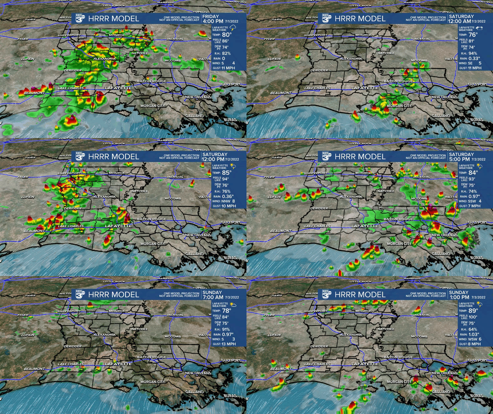
Well, after a damp day across Acadiana, we have more wet weather on the way Saturday as activity will start to fire back up late tonight and into the morning hours (especially across SW LA and western Acadiana).
The culprit continues to be a tropical disturbance that is moving northeast and bringing in a slug of moisture.
With that feature hanging around, coupled with sufficient low-level moisture Saturday, rain chances look to stay elevated.
Plan on scattered tropical showers and storms just about at any time, but especially during the morning and early-mid afternoon hours.

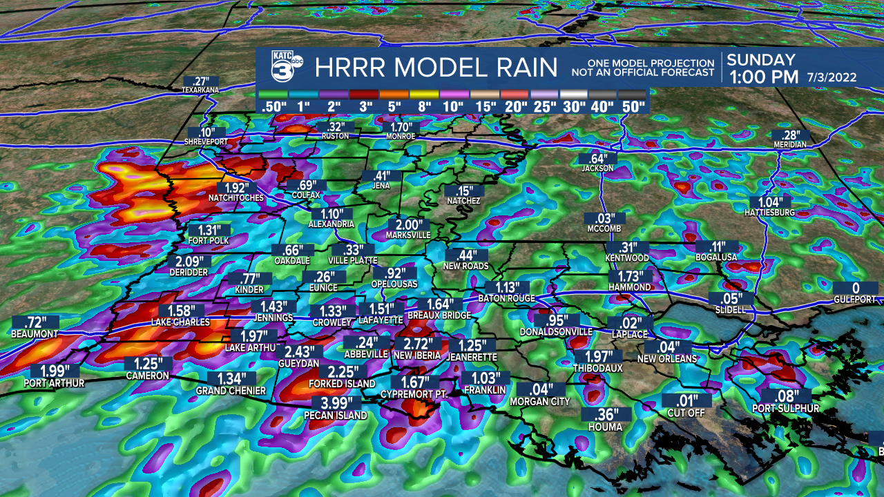
An additional 1-2" of rainfall will be possible with locally higher amounts in spots.

Rain chances will start to settle down a bit Sunday and into Monday (4th) as that disturbance lifts out of here.
However, scattered showers and storms will still be possible during the afternoon hours as the pattern switches to more of a typical summertime scenario.
That looks to carry over into most of next week.
We'll see highs in the low-mid 90s with afternoon rain chances at around 40-60%.
Have a great holiday weekend!
TROPICS
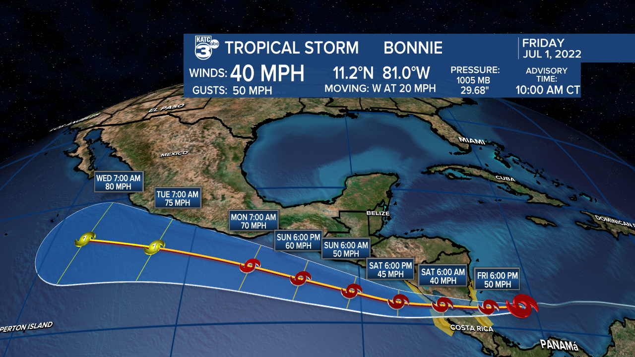
To no one's surprise, tropical storm Bonnie officially formed this morning.

It remains no threat to Acadiana, but will bring some impacts to portions of central America Friday night and into Saturday.
The hurricane center is highlighting two other small areas in the basin, but only gives them each a 10% chance of development (no concerns).
Rest of tropics are quiet at this time and appears to stay that way over at least the next two weeks.
------------------------------------------------------------
Stay in touch with us anytime, anywhere.
To reach the newsroom or report a typo/correction, click HERE.
Sign up for newsletters emailed to your inbox. Select from these options: Breaking News, Evening News Headlines, Latest COVID-19 Headlines, Morning News Headlines, Special Offers


