


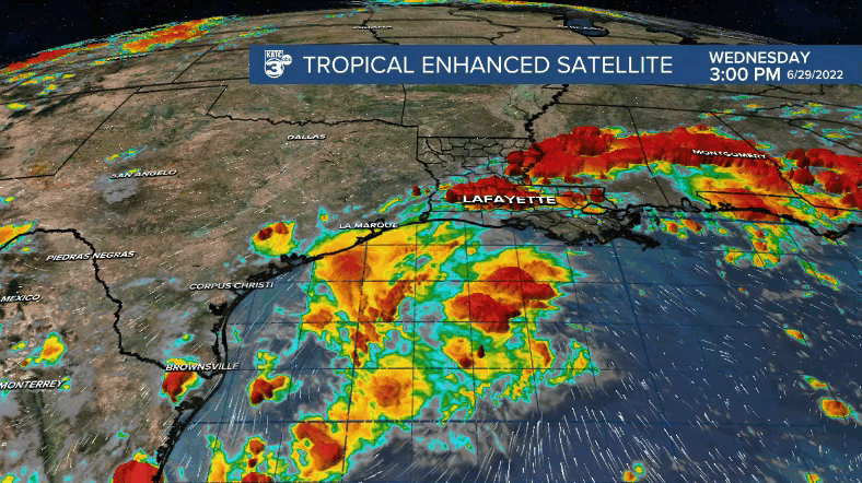
A stalled frontal boundary across the region coupled with deep tropical moisture will keep scattered showers and storms in the forecast for the rest of the week.
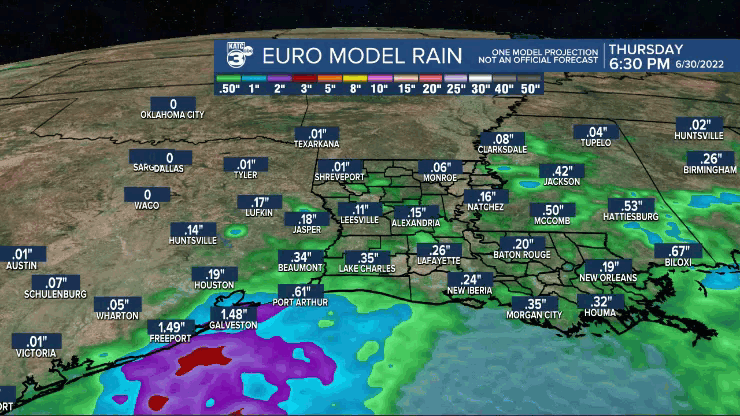
Rain chances will remain in the 50-60% range with a slight bump Friday.
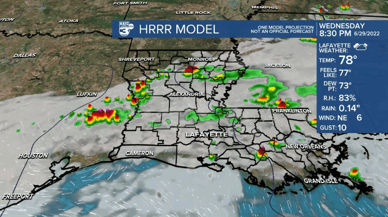
Not everyone will get wet every day, but be prepared to dodge some tropical downpours from time to time (heavy at times).
GRAF model may be a bit overdone on the rainfall, but it does suggests the potential for high rainfall totals somewhere across the Texas/Louisiana coast.
The good news? It won't be quite as hot and we get much needed rainfall in the process!
With the added cloud cover, afternoon high temperatures will be limited to the upper 80s and lower 90s (right where we should be).
Tropical moisture looks to linger into the holiday weekend, keeping scattered rain chances in the forecast.
But again, no particular day looks like a washout.
Have a good one!
TROPICS
An elongated area of low pressure in the NW gulf still has a medium (40%) chance of development into a depression as it drifts toward the Texas coast.
No real issues with this disturbance as it will mainly be a rainmaker for Texas and us here in Louisana over the next several days.
Potential tropical cyclone two is still expected to become tropical storm Bonnie in the next 24-36hrs as it continues to track westward in the southern Caribbean.
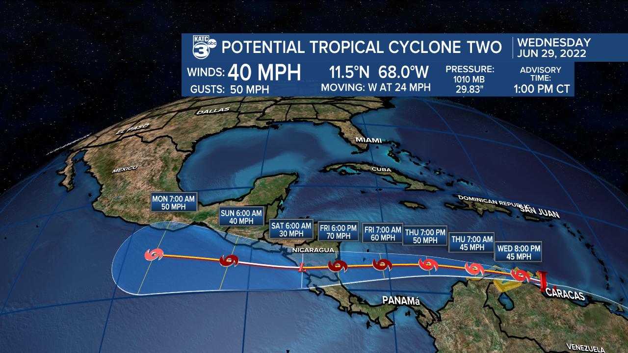
Due its close proximity to land at the moment, significant intensification is not expected.
However, it should have a better chance at strengthening once back over the open waters.
It may get pretty close to hurricane intensity before all is said and done.
Regardless, high pressure will continue to steer the feature to the west and well to the south of Acadiana (No threat to us).
Interests in central America should monitor the progression of the system.
Another area of disturbed weather (behind PTC #2) has a low, 30% chance of development in the next 5 days.
We'll keep an eye on it, but does not look too concerning at this point.
------------------------------------------------------------
Stay in touch with us anytime, anywhere.
To reach the newsroom or report a typo/correction, click HERE.
Sign up for newsletters emailed to your inbox. Select from these options: Breaking News, Evening News Headlines, Latest COVID-19 Headlines, Morning News Headlines, Special Offers
