LOWS TONIGHT: MID-60S
HIGHS FRIDAY: UPPER 80S/LOWER 90S
DISCUSSION
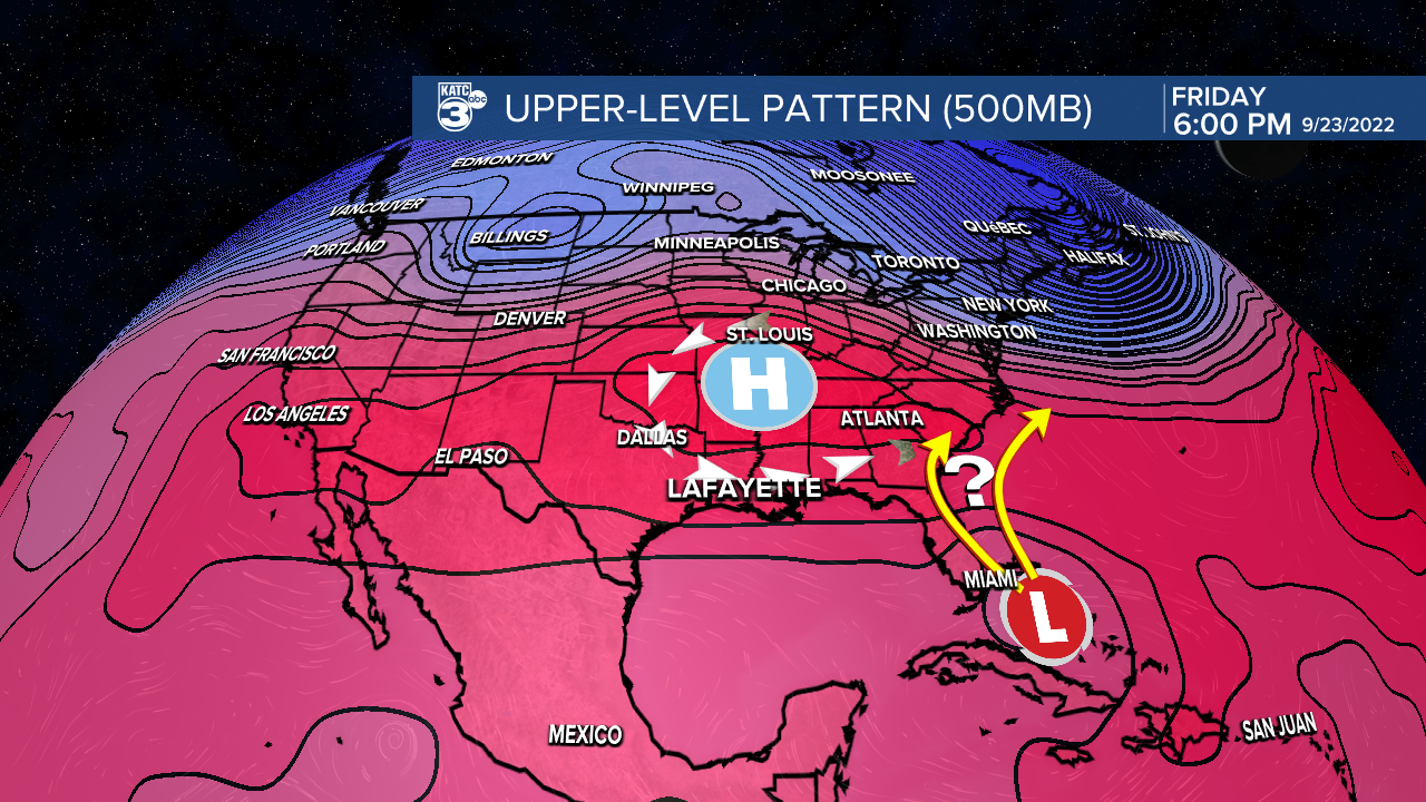
The upper-level ridge that has dominated the forecast this week, providing us with drier and more pleasant weather, will begin to break down and nudge eastward over the next couple of days.
As a result, expect the humidity to be on the increase...
A pleasant and comfortable Thursday evening and night is in store for Acadiana.
We'll see those lows dropping into the mid-60s under clear skies.
Outside of a few fair weather cumulus clouds Friday, expect another mostly sunny and hot day with the humidity slightly more noticeable.
We'll start to introduce a few isolated showers back into the forecast this weekend... but still not too terribly high (20-30%).
A large ridge of high pressure will build in next week.
As a result, the heat will be on (low-mid-90s) as rain chances remain low.
Hopefully you did not let false fall fool you because it will be back to summer very soon!
Have a great one!
TROPICS
Tropical Storm Fiona continues to be the only feature in the Atlantic basin.

Currently, the low-level center of circulation is well displaced from all of the shower and storm activity
In the short-term, it'll impact the Caribbean islands bringing tropical storm conditions.
Thereafter, the forecast becomes a bit murky as we do not have great model consensus.
However, folks in the Bahamas and eastern U.S. should pay close attention and have interest for down the line.

At this time, the steering pattern does not support a track toward the Gulf of Mexico.
We'll continue to keep an eye on it regardless...
------------------------------------------------------------
Stay in touch with us anytime, anywhere.
To reach the newsroom or report a typo/correction, click HERE.
Sign up for newsletters emailed to your inbox. Select from these options: Breaking News, Evening News Headlines, Latest COVID-19 Headlines, Morning News Headlines, Special Offers


