


It will be a chilly start for Acadiana as we enter "winter" on the calendar Tuesday, but warmer weather is expected to return in time for Christmas.
In the near term, although the rains have ended, the upper level low that produced that rain won't exit the region until tomorrow, leaving the area with cloudy/wind-chilly conditions overnight through Tuesday morning.
Temperatures tonight will range anywhere from the upper 30s to lower 40s depending on the thickness in cloud cover and whether any breaks in this clouds occur through morning.
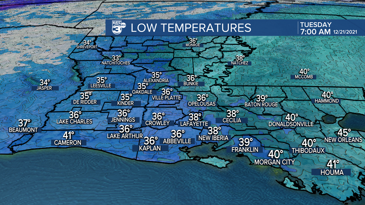
Wind chills will likely be closer to the mid-30s come Tuesday morning.
Sunshine should return for our Tuesday afternoon with temperatures rebounding back into the low-mid 50s.

It looks to be a touch colder tomorrow night into Wednesday morning with readings closer to the mid-30s, and some patchy frost cannot be ruled out in more rural locations and to the north of the I-10 corridor.

The winter chill be short-lived with temperatures rebounding into the low-mid 60s under full sunshine Wednesday afternoon.
The warming trend will continue later this week as high pressure slides to our east allowing for persistent southerly winds and temperatures returning some 15-20° normal by the end of the week.
Christmas Eve and Christmas day look to be fair to partly cloudy with highs in the upper 70s to lower 80s with this pattern continuing well into next week.
See the KATC 10 Day Forecast for the latest.
Seasonally speaking, the winter solstice occurs Tuesday at 9:59 am CST, as the sun will be directly over the Tropical of Capricorn, meaning our shortest days of the year are right now, will begin to get slowly longer again into January.

Our daylight is currently limited to 10 hours and 12 minutes but will begin to lengthen by a minute every few days starting around December 28th.
Finally in climate news: with the recent rains, 2021 has moved up to the 6th wettest year on record...with 78.53"...our yearly average is near 61".
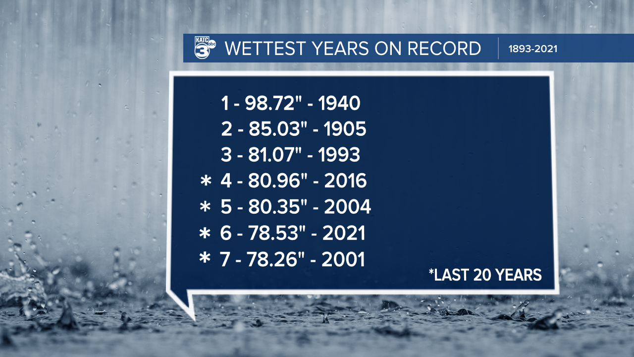
Four of the of the top seven wettest years in Lafayette have occurred in the last 20 years.
This fits with the trend of a warmer atmosphere, a 2-3°F warmer Gulf (compared with 20th century average) allowing the atmosphere to hold more moisture, which translates to more intense and more frequent heavy rain events...thus wetter years now and moving forward.
We're not alone either...big records set this year along the Gulf Coast into Southern Mississippi where rain totals this year have exceeded 100"!
------------------------------------------------------------
Stay in touch with us anytime, anywhere.
To reach the newsroom or report a typo/correction, click HERE.
Sign up for newsletters emailed to your inbox. Select from these options: Breaking News, Evening News Headlines, Latest COVID-19 Headlines, Morning News Headlines, Special Offers
