LOWS TONIGHT: MID-40s
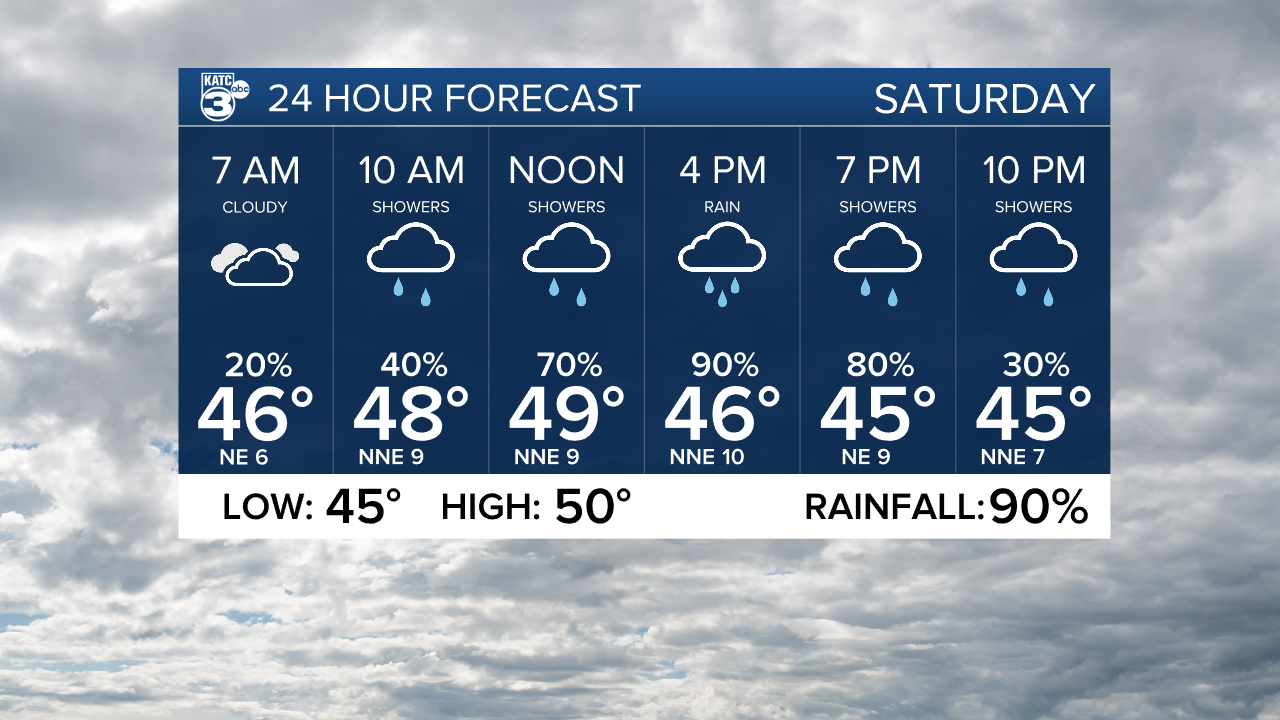
HIGHS SATURDAY: UPPER 40s/LOWER 50s
DISCUSSION
Welcome to the weekend!
Expect chilly conditions overnight as lows settle into the mid-40s under mostly cloudy skies.
Isolated patchy light sprinkles could be possible through this evening, but nothing really of consequence.
A surface low off the SE Texas coastline, coupled with enough atmospheric lift aloft, will yield to a pretty good chance of scattered light-moderate showers throughout our Saturday (90%).

Not much rainfall is anticipated.
Plan on a quarter of an inch or less for most locations.
It's going to feel and look very much like winter out there as highs struggle to get out of the 40s under otherwise overcast skies.

Wind chills will remain in the low-mid 40s into the afternoon.
Sunday will be the better day of the two this weekend.
After a morning start in the upper 30s to lower 40s, expect highs to push into the mid-50s Sunday afternoon under partly cloudy skies.

Another quick moving disturbance should give us some rain chances late Monday.
Otherwise, we will finally see some slightly milder temperatures through the middle parts of the week as highs climb into the 60s.
A front still looks to be on track to arrive to Acadiana sometime on Thanksgiving or Friday.
Timing and details still need to be ironed out, so stay tuned for the latest.
Have a great weekend and stay warm!
------------------------------------------------------------
Stay in touch with us anytime, anywhere.
To reach the newsroom or report a typo/correction, click HERE.
Sign up for newsletters emailed to your inbox. Select from these options: Breaking News, Evening News Headlines, Latest COVID-19 Headlines, Morning News Headlines, Special Offers


