


It was a nice stretch but Louisiana returned to the "cone of uncertainty" on Thursday, and still finds it self there early Friday as watches and warnings are being issued ahead of Tropical Storm Claudette.
Technically we are still awaiting the official arrival of Claudette as the storm remains PTC 3 (Potential Tropical Cyclone) but the impacts for the central Gulf states will remain largely the same.
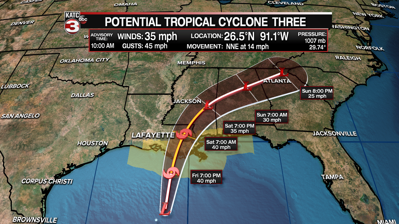
The forecast track from the NHC is based on general model consensus which has been fairly consistent in keeping the center around Acadiana with the impacts sheared mostly out to the east.
Claudette is expected to make landfall in the early morning hours of Saturday and should be out of Louisiana by lunch time Saturday, heading off towards Appalachia and eventually the mid-Atlantic.
Locally the impacts will be minimal, Friday afternoon into Saturday morning, we may see a few rogue tropical showers but they'll be moving too fast to produce much accumulation if any at all.
The winds will be breezy and gusty, hovering around 10-15 mph with gusts around 20-30 mph along the coast, but that isn't expected to produce any damage only help us break up the heat a little.
Some minor coastal flooding will be possible as well with tides coming in maybe a foot or two above average, although this isn't hugely uncommon so the impacts will be pretty minimal.
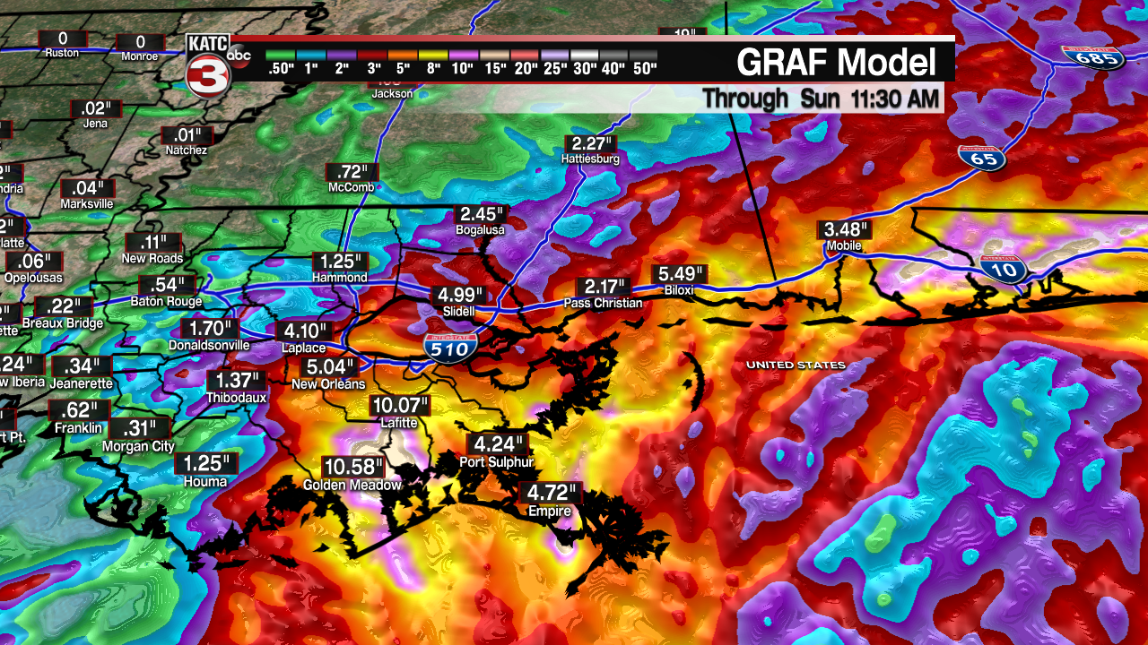
While it is quiet in Acadiana, there are potentially significant impacts expected across the greater Gulf Coast with flash flooding possible between New Orleans and Pensacola Bay as training tropical showers produce up to a foot of rain.
The central Gulf Coast will average around 4-8" of rain with some isolated areas receiving up to a foot, this could cause significant flash flooding and travel through this area should be avoided if possible this weekend.
In some of the outer rim squalls a few spin up tornadoes will also be possible so folks in these areas should make sure they have a way to receive watches and warnings for the places they'll be staying.
------------------------------------------------------------
Stay in touch with us anytime, anywhere.
To reach the newsroom or report a typo/correction, click HERE.
Sign up for newsletters emailed to your inbox. Select from these options: Breaking News, Evening News Headlines, Latest COVID-19 Headlines, Morning News Headlines, Special Offers
