


Acadiana has another round of potential severe weather on the way for Tuesday morning as an energetic front slides east.
A Tornado Watch has been issued as a result for eastern Acadiana and will remain in effect until 11:00 a.m.
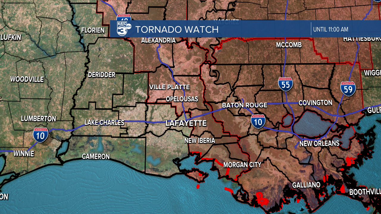
While the watch is in place for the eastern half of Acadiana we all need to be on the look out for storms as some severe weather dynamics are in place for all of Acadiana.
Those storms will move through the area from the morning commute through the mid morning before starting to ease up in the early afternoon, although clouds will certainly linger a little longer.
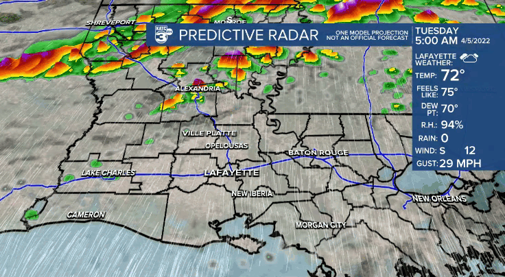
The primary threat for the day is going to be strong, damaging winds with storms capable of producing wind gusts up to 60 mph.
A few isolated tornadoes will be possible, although they will remain isolated and spin-up in nature, so while it's a lower chance even we still need to be aware.

Clouds will break briefly Tuesday evening, but will return on Wednesday as warm, muggy air stays in place through the middle of the week.
Those clouds will finally clear out on Thursday with cool air rushing into the area, and a beautiful back half to the work week.
------------------------------------------------------------
Stay in touch with us anytime, anywhere.
To reach the newsroom or report a typo/correction, click HERE.
Sign up for newsletters emailed to your inbox. Select from these options: Breaking News, Evening News Headlines, Latest COVID-19 Headlines, Morning News Headlines, Special Offers
