
BREAKING UPDATE at 7pm:
A Flash Flood Watch in effect Vernon, Beauregard, Allen, Evangeline, Rapides & Avoyelles Parishes through 11pm.
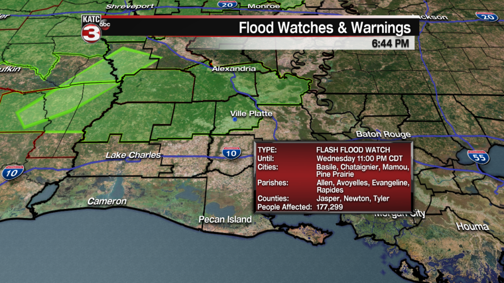
Rainfall rates up to 2-4″ per hour with a total of 5-7″ will be possible in isolated spots (especially Vernon & Rapides) this Wednesday evening. See the Doppler Imagery link below for the latest on the storms.
Original Story:
Acadiana will stay in an “on and off” stormy pattern over the next several days as a series of upper level disturbances continue to interact with a quasi-stationary surface boundary that has been draped across Eastern Texas into Northwestern Louisiana.
Latest Doppler Radar and Satellite Imagery:
 Power Doppler HD Acadiana View


The forecast however, remains quite complex, with none of our models (including the Euro, GFS, RPM, NAM, & HRRR) having any consistency to the forecast rainfall and storm patterns.
With that in mind, there remains much below normal forecast confidence on timing and intensities of thunderstorm complexes to come, but we do know this: rain chances will likely increase to their highest levels starting Thursday night and continuing through Saturday.
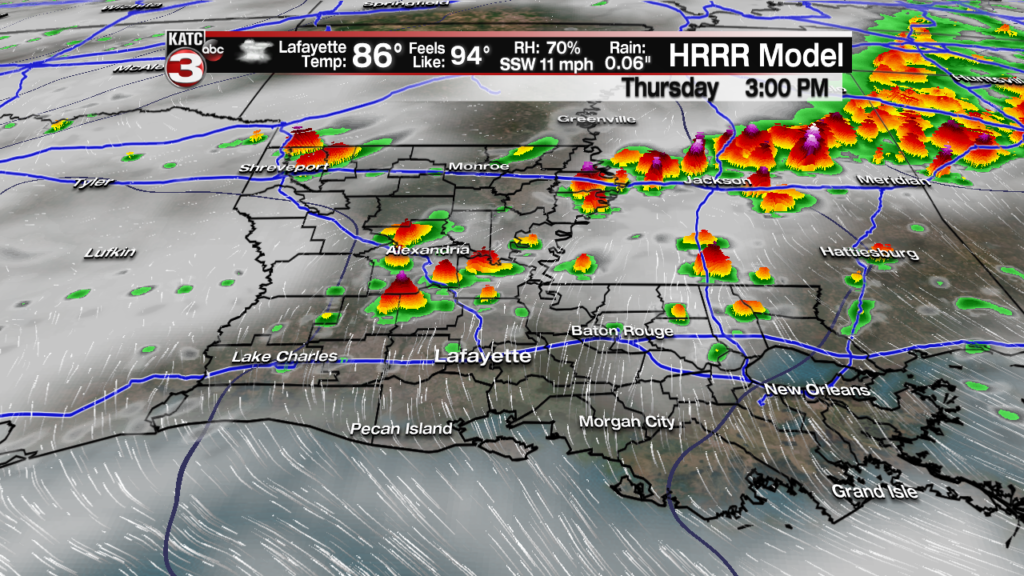
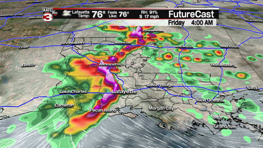
For Thursday, we currently have a 50% chance of showers and storms, primarily expected across the northern parishes Thursday, with the action likely to drop southward and possibly redevelop overnight into early Friday (Per the RPM Model below).
Rain chances will increase to 80% Friday and Saturday, and as mentioned earlier the best rain chances may arrive at any time during the day and/or night!

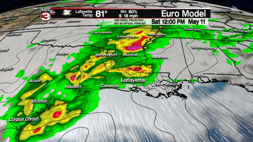
Based on the latest Euro Model it appears that the highest chance of showers and storms Saturday will arrive by the early afternoon and continue into the overnight hours with activity mercifully (we hope) coming to an end by Sunday morning.
After the risk of a few morning storms, the weather should improve Sunday afternoon with some sunshine returning for the latter part of Mother’s Day.

Rainfall totals remain a complete challenge with an additional 3-5″ or more possible for portions of Acadiana over the three day period from Thursday through Saturday.

But within the forecast areas, isolated amounts of 8-10″ or more may be possible…(just see what happened in Southeast Texas near Houston Tuesday night where more than a foot of rain fell in spots in a 12 hour period).

The GFS forecast rainfall may be a little more accurate through Saturday, with isolated rainfall totals possibly approaching that 8-10″ range…and possibly more, where storms may repeat or “train” over the same areas.
Before all is said and done, some Flash Flood Watches may be in the future for portions of Acadiana, and in addition to that, there may be some severe weather to contend with as well.
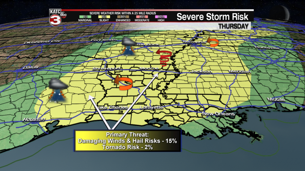
The Storm Prediction Center (SPC) has all of Acadiana hatched in for a slight risk of severe storms Thursday into Thursday night primarily for the possibility of storms capable of producing damaging winds.
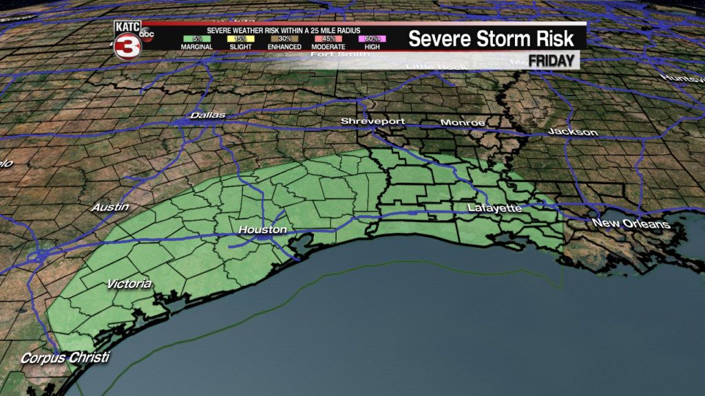
And the SPC maintains a lower, marginal threat, of severe storms locally for Friday into Friday night…and may continue that same thinking for Louisiana into Saturday/Saturday night as well.
Fortunately, if following the Euro Model, we should have a couple of nice days entering early next week…see the KATC 10 Day Forecast for the latest.
