

LAFAYETTE PARISH — The Lafayette Parish School System and Lafayette 911 have launched a new school mapping system designed to give first responders real-time access to detailed campus layouts during emergencies.
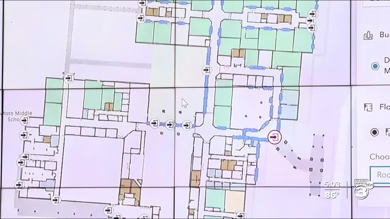
The initiative was highlighted Tuesday at a demonstration held at the LPSS Central Office on Rue Iberville. The digital platform allows police, firefighters and EMS teams to pull up school blueprints immediately when a call comes in, showing key areas such as entry points, classrooms and common spaces.
“If a first responder gets a call from a school, they’ll now see a map attached to that alert,” said Craig Stansbury, director of Lafayette 911. “They can click it and view the full layout in seconds — it’s a game-changer for emergency response.”
The program was developed before Louisiana passed Act 425, which will require all school districts in the state to implement similar mapping tools. Lafayette is now one of the first parishes to roll it out ahead of the statewide deadline.
So far, more than 30 LPSS campuses have been integrated into the system, with more expected to follow. The school board approved a partnership with Lafayette 911 earlier this year to proactively address campus safety and streamline communication with emergency services.
Officials say the technology enhances their ability to respond quickly, accurately and with the information they need to keep students and staff safe.
