


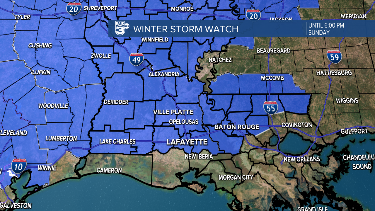
Out of an abundance of caution the National Weather Service issued a Winter Storm Watch for portions of Acadiana from the I-10 Parishes northward including Lafayette for Saturday into Sunday afternoon.
While the Euro Model has backed off and moved north on the threat of any frozen precipitation in Acadiana, the GFS remains a little more bullish for perhaps a period of freezing rain, sleet or even a snow flurry primarily Sunday morning into the Sunday afternoon...whereas the Euro is dry by the afternoon and shows little or no frozen precipitation into Sunday afternoon.

A blend of both models may work for Acadiana, but we are a long way away from any certainty in the forecast...so stay tuned.
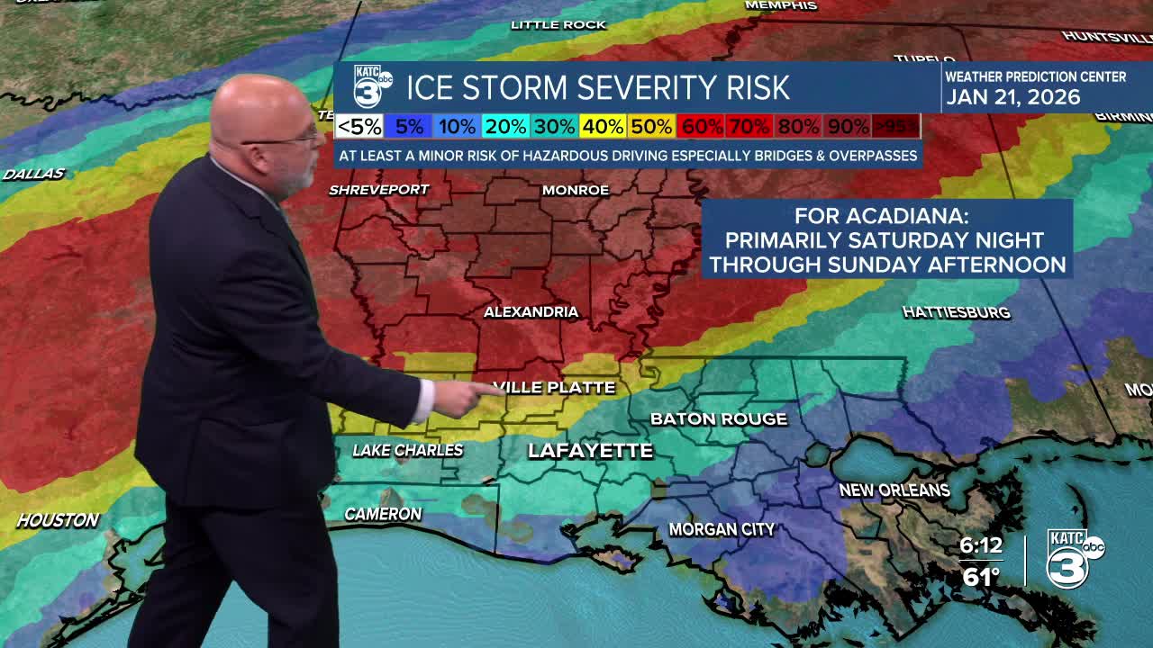
The risk of minor icing per the Weather Prediction Center has also decreased down to the 20-30% for Lafayette...yesterday it was in the 40-50% range.
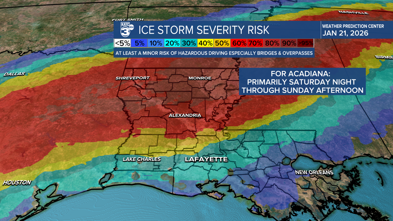
So for now, expect cold rains, but we'll be watching the temperature forecast trends as we still do not know when sub-freezing temperatures will arrive...if not until Sunday much better...but if sooner ie Saturday night, then there will be icy trouble.

We do know for sure the coldest air of the season is on the way with temperatures by Monday morning possibly dropping into the upper teens to lower 20s with wind chills in the lower teens! Prepare accordingly!
Meanwhile, the big snows have also shifted to the north and this will be indeed a whopper of a winter storm.
Latest Power Doppler 3 and KATC 10 Day Forecast
Stay with KATC for the latest updates on this evolving winter scenario as aspects of the forecast will likely change.
