


Just as our temperatures got back to near normal in Acadiana, it will be back to a touch of winter Wednesday into Thursday.
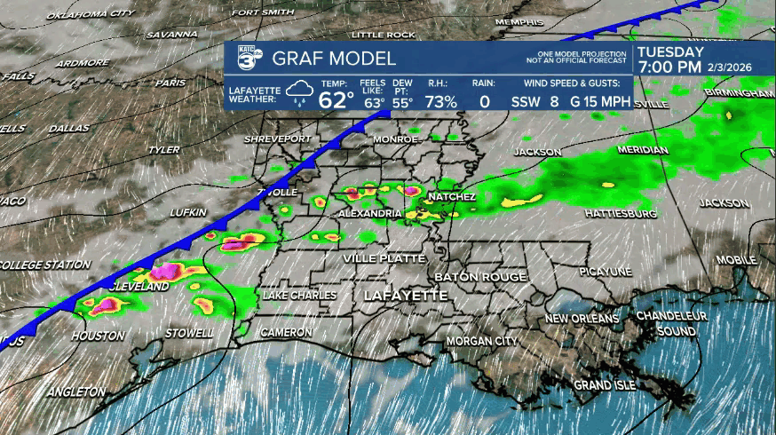
On and off scattered showers will continue into the overnight hours ahead of a cold front that will bring breezy and chilly, more winter-like temperatures, to Acadiana.
Behind this front, is a modified Pacific airmass, so it will not be nearly as cold as we've already experienced recently and there should be no hard freezes.
Highs Wednesday and Thursday will be in the 50s, while the coldest readings of the week should occur Thursday morning, accompanied by lows in the low-mid 30s.

A light freeze and/or frost is expected Thursday morning.
Rain totals through tonight should generally be in the 1/4-1/2" range or less...a few isolated spots may see more if we can get better convection and/or a rumble of thunder...no severe threat is anticipated.

After Friday morning the plants can go back out and it's a pre-spring pattern with daily highs pushing into the lower 70s into the weekend and near the mid-70s most, if not all of next week.
We can't say yet how Mardi Gras is looking, but climatologically-speaking it may be a little cooler than next week...normal highs for this time of year are closer to the mid-upper 60s and that would be a good guess.
