


12 PM Update:
The National Weather Service has issued more winter weather related advisories/watches/warnings. As these overlap and can become confusing here is an explanation:
I just wanted to remind everyone the Extreme Cold Watch is really replacement language for what we used to refer to as the Hard Freeze Watch/Warning.
This is to account for the absolutely frigid temperatures and wind chill we are expecting through Monday.
The Winter Storm Watch/Advisory is ongoing because we have the ever so slight chance of frozen precip. south of I-10, but it is appearing to be more of a rain event for Southern Acadiana, maybe even some soaking storm totals. It's not impossible for some areas to see a flicker of snow Sunday. But, not those accumulating amounts like last year.
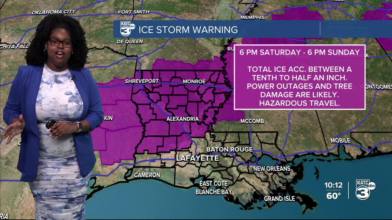
The Ice Storm Warning is covering the areas models are hinting are on the southern border of where that magic line of the freezing air temperature with correct areas of warm air in the mid-levels of the atmosphere are landing and those areas should prepare for frozen precipitation. If this verifies that amount of ice can be debilitating and you'd need to be prepared to stay in your home for 1-2 days, although if it happens your landscape and view the following morning will be beautiful.
Also schools are beginning to announce and are very properly canceling school for Monday which is a great call and extreme valid. For a full list of closures follow KATC's website.


——————
The forecast remains a bit of a mess this morning, but we are feeling a little more confident regarding some aspects of the weekend.
Showers will arrive on Saturday and will remain liquid rain through the course of the day as temperatures will stay in the mid 50s through the afternoon.
There may be just enough lift along the frontal boundary to produce a thunderstorm or two but severe weather doesn't look to be an issue.
Temperatures will start to drop Saturday night and this is where the forecast becomes a little less clear, and a few degrees will make a major difference.
This will be the time period that will determine whether Acadiana sees any freezing rain or if it'll just be a very cold liquid rain going into Sunday.
Naturally models seem split here with the EURO remaining much warmer (as it has done for most of the week) while the GFS has been consistently colder and more aggressive with freezing rain.
Candidly I've lent much more on the EURO for this forecast given some of the performance issues with the GFS over the last few weeks.
We finally got into the window that some of the higher resolution models can start to work and it looks like the GRAF may be splitting the difference a little.
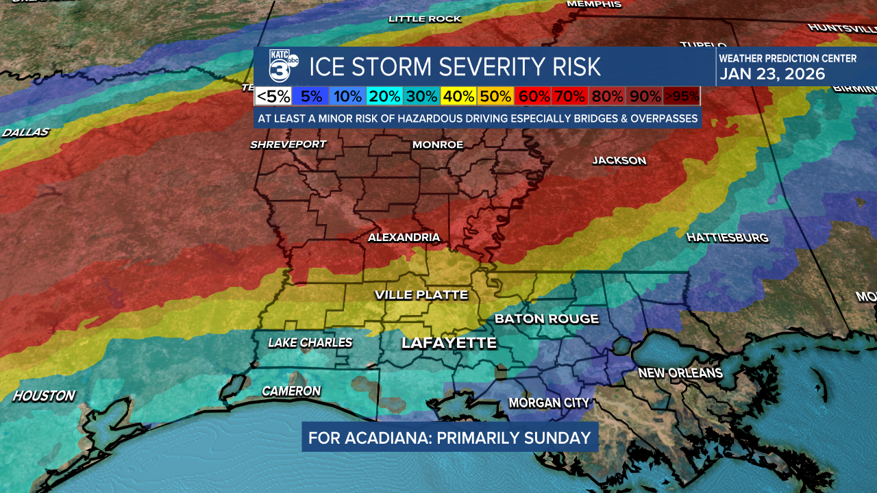
This seems to go inline with our thinking through most of the week with minor impacts possible north of Highway 190, with areas along and south of I-10 likely avoiding any kind of freezing rain.
Temperatures will drop through the day on Sunday as the showers slowly taper off, and as long as we stay above freezing while it's raining we'll avoid winter precipitation.
Acadiana will likely be at freezing by the time the sunsets and temperatures will drop down into the low 20s by Monday morning with windchill values in the low teens.
This could still cause some bridges and overpasses to get slick with leftover moisture freezing overnight, but I doubt we see widespread roadways that are impassable.
You'll want to make sure your pipes are wrapped and taken care of as this is the kind of freeze that can cause plumbing issues.
I wouldn't be surprised if we find ourselves with low water pressure and may be asked to conserve water to start the week.

Conditions will be much more severe in north Louisiana and travel north of Alexandria should be avoided.
While Acadiana is facing minimal impacts this will still be a major winter storm in other parts of the deep south with widespread impacts.
Folks in north Louisiana may be facing downed trees and power lines with possible power outages arriving as the temperatures drop.
We'll likely remain right around the freezing line through the forecast so we'll continue to make tweaks as we go but as of now it looks like Acadiana will avoid some of the more severe impacts.
