

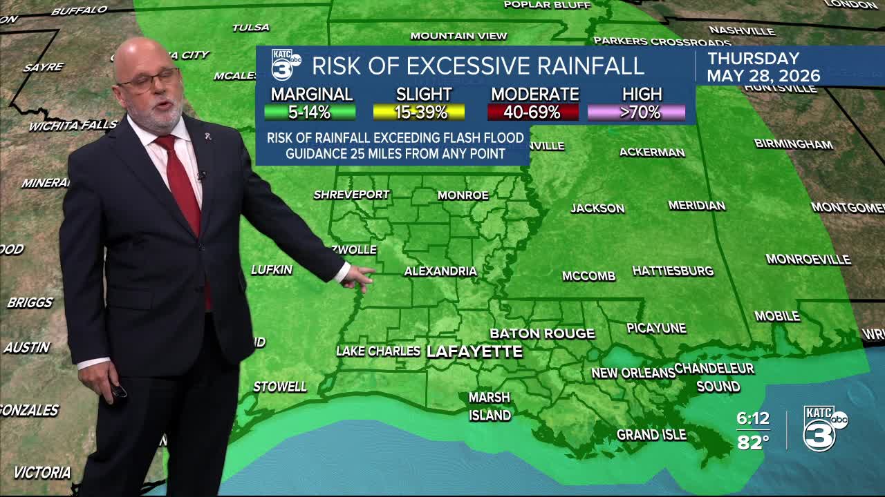


After a day or so break from the daily downpours across Acadiana, they'll be coming back in the days ahead with Wednesday and Thursday looking the wettest.
Tuesday will bring another day of some sun (like today) with scattered showers and thunderstorms across the Acadiana area into the afternoon/early evening hours...we're going with 60% for rain chances Tuesday.

More widespread showers and thunderstorm activity is anticipated for Wednesday into Thursday as a series of upper disturbances in the west replace the weak upper low near us today.
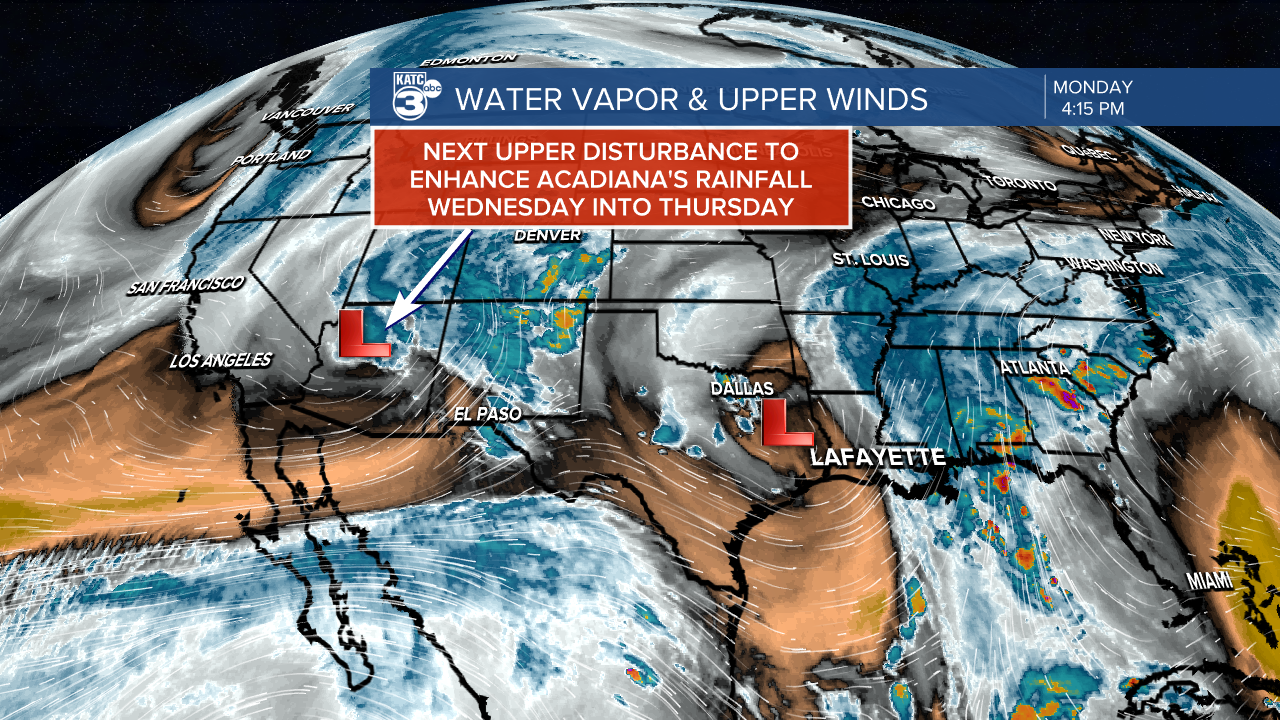
Rain chances for Wednesday and Thursday will push the 80% range on those days.
A good chance of scattered showers and storms will continue Friday, but it is encouraging that our rain chances look to decrease (but won't be completely eliminated) into the weekend.
And once the rain chances begin to decrease, the heat with the humidity will start to come on with temperatures reaching the more 'normal' upper 80s this weekend.
Scattered activity will stay in the forecast into next week with hints of a weak front arriving a week from Tuesday, which could usher in a couple of sunny and dry days to follow as we move into the first week of June.

Rainfall totals "(above): HRRR model that is just through 1pm Wednesday, we should see the totals increase into Wednesday afternoon...and Weather Prediction Center's Forecast total for the next 7 days (below) yields about 2-5" for our area...mostly coming through Friday.
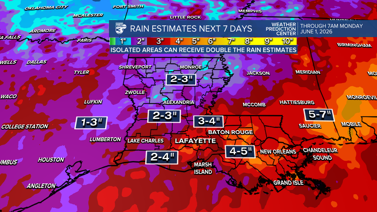
Locally higher totals will be possible depending on how the activity sets up for the mid-late week period.
See the KATC 10 Day Forecast and Power Doppler 3 page for the latest, and KATC's Futurecast page for future forecast data and rain totals.
