


It finally started to feel like summer out there this weekend as humidity started to inch up along with those temperatures.
We'll continue to see that moisture move in, especially given we'll have some pretty gusty winds blowing out of the south through the course of the day.
Highs are still expected to get into the upper 80s and heat index values will likely climb into the 90s.
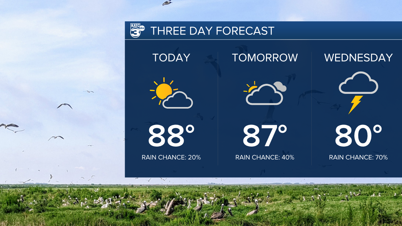
This increase in moisture is setting the table for a very wet week with daily rain chances hovering around 60-70 percent starting on Wednesday as a front stalls out over Acadiana.
We'll get a gradual build up in cloud cover on Tuesday and maybe a few showers popping up the next few afternoons, but the more widespread rains will hold until the end of the week.
The way the pattern is shaping up should be able to pull most of Acadiana out of drought as we'll have solid afternoon rains arriving daily through most of this week, weekend, and even looks to continue into next week as well.

We're looking at 2-4" of rain through the week in most of Acadiana, although hotspots could easily double those amounts depending on where the downpours set up.
Localized flash flooding will be an issue this week, particularly during those evening commutes, so be mindful of water pooling up on the roads.
Thunderstorms will be embedded in the showers, with one or two severe storms possible, but severe weather doesn't look likely enough to be the main concern this week.
All in all it looks like a pretty wet finish to May so we should be headed into summer firmly out of drought.
