


Acadiana's soaking wet weather pattern that has plagued the area over the four days will come to a temporary end this week, as temperatures warm closer to summer readings.
And after a period of drying out through the weekend; it appears that another rainy/stormy period may be shaping up again for next week...more on that later.
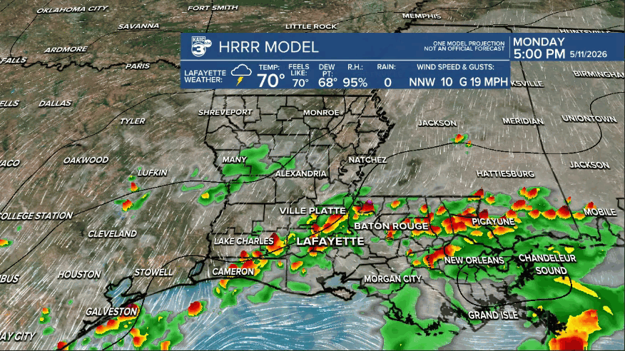
In the near term, an upper disturbance and weak frontal boundary will keep rain and locally heavy storms/downpours going well into the evening with activity tapering across the region after midnight, or sooner.
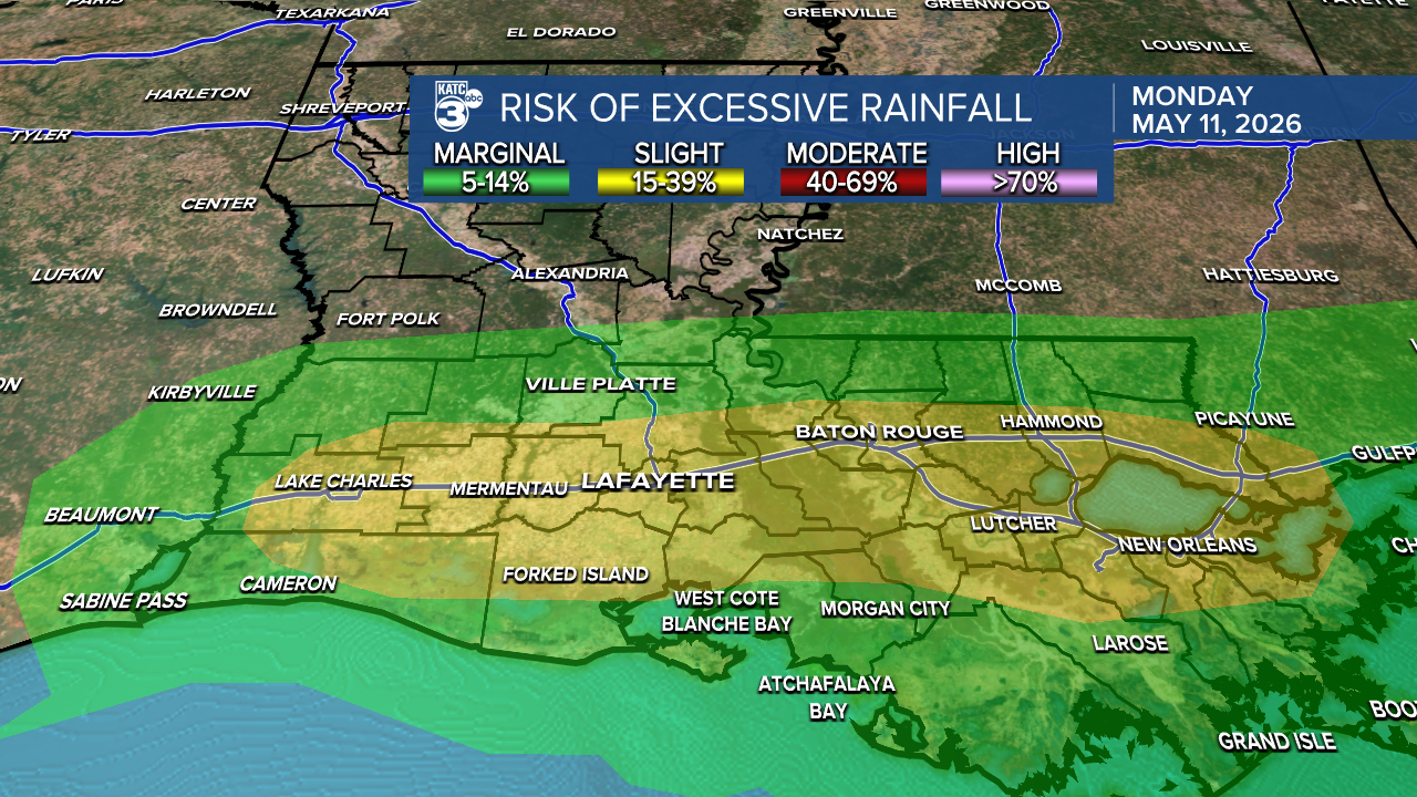
The area remains in a "slight risk" (level 2/4) for excessive rainfall into tonight.
The Weather Prediction Center issued a Mesoscale Discussion late Monday afternoon concerning the threat of heavy rainfall and flooding for Acadiana.
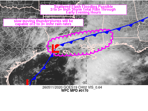
Per their summary..."Scattered thunderstorms will pose a flash flood threat from southwestern LA into southern MS and far southwestern LA. Hourly rainfall of 2 to 3+ inches and localized totals of 3 to 5+ inches are expected." ... in the highlighted area.
Drier air will begin to filter into the region Tuesday, with morning clouds yielding to plenty of afternoon sun.
Temperatures will rise from the mid-60s in the morning reaching the lower to possibly mid-80s for the afternoon.
Any residual moisture in the atmosphere and on the ground, may allow for a few pop-showers Tuesday afternoon or early evening (20%), however even drier air will filter into the region Tuesday night.
Wednesday through Friday, and most of the weekend, will be mostly sunny and warmer with daytime highs clawing their way toward the upper 80s to near 90° by Thursday.
More clouds into the weekend, especially during the morning hours, should keep highs a little closer to the mid-80s.
Rain totals across portions of Acadiana have been in the 5-10" range since late last week with isolated spots seeing more...so the dry weather ahead will help, but the pattern may turn quite wet and potentially stormy again into next week.
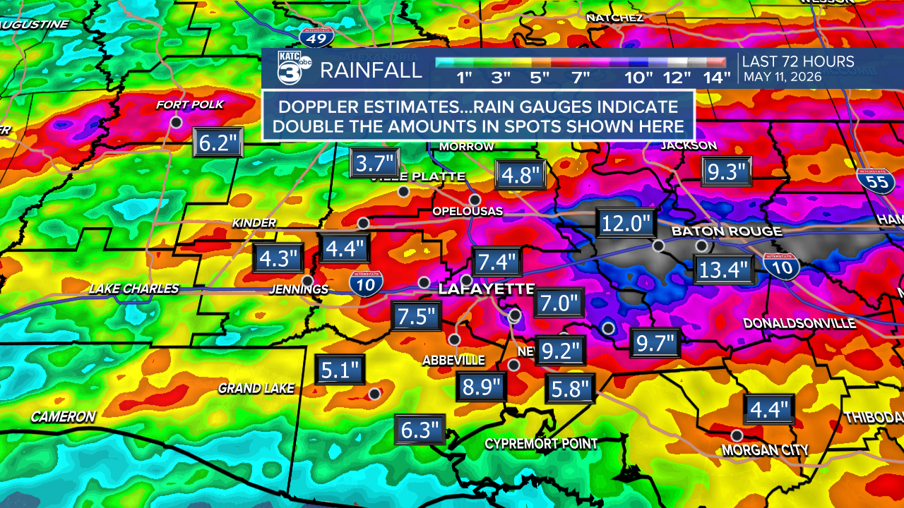
And going back to April 30th, Lafayette has received anywhere between 10-14" of rain with isolated spots around Acadiana receiving even more.
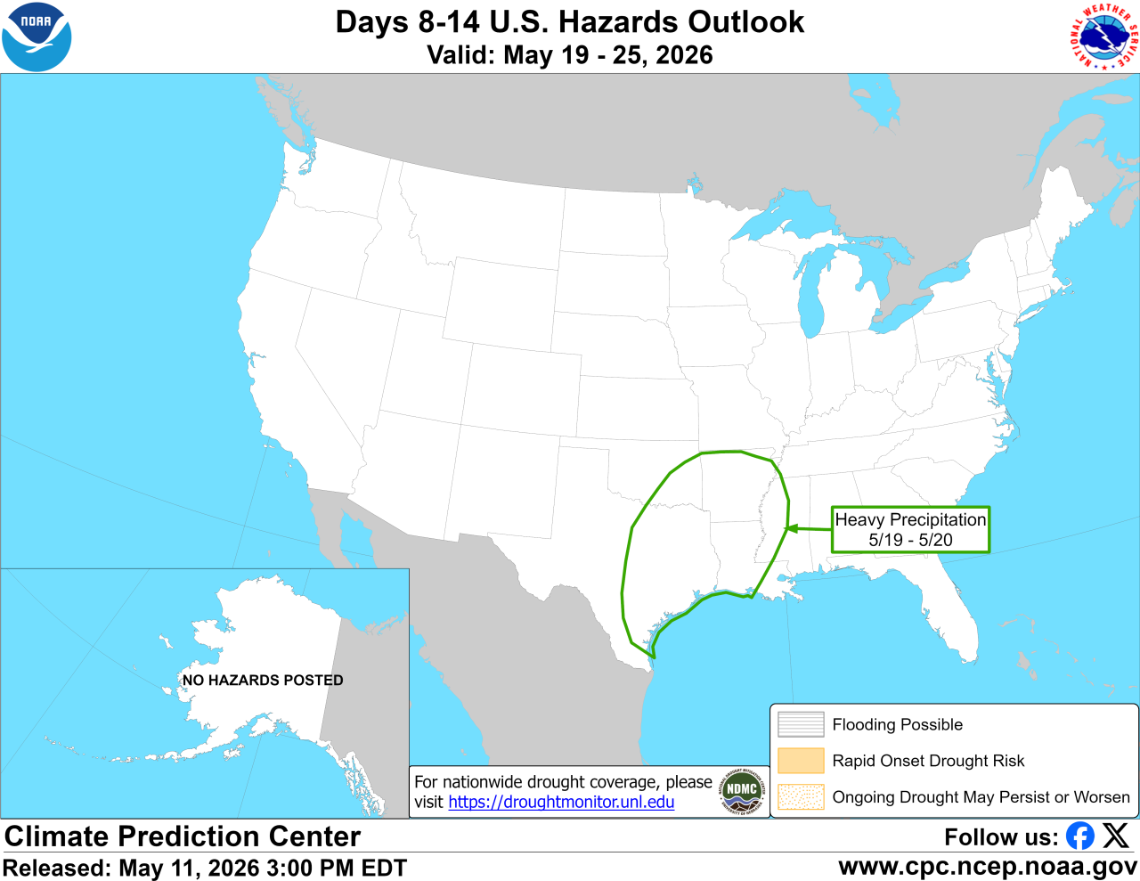
The Climate Prediction Center's (CPC) 8-14 day outlook is looking rather wet again between May 19th through the 25th at least, give or take a day....so any drought concerns will likely be completely erased before the month is done.
See the KATC 10 Day Forecast for the latest forecast details.
