


The chance of scattered showers and some thunderstorms will increase for Acadiana this weekend, especially into Saturday night and ending sometime early Sunday.
In the near term, expect mild and humid conditions again overnight through Friday morning with lows near 70°.
A few isolated showers may be possible, but should become a little more likely into the day Friday as temperatures near the mid-8-s in the afternoon and the atmosphere become a little more unstable.

Showers and some thunderstorms are expected to become more likely as a disturbance and associated cool front approach the area into Saturday.
Rain chances Saturday should increase from 60% in the latter part of the afternoon to 90% overnight with a 60% chance of lingering rains/showers possible through midday Sunday.
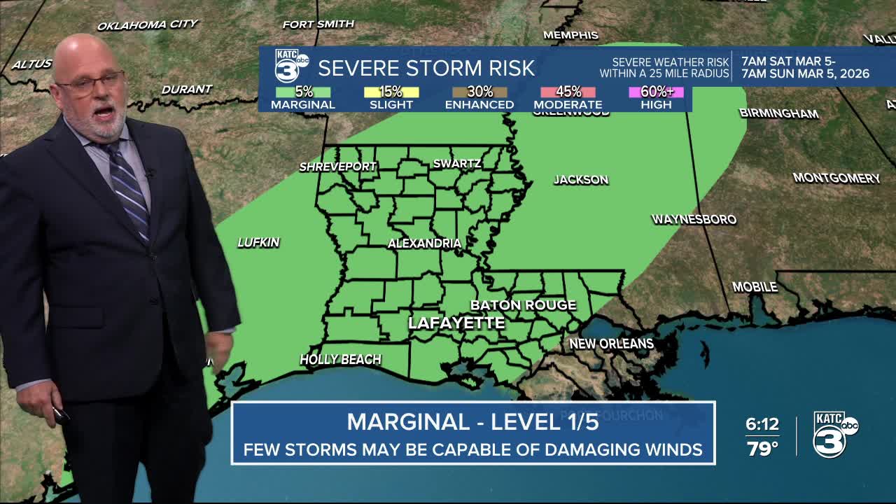
In addition, a "marginal risk" (level 1/5) of a few severe storms may be possible for Acadiana Saturday into Saturday night as introduced by the Storm Prediction Center earlier today.

Conditions may favor a few isolated severe storms capable of producing primarily damaging winds...but an isolated weak tornado may be possible, but should be least likely.
The dynamics for any potential severe storms will continue into the evening hours Saturday before the surface front outruns the severe dynamics, sometime during the overnight hours into Sunday morning.

Meanwhile, drought conditions have worsened across the state and for Acadiana with much of our area now in a dry to moderate drought status, which worsens to the southeast and to the north/northwest.
The rain on the way into the weekend should help a little, but how much is still a difficult proposition, with the GRAF Model all over the place on its latest run, while the Euro paints a more consistent picture.
For now, expect around an inch or less for most locations, most of which comes Saturday afternoon and overnight into Sunday morning.

Isolated spots could see up to 2", perhaps 3", as models have been underestimating rain events so far this spring, and add to that the uncertainty given the current model disagreement.

Expect cloudy, breezy and cooler conditions into Sunday afternoon with temperatures holding in the 60s while breezy north winds make it feel that much cooler.

And after a dry and cool spell early next week, look for moderating temperatures and rain chances to return to the area...and this time, more substantial rains may develop down the road.
See the KATC 10 Day Forecast and the latest Power Doppler 3 for the latest.
