


Acadiana's weather will be status quo until a cool front arrives Saturday night.
And after a nice Sunday and start to next week, it's looking wetter and potentially a little stormy by week's end.
In the near-term, look for another quiet and mild night with clouds and some patchy fog possible toward daybreak.

Temperatures will bottom out in the mid-60s tonight and rise back into the mid-80s Tuesday.
Expect mostly cloudy skies to start our Wednesday, followed by mostly sunny and breezy conditions into the afternoon.

More of the same is expected Thursday into Friday with rain chances going no higher than the 5-10% range all this week.
A frontal system will approach the area Saturday night generating scattered showers, but not much in the way thunderstorms.

At this point do not look for a whole lot of rain with rain totals 1/4" or less for most...perhaps a little more to the northwest.

It does not appear that there will be any severe weather threats in our area.
Rain chances Saturday during the day will probably be in the 10-20% range but then increase to the 40-50% range...perhaps higher chances to the northwest and lower to the southeast.
Sunday is expected to become partly cloudy, breezy and cooler with highs holding in the lower 70s.
Sunday and Monday nights we should see some refreshing low-mid 50s!
Temperatures will warm later in the week with a warm, humid and more unsettled pattern developing toward the end of next week.
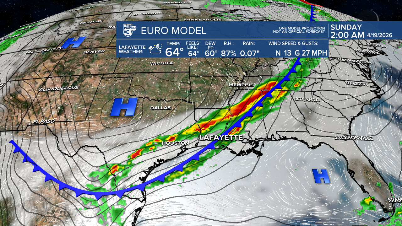
Acadiana could see some much needed rain to battle the drought toward the end of next week, and perhaps carrying into the weekend, but unfortunately it may impact some of the Festival International activities.
It's still early in the game forecasting that far out, but more robust thunderstorms and some soaking rains may be possible per the latest long-range outlook from the Euro Model.

A lot can change between now and the end of next week, so do not "anchor" to this forecast as changes are certain this far out.
See the KATC 10 Day Forecast for the latest.
