

After a cold weekend, tonight will be our last night dipping into the upper 20s, with no cold weather alerts.

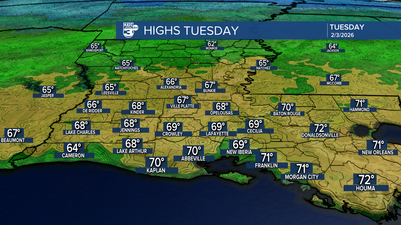
Good thing, tomorrow afternoon will bring an exceptionally warm day with temperatures rising into the mid-60s—finally, we can enjoy a day without a heavy winter coat!

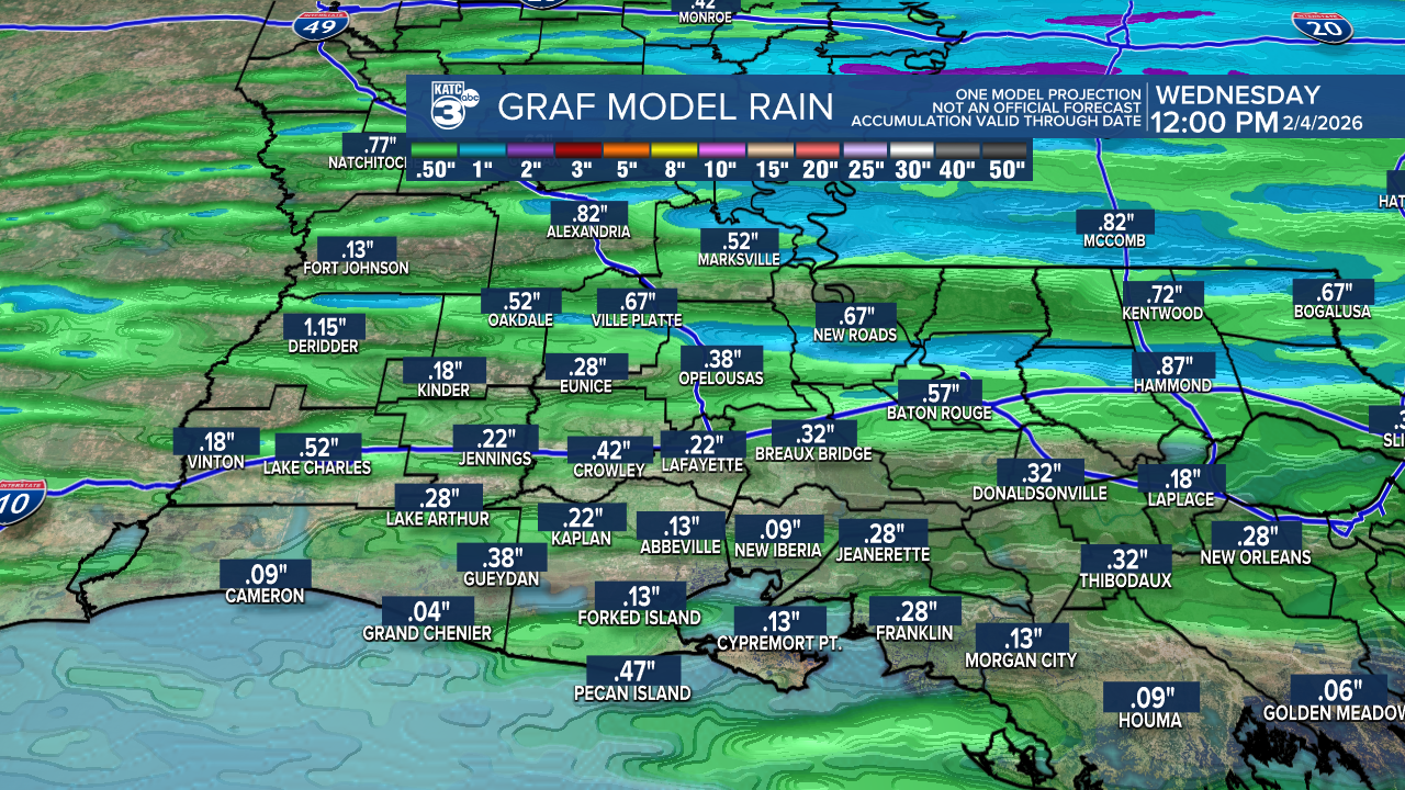
We will stay dry through early Tuesday before a cold front arrives Tuesday night, bringing a mix of showers and isolated thunderstorms.


Thankfully, severe weather is not expected, and rainfall totals should remain around 1".

Following that, cooler temperatures will settle in the 50s during the day and mid-30s at night. By the end of the week, we can expect things to warm up again, feeling more like Spring.
Follow Meteorologist Breyanna Lewis for further updates.
See the KATC 10 Day Forecast for the latest.
