


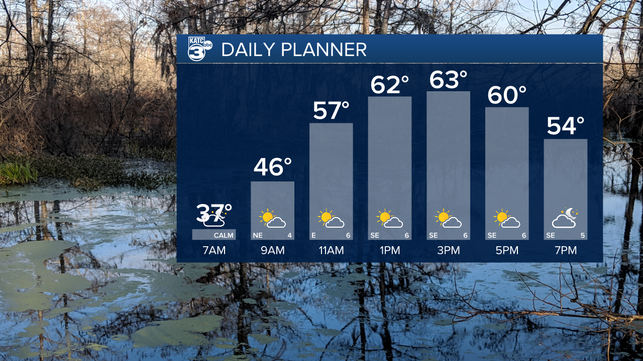
It'll be a cold start on Tuesday with temperatures down in the 30s yet again, although sitting slightly warmer than Monday morning.
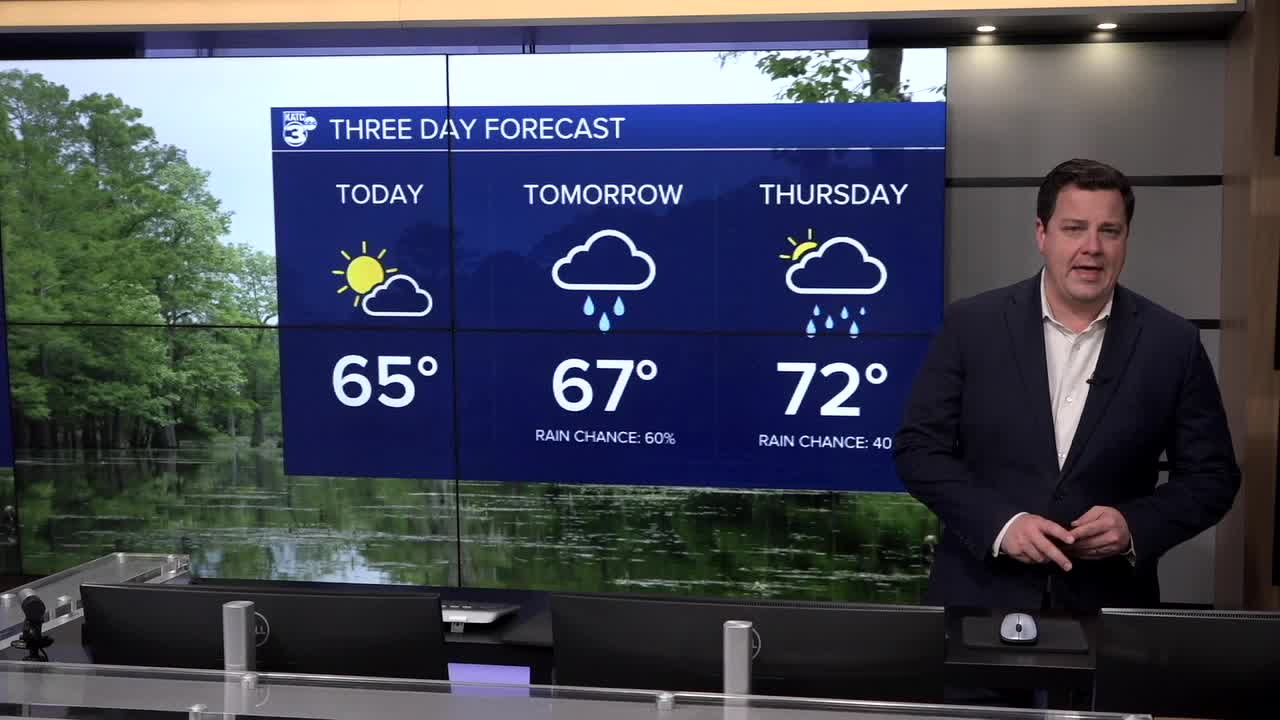
Despite that, however, it's a slightly more mild day with temperatures sitting in the mid 60s during the afternoon.
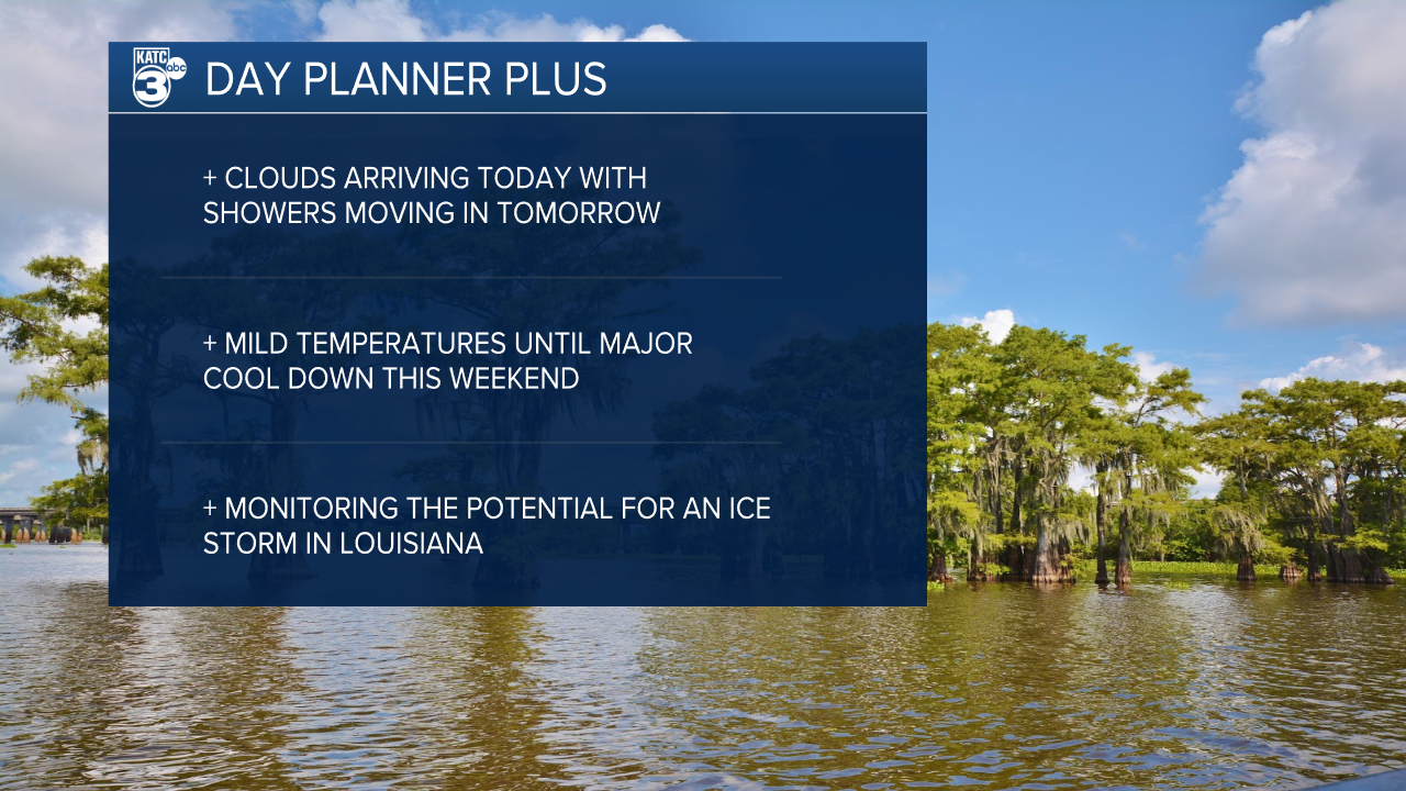
We'll see a gradual increase in moisture and clouds through the day, with clouds taking over ahead of a round of showers on Wednesday.
We're not anticipating any severe weather or flooding on Wednesday, although we may get a few rumbles of thunder through the day.
Showers will mostly be pretty scattered and arriving later in the afternoon and evening.
We'll have a hard time clearing out through the remainder of the week and clouds and spotty showers will likely linger around as temperatures warm up.
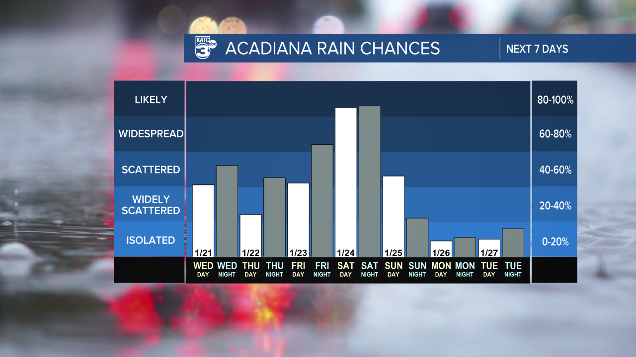
The day to watch remains Saturday as a disturbance swings through the area bringing us a round of rain while an outburst of Arctic air dips down.
We're still watching for the possibility of freezing rain Saturday afternoon into Sunday morning, although it looks like this may just miss Acadiana.
Models continue to suggest that the I-20 corridor will be the place to watch as the bullseye for this storm, but we can't rule out a little freezing rain in areas north of Highway 190.
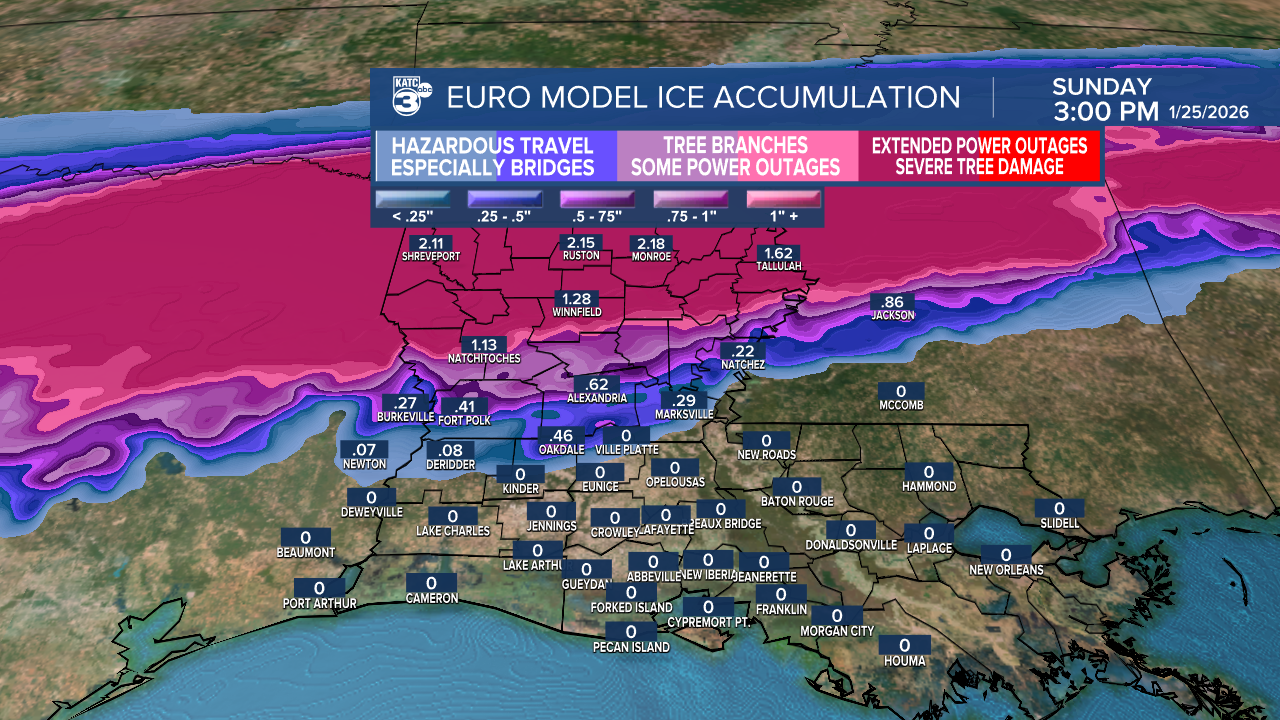
It should be mentioned that the above graphic is the EURO model and isn't reflective of what the GFS is putting out there, however, given the performance of the GFS last week I'll lean more heavily on the EURO output.
As of Tuesday morning impacts for Acadiana will be minimal but travel to areas north of Alexandria should be avoided this weekend as north Louisiana is looking at major impacts.
At a minimum travel in north Louisiana will be difficult, if not impossible, but if some of these totals verify there's the possibility for downed trees, power lines, and widespread power outages.
Folks with interest in the area should monitor the evolution of this storm closely.
The coldest air of the year will then arrive to start next work week with a possibility of temperatures in the 20s and wind chill values in the teens.
