


Although Acadiana will get one more day of spring-like conditions, a vigorous cold front arriving by Saturday evening will bring back some winter temperatures to the area Sunday through Tuesday.
In the near term, it will be another cloudy, mild and humid night with some sea fog and/or low clouds building in overnight.
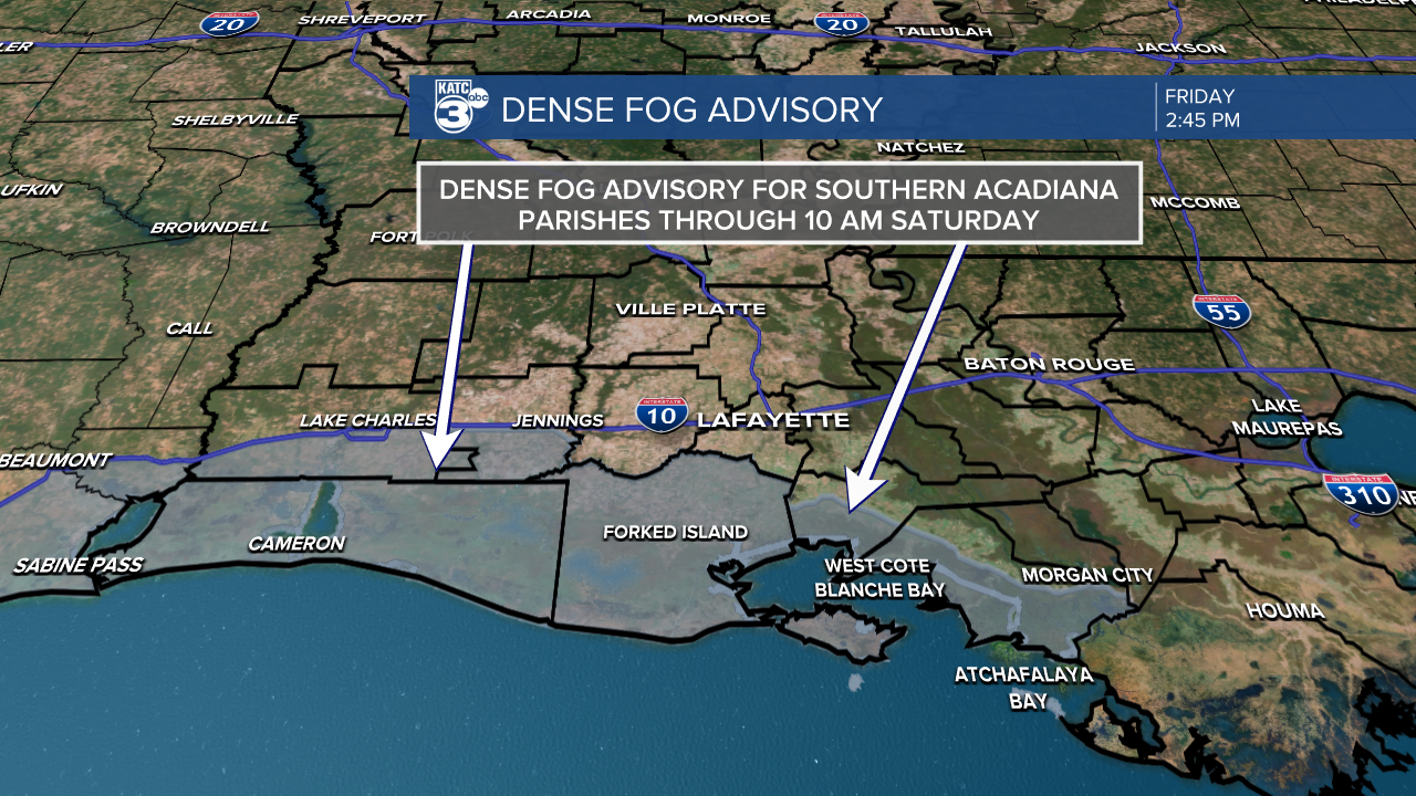
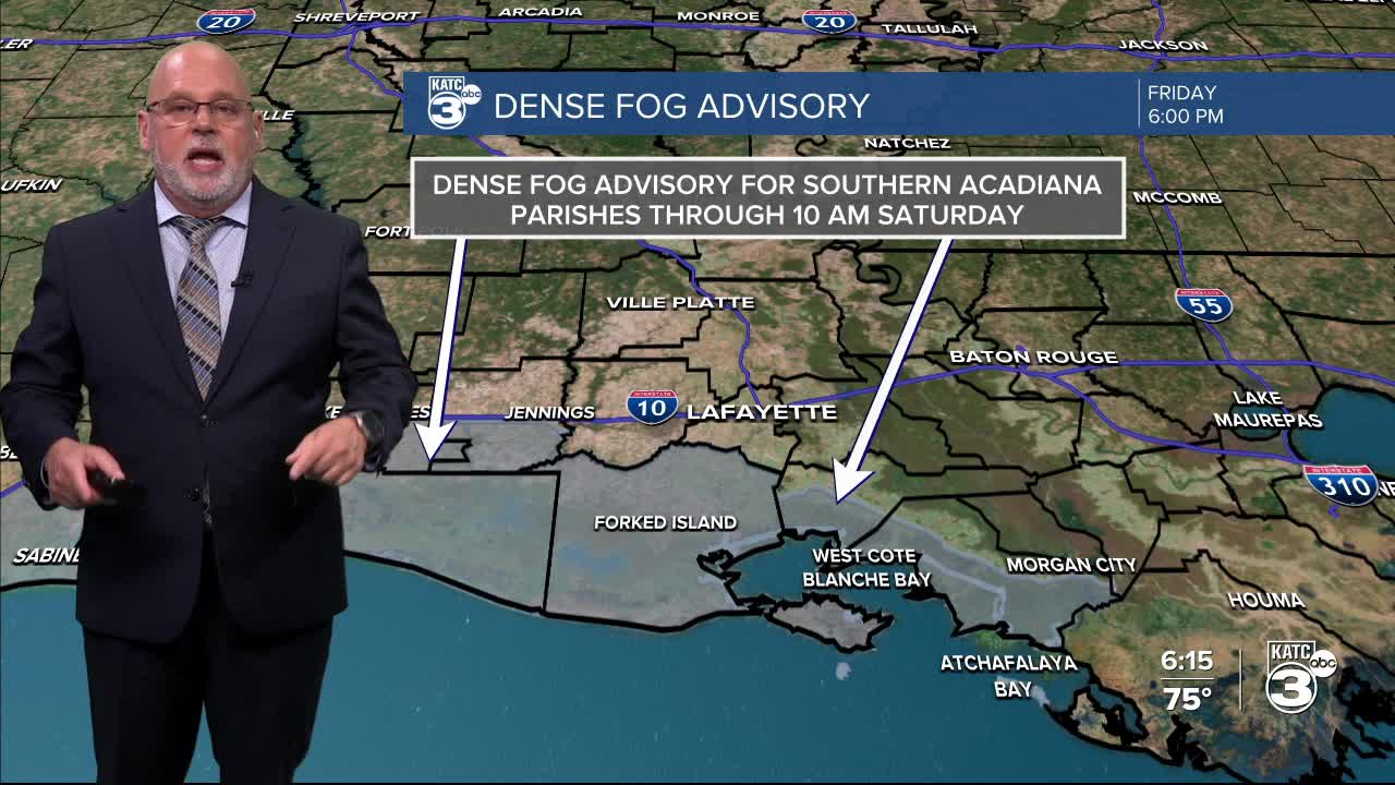
A Dense Fog Advisory is in effect for the Southern Acadiana Parishes through 10am Saturday.

A few spotty showers and some occasional misty drizzle will also be possible through the overnight and early morning hours Saturday.
After any morning fog and clouds, look for a few intervals of sun Saturday with temperatures once again reaching near 80°.

There will be a 40% chance of a few scattered showers preceding and accompany the front primarily for Saturday afternoon into the evening hours.
It will turn windy and sharply cooler into Sunday with morning temperatures in the 40s topping out in the upper 50s to lower 60s.
The chilliest air arrives Monday into Monday night with lows Monday morning in the upper 30s to lower 40s, staying in the 50s during the day, and then dropping into the low-mid 30s Monday night into Tuesday morning.
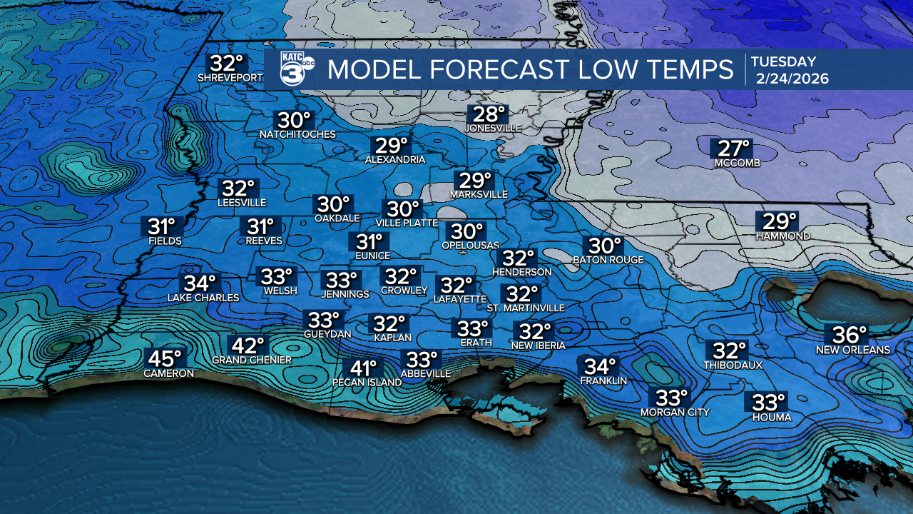
A light freeze/frost may be possible for portions of Acadiana Tuesday morning.
Thereafter, it's a nice warm-up again later next week.
See the KATC 10 Day Forecast for the latest.
The long range outlook does not show any low-mid 30s for at least two weeks beyond Tuesday.

And with the Climate Prediction Center's forecast for March looking above normal for our area, it should be okay to start working on your gardens and clearing the flora and fauna by next weekend!
