

If you didn't believe in calendars and closed your eyes you could probably convince yourself it was April based on how warm things have been lately.
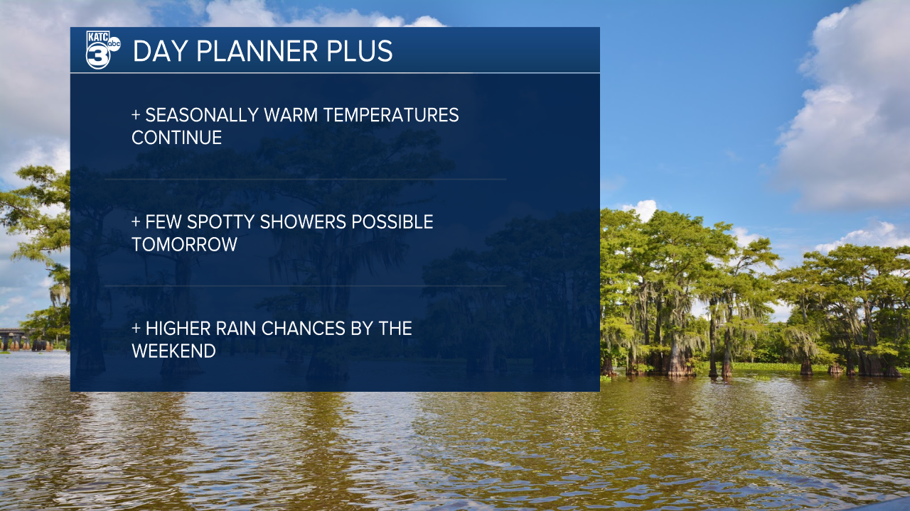
That doesn't seem to be changing anytime soon as we continue a stretch of temperatures running roughly ten degrees or more above average.
In fact we'll be back close to record highs on Tuesday and will remain on record watch for the majority of the week.
Highs Tuesday will be back in the low 80s in the afternoon with a light breeze continuing to come in from the south.
We've had a steady south wind for a few days now and we're starting to really feel those impacts from a continued surge of moisture into the area.
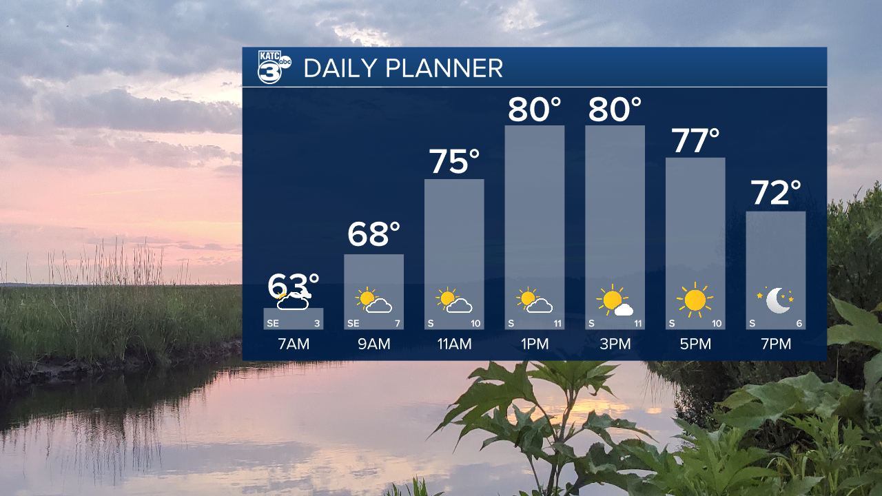
The buildup of moisture has lead to some patchy areas of fog and much warmer overnight temperatures which will consistently be in the upper 60s.
Rain chances will start to increase on Wednesday with a few spotty showers possible in the afternoon, before really picking up over the weekend.
Despite a relatively quiet Thursday and Friday it looks like we'll get a frontal boundary to move into the area on Saturday leading to a few days of unsettled weather.
This looks like the beginning of a stormier pattern in Acadiana which will last through a majority of next week as well.
