


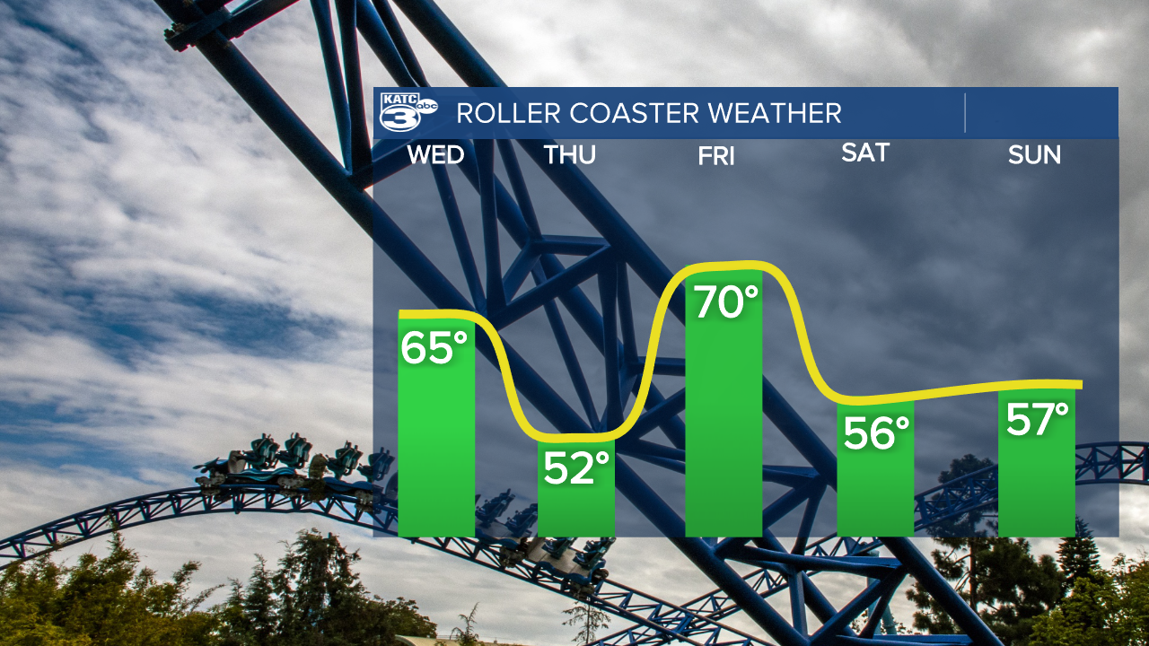
I hope everyone enjoys a good amusement park ride because there's a whole lot of up and down coming in the temperatures over the next few days.
Wednesday will be the start with highs sitting in the mid 60s, a continuation of what we had yesterday and the last day of normal temperatures for the rest of the week.
A cold front is moving through the area, this has resulted in a layer of cloud cover out there this morning that will burn up later in the day.
Winds will be shifting to the north and picking up around lunch time and temperatures will start to fall in the evening.
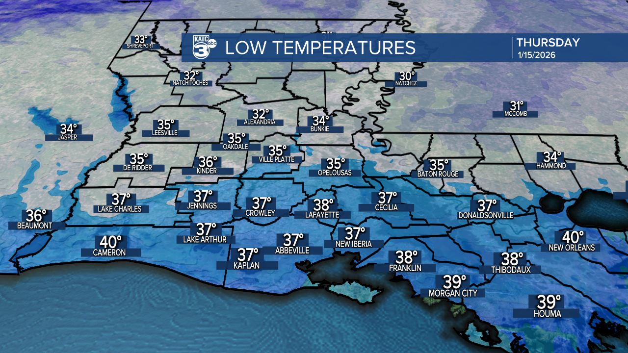
We'll see the lows bottom out in the mid to upper 30s by early Thursday but elevated winds will keep the wind chill in the low 30s.
Despite an abundance of sunshine temperatures will struggle to get into the 50s Thursday afternoon, and the wind chill will likely remain in the 40s.
This will then be followed up by an afternoon in the low 70s on Friday and then another day in the 50s Saturday.
Like I said, I hope everyone likes amusement park rides.
The pattern is going to gradually shift to a more unsettled one next week and we could get a string of wet days starting a week from today.
It's tough to really get into much detail this far out as it can all change, but at this point I would prepare for a little bit of rainfall next week.
