


Even though Acadiana's weather pattern is expected to stay unsettled with building rain chances developing Saturday into Saturday night, Easter shouldn't be a washout.
In the near term, it's going to be a breezy and seasonably warm pattern for Acadiana into the weekend with highs reaching in the low-mid 80s accompanied by a few isolated showers Thursday and a few more showers possible Friday.

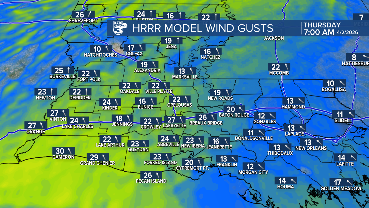
Winds will be gusty from morning to the evening hours Thursday and Friday with wind gusts reaching the 25 mph range.
Rain chances should ramp up later into Saturday and Saturday night ahead of our next cool front that arrives Sunday morning.

The highest chances for showers and a few embedded storms should arrive overnight Saturday and be ending toward Sunday morning, per the latest Euro Model.

At this time, severe storms are not expected in the region with the weekend frontal system.
It will turn cooler Sunday with highs in the 60s accompanied by breezy northerly winds and perhaps a few lingering showers into the afternoon.

And do not look for a whole lot of rain through this weekend with the latest Euro suggesting near 1/2-1" or less for most in our area.
Thereafter, it looks cool and dry early next week with temperatures and humidity moderating later in the week along with the chance of a few spring showers.
See the KATC 10 Day Forecast and Power Doppler 3 page for the latest.
