


Acadiana can expect an unsettled weather pattern with increasing rain and thunderstorm chances into the latter part of the week and the weekend.
In the near term, look for warmer and more humid conditions overnight into Wednesday with lows closer to the low-mid 70s while highs Wednesday push into the mid-upper 80s.
Breezy southerly winds near 15-25 mph will kick in Wednesday afternoon feeding into storms that will be developing well to the north during the day Wednesday.

A few scattered showers will be possible Wednesday with rain chances near 30%, with those chance of some showers and/or thunderstorms are expected to increase overnight Wednesday.
The Storm Prediction Center is maintaining a marginal to slight risk of severe storms for Acadiana into Wednesday night, but models are not supporting much in the way of storms with a fizzling front in our area...for now.

The severe threat looks much more substantial from CenLA north and northeastward into Northern Louisiana, Mississippi and Alabama.
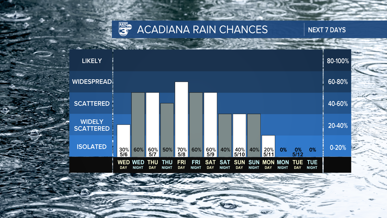
Additional rounds of rain and storms will be possible for South Louisiana Thursday, especially Friday and Saturday, and perhaps through Sunday night, before a definitive front sweeps through the area early Monday.

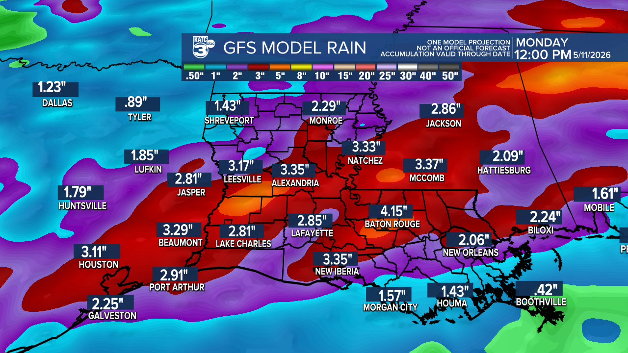
This type of pattern (and the lack of any real model agreement) lends itself to unpredictable times when the best rains may fall (and there will be 6-12hr lulls in activity), but the total rain accumulation products from the Euro and GFS show a good soaking 2-3" or more possible for our area over 5 day period through at least Sunday night.

And it should be noted when we have gotten the rains this spring, they have been heavier and more widespread than model forecasts of late...right now the higher resolution models, HRRR and GRAF, are not doing well with their input and output either.
See the KATC 10 Day Forecast and Power Doppler 3 for the latest.
