


A typical summer pattern is expected for Acadiana this week, while tropical activity is beginning to perk up in the Atlantic Basin.

In the near term, after some slightly drier and less humid air across the Acadiana region reducing shower activity over the last couple of days, some tropical moisture will slowly creep in from the south and east over the next couple of days, bringing back the chance of scattered afternoon showers and a few thunderstorms.

Overall, rain chances look to be in the 20-30% range for the entire Acadiana area, with most favored spots for any afternoon storms likely to be closer to the I-10 corridor on south and eastward.
High temperatures will continue to top out mostly in the 91-93° range, while overnight lows stay planted in the mid-70s.
This pattern looks to hold through the weekend before an increase and moisture associated with a possible tropical wave that could enhance our rain chances by sometime mid-next week.
See the KATC 10 Day Forecast for the latest.
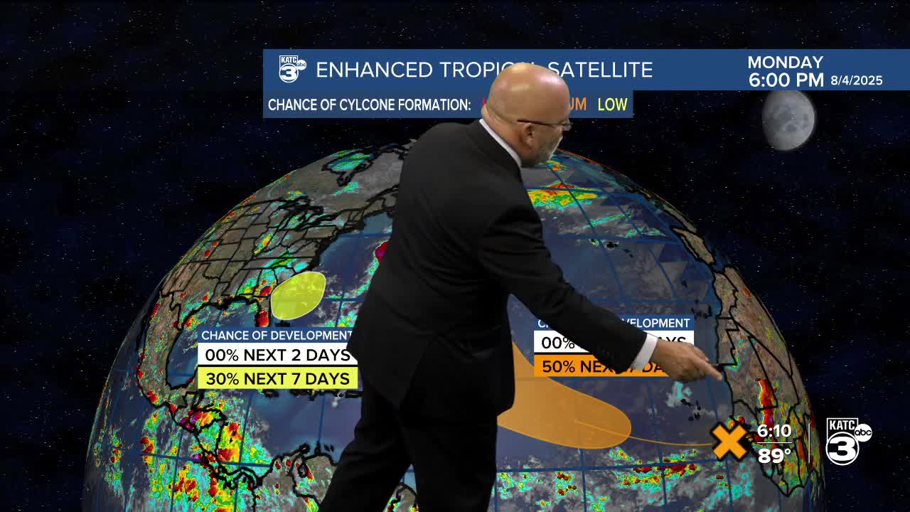
Meanwhile in the tropics, and right on climatological queue, the Atlantic Basin is beginning to show signs of a more active pattern.

Tropical Storm Dexter which formed Sunday night will remain a TS as it moves away from the U.S. and eventually dies in the open north Atlantic.

Closer to home, a broad area of low pressure is forecast to develop in a day or two several hundred miles off the coast of the SE U.S. Some gradual development is possible during the middle or latter portion of this week as any potential system could drift to the west or northwest.

This is not expected to be a big system, but perhaps a rain-maker/enhancer for portions of the East U.S. (looks like NC at this time), and currently not a direct threat to the Gulf.
Way on the other side of the Atlantic, a relatively convection-less wave emerging off of the African Coast has a medium chance to develop into a depression later this week, but may remain an Atlantic storm should it develop, but that's still too early to call.
The wave behind it over Africa may develop down the road into next week as models are catching onto this feature as well.
Climatologically-speaking, more than 90% of all tropical cyclone activity occurs after August 1st with the season peaking in 6 weeks.

No worries for Louisiana for the next week or two, but thereafter we'll be watching systems a little more closely as we approach mid-August.
