


In advance of the possibility of near tropical storm winds for the southern portions of Acadiana, the National Hurricane Center upgraded the Tropical Storm Watch to a Tropical Storm WARNING late Wednesday afternoon.

A "warning" means tropical storm conditions can be expected within 24 hours.
Tropical Storm Bertha made landfall in St Bernard Parish around 2pm Wednesday with the center of circulation still remaining detached from the intense storms found well offshore in the Gulf.

The circulation center is expected to travel westward to southwestward tonight reaching the vicinity of Acadiana by Thursday morning.
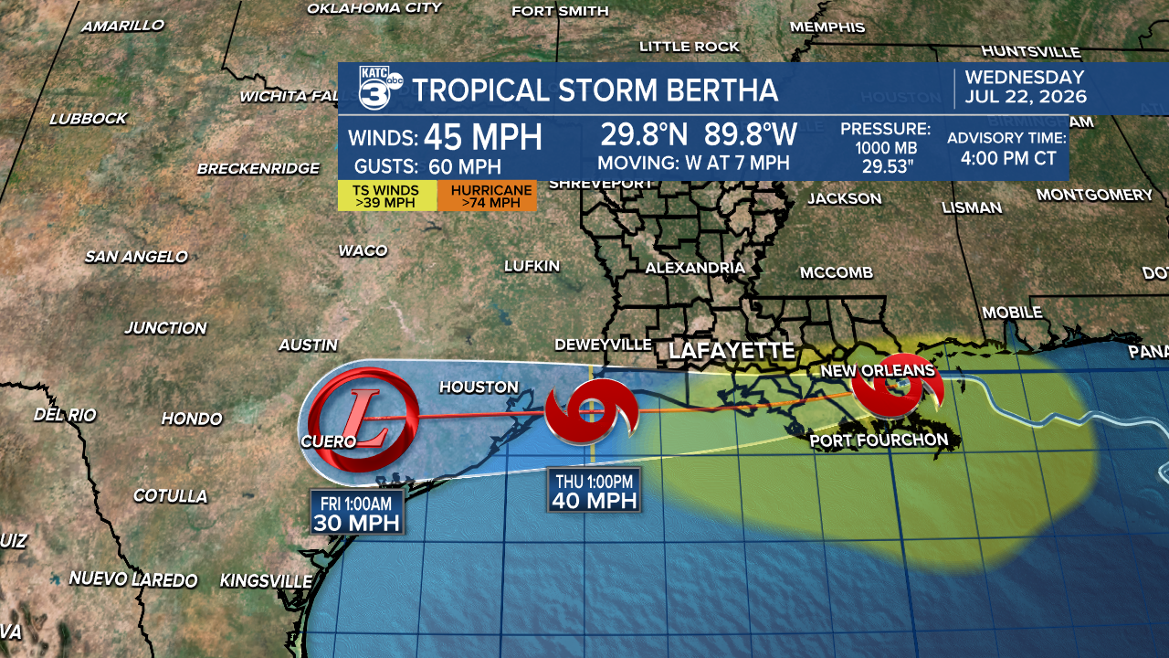
It is not out of the realm of possibility that a newer center may reform offshore south of our area closer to the Gulf storms that have been brewing for more than a day now. Or, that the ceneter takes a more southwestward turn overnight.
The HRRR Model offers the "drift west", weaker solution.

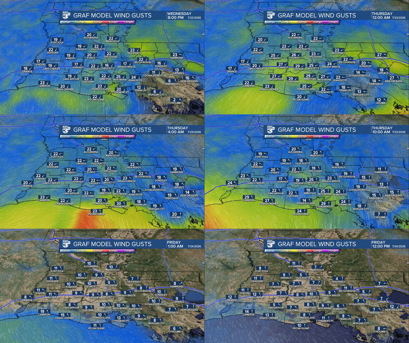
While the GRAF makes Bertha center move or reform southwestward.

Either way, Acadiana can expect increased cloud cover with breezy NE/E winds tonight near 15-25 mph, turning southerly Thursday with a few gusts near 30-35 mph in scattered tropical rain shower activity.
Rain chances are set at 60-70%, but at this point there shouldn't be much accumulating rainfall.

Gustiest winds will be found along Acadiana's southern coastal marshes where peak gusts to 35-45 mph may develop later tonight through mid-afternoon Thursday.
As winds turn southerly tomorrow, there could be elevated tides of 1-2ft or more above normal depending on the strength and orientation of Bertha...but as of now, there are no other coastal advisories in place from the National Weather Service at this time other than the Excessive Heat Warning for all of Acadiana that ends 8pm this evening.
Heat Index values in most places reached near 115° Wednesday with readings in a few spots exceeding 120°...that's dangerous heat.

At least with the clouds and breeze Thursday will be much cooler than Wednesday with highs holding closer to the upper 80s.
Thereafter, Friday into the weekend, and much of next week for that matter, will be partly cloudy, hot and humid with minimal rain chances at best.
It could get quite hot again next week...see the KATC 10 Day Forecast and Power Doppler 3 page for the latest.
