


Tropical Depression #5 looks to become Tropical Storm Edouard tonight and bring it's primary impacts to Southeast Texas Tuesday...with Acadiana benefiting from the return of scattered showers and thunderstorms.
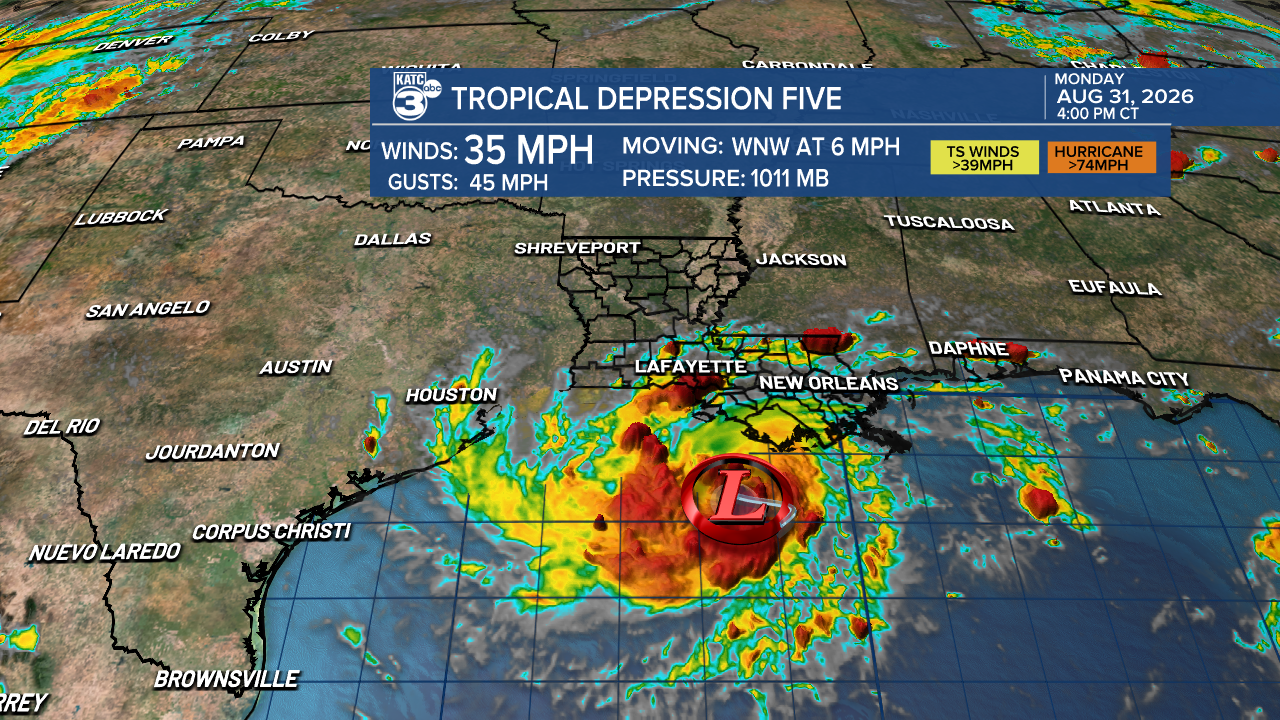
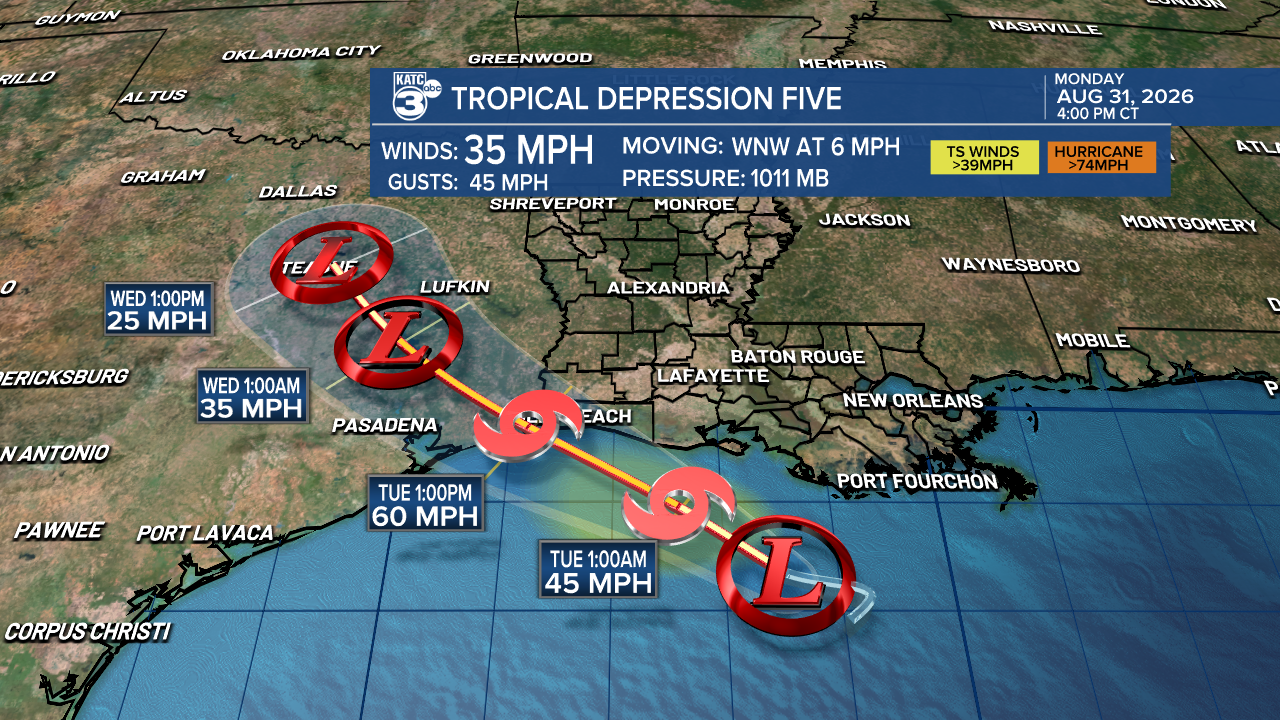
TD#5 was sporting 35 mph winds this afternoon as it was heading to the west-northwest at 5 mph and toward the Upper Texas Coast with landfall there as a 60 mph tropical storm, expected Tuesday afternoon/evening.
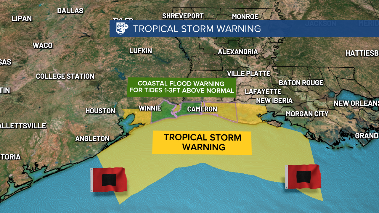
Tropical Storm Warnings are in effect locally for Cameron Parish eastward to the Vermilion/Iberia Parish line, where minor coastal flooding of 1-3 feet and gusts of tropical storm force, near 40-45 mph may be possible Tuesday, especially for Cameron Parish where gust could push 50-60 mph.
For the rest of Acadiana, we can expect another round of scattered tropical showers and a few thunderstorms.
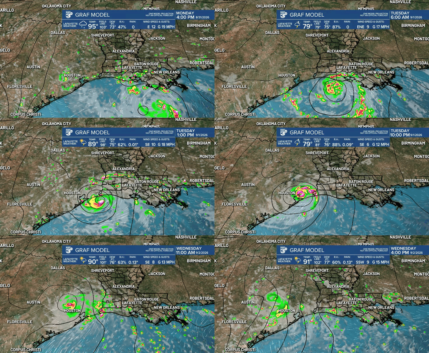
Although the Storm Prediction Center does not have the area hatched in for any severe storms, it would not be surprising for a few funnel clouds to develop in some isolated storms that grow quickly in the mid-morning/early afternoon.
Rain chances for Acadiana Tuesday will be in the 60% range...higher toward Southwest and Coastal Louisiana and lower for our northern parishes.
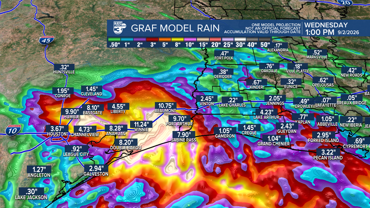
Biggest rain totals with this system and the threat of flooding rain will likely manifest in Southeast Texas where 5-10" of rain may fall.
A few isolated areas primarily across the coastal parishes could catch up 2-4" through midday Wednesday.
As for winds, all tropical storm force wind and wind gusts will be confined offshore and to portions of Coastal Vermilion and Cameron, and especially Western Cameron.
Tropical storm force winds inland will likely be found in Southeast Texas late Tuesday into Tuesday night and mainly near or just east-northeast of the Houston metro area into Tuesday night.
The good news for Acadiana, the daily chance of typical summer scattered showers and storms will stay in the forecast for the foreseeable future, eventually delivering some much need moisture in the week ahead.
Stay with KATC for the latest.
