


Overall I would say the trends have been positive for Acadiana over the last 24 hours as we've watched model runs start to show a little consistency.
That doesn't mean the threat is gone entirely, there's still a lot of nuance to the forecast, and flooding certainly remains a possibility.
The area of low pressure came off the Florida Peninsula on Tuesday and seems to be taking a route that keeps it fairly close to the coast line.
It'll spark bands of tropical showers along the north coast of Florida as it moves west through the day and will eventually start to bring that rain to Louisiana.

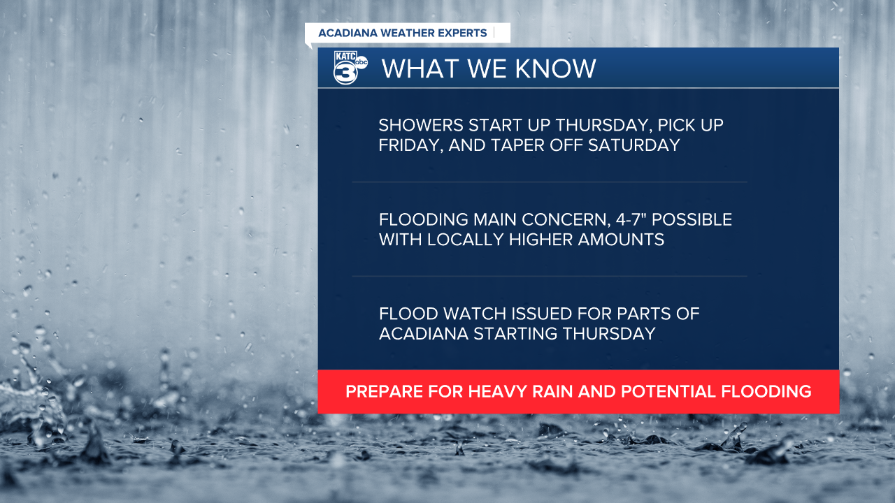
Showers will begin to push into east Louisiana overnight Wednesday and will continue into Thursday morning when the rain will begin to arrive in Acadiana.
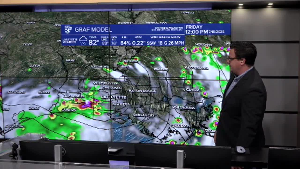
Through the day Thursday showers will arrive in waves and should be widely scattered across the region, expect periods of heavy rains but with enough breaks that major flooding concerns should be alleviated (although minor street flooding, as always, will be possible).
Acadiana will likely get its heaviest rain Friday into Saturday as the system lifts north and out of the area, the speed of the system will be important here and any signs of stalling would spike the chance of flooding.
Keep in mind that this will be a very disorganized system and won't necessarily follow the rules of traditional tropical weather with the worst weather being concentrated around the center.
Flooding rain bands could materialize miles away from the low and we won't get a great sense of where that is occurring until we begin to see it.

One feature that's been fairly consistent in the models, regardless of strength or track is that a lot of the rain will be produced south of the low.
This could be a really key aspect of the forecast as it would indicate that most of the showers will materialize offshore, which would be a best case scenario.
That's why the risk for Acadiana increases on Friday as it lifts north, and again any stalling of the system could drastically increase rain totals.
So far it seems reasonable that most areas along the coast could probably see somewhere between 4-7" of rain with isolated spots higher (potentially much higher).

As I mentioned earlier the trends have been mostly positive for Acadiana after the last 24 hours or so, but that doesn't mean we'll take the storm less seriously.
There's still the potential for flooding, and minor tweaks to the forecast could have large effects on our impacts so it's best to still be prepared.
