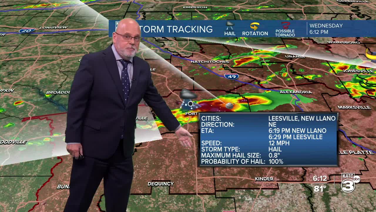


A Tornado Watch was issued for the northern parishes of Acadiana through 11pm with showers and storms expected to weaken as they move southeastward through the rest of Acadiana overnight.

In Acadiana, the "watch" includes Allen, Evangeline, St Landry and Avoyelles parishes.
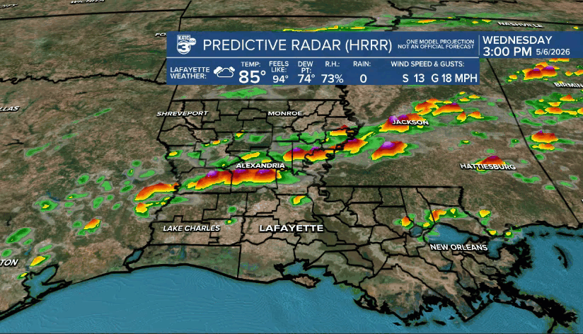
Strong to severe storms across Central Louisiana Wednesday afternoon are expected to slide slowly southeastward through this evening, and per the Predictive Radar Model (HRRR) activity should weaken as it moves southward overnight.
Nonetheless, a few storms could produce damaging winds, hail and perhaps an isolated tornado in the watch area into early this evening, before they begin to weaken after 10pm.
A weak cool front will push through Acadiana toward daybreak Thursday leaving in its wake mostly cloudy skies, temperatures holding closer to the low-mid 70s and a few scattered showers possible, with rain chances down to 30%.
The same front will become nearly stationary in the Gulf and begin drifting back to the north Friday while disturbances in the sub-tropical jet stream will allow for a high chance of showers and and locally heavy thunderstorms into Friday and likely again Saturday.

While there may be a low end severe threat for the storms Friday into Saturday, (currently the Storm Prediction Center does not have our hatched in for any (other than for this evening)), gusty winds and some small hail may be possible in some of the storms.
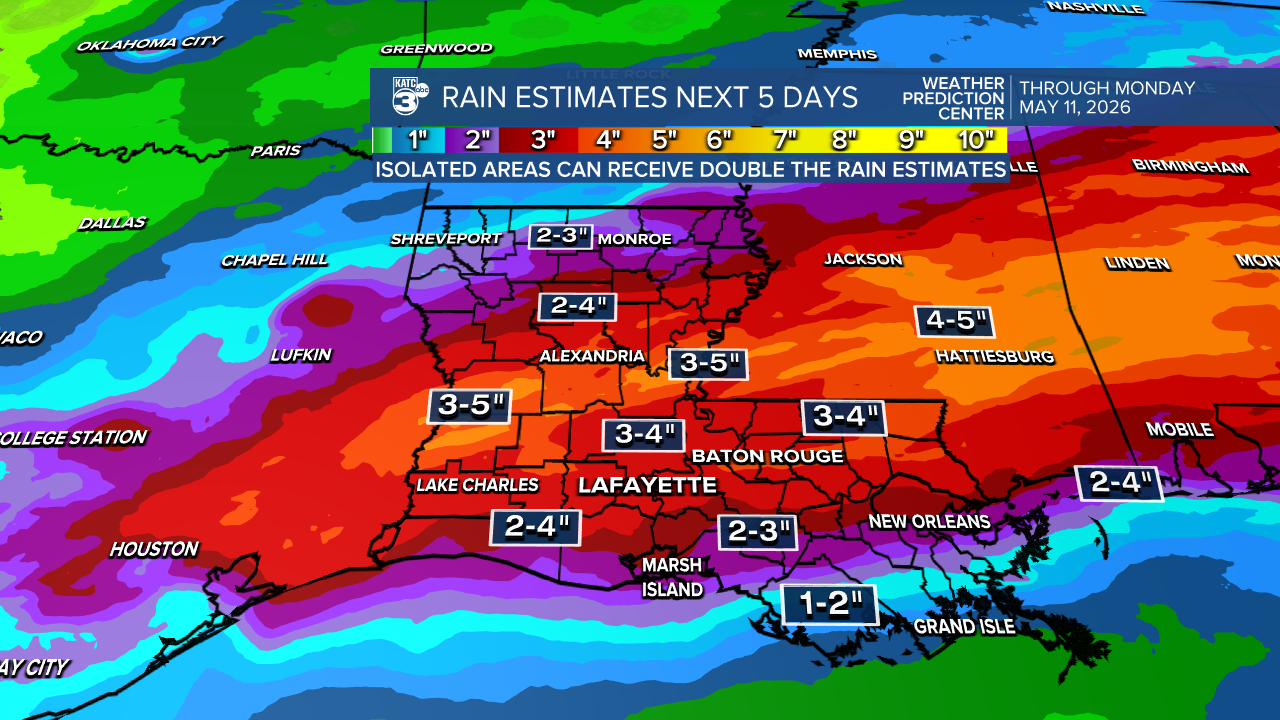
More importantly the threat of some localized heavy, soaking rainfall will be possible with rain accumulations reaching up to 3-5" or more in portions of the area.
As always, isolated amounts up to double as advertised may be possible in a few spots leading to some localized flooding.
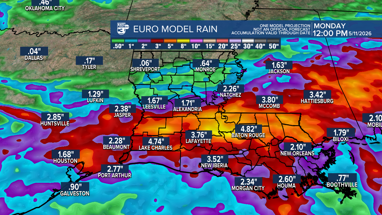
Today's Euro Model rain accumulations through Sunday is consistent with the rainfall outlook per the Weather Prediction Center.
Do not look for a whole lot of sun until perhaps we get some breaks Sunday afternoon ahead of a cool front that arrives early Monday, sweeping the rain chances out and bringing the sunshine back to Acadiana for the start of next week.
See the KATC 10 Day Forecast for the latest.
